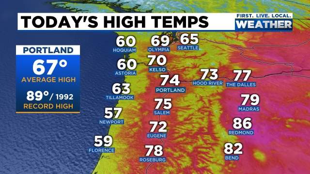
For us Star Wars fans today is a great day to celebrate the Star Wars franchise. Every year on this date I see a number of Star Wars themed shirts and hoodies, and today was no different. Today was also a wonderful day to be outside with highs reaching the mid 70s this afternoon. You can check out the very nice high temps from around the NW today with 60s extending out to the coast as well. I hope you took full advantage of the nice weather, because looming on the horizon is a washout.
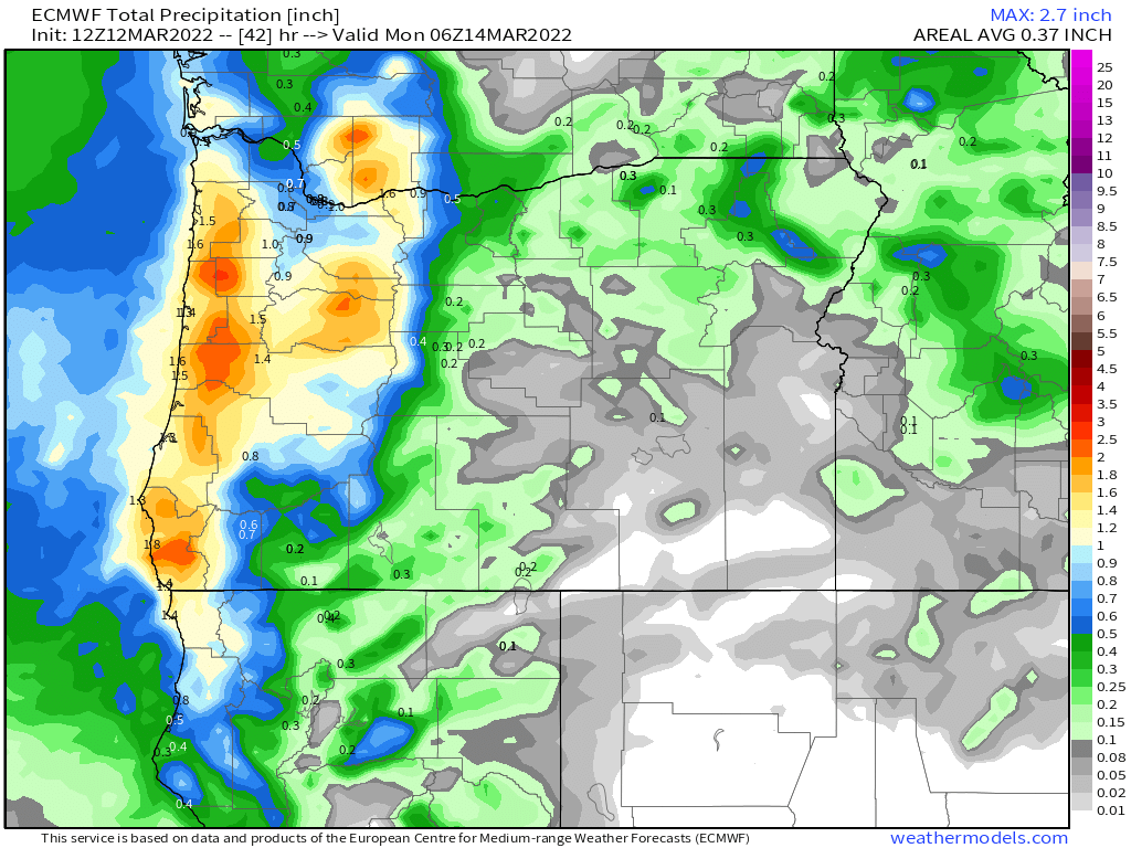
Now take a look at the total rainfall expected through Monday night.
Widespread totals around 2 inches here in the Willamette Valley, and what is perhaps even better news are the inch plus totals east of the Cascades where they still could really use the additional precip.
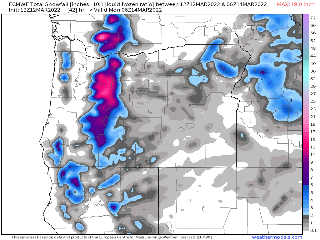
Next check out how much snow is expected as well.
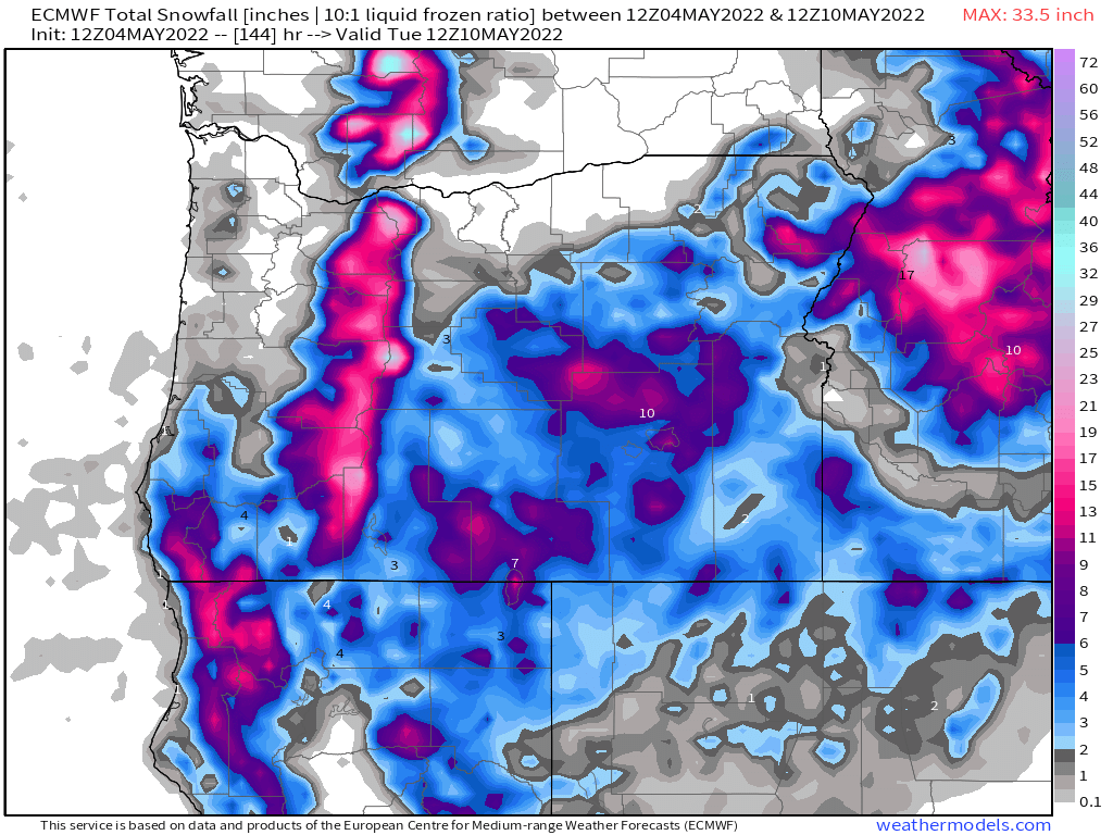
The map above looks more like a winter time map than a early May map with snow levels Friday night through Tuesday running quite low for this time of year. I’m going with a solid 1 to 2 feet of new snow for the Cascades above about 4000′ with up to 10 inches down as low as 3000′. Really great news for delaying the start of any major wildfires.
I know this wet weather is going to start getting old, but it’s what we needed. This is a huge change in pace to the past few springs which have generally been very warm & dry, plus I can assure you that as long as we still have 4 or 5 feet of snow on the ground in the Cascades, our risk of having a big early season fire outbreak is next to none.
Salem’s Extended Forecast
Right here in Salem expect Thursday to be cloudy and wet – a real soaking for sure! Maybe some breezy conditions at times with highs in the upper 50s.
Friday will also be quite wet with periods of heavy showers, but with a slight chance of thunderstorms too – especially if we get lucky and see some sunbreaks that day.
Saturday & Sunday will be more of our typical sunbreak/shower type of days with a number of sunbreaks mixing in between downpours. Small hail, thunder, and lightning are definitely possible all weekend.
Next Monday will be a sunnier version of the weekend with showers slowly building through the course of the day after what should be a fairly sunny AM. Chilly though with lows dipping into the upper 30s possibly. The late afternoon and early evening hours on Monday feature the greatest threat for showers and storms.
I’m searching hard for our next 70 degree day and will alert you the moment I feel confident one is coming. This spring really is vastly different than what we experienced last year, and for the time being there seems to be no sign of things dramatically changing either…
Take care and be kind to each other.