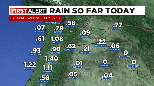
What a wild way to finish out November! Salem recorded a wind gust of 44mph last night making it the strongest wind so far this season! Several power outages occurred due to the strong winds too. It’s also been quite the soaker. Take a look at the rainfall totals as of 8PM:
The wild weather of course reached the Cascades. Copious amounts of snow have fallen in the mountains and there is more on the way. Take Hoodoo Ski Area for example which had only 5 inches of snow just 4 days ago. They currently have 36 inches with another foot yet to fall later this week. Definitely a great start to the ski season! Alright, on to the forecast!! 😉
Tonight and Thursday morning
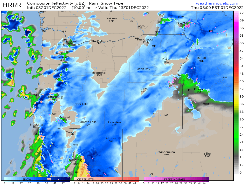
Rain showers will transition to rain and snow showers and even just snow showers for some areas later tonight. These “estimated” radar images like the one I have below are great for showing the big picture. The big picture tonight is that just about any location in the mid Willamette Valley could see not only a snow shower, but perhaps some sticking snow as well. Here is the estimated radar for 5AM showing a mix of rain and snow showers moving through the region. More details below.
Highlights
Don’t expect the snow to stick, but don’t be surprised if you wake up to some either. That’s not meant to be a wishy washy forecast lol, it’s quite literally the truth. Again, reference the image above and you can see this is not a widespread snowstorm type of situation. This is just scattered showers/snow showers. Furthermore, temps will be very marginal (32 to 35°) which also limits how many people will see snow around here in the next 24 hours. Expect anything from nothing at all (more likely scenario) – 2 inches tops with better chances of seeing snow in the higher elevations around the valley.
Thursday
The middle of the day will feature sunbreaks and a few showers of rain, hail, graupel (which is similar to a mix of hail and snow we get sometimes), and possibly snow again in the heavier showers. Highs in the low 40s.
Friday
This day could start off icy depending on how quick or slow we are to dry out Thursday night. Regardless, we will start the day off chilly with lows 30 to 32° for most areas. Highs in the lower 40s.
My hope is to write a fresh forecast Thursday evening with an updated look into the weekend as we flirt with snow again possibly Saturday or Sunday. Currently there is still too much up in the air to say anything more about it.
Stay safe and have a wonderful Thursday!!