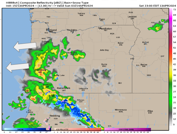
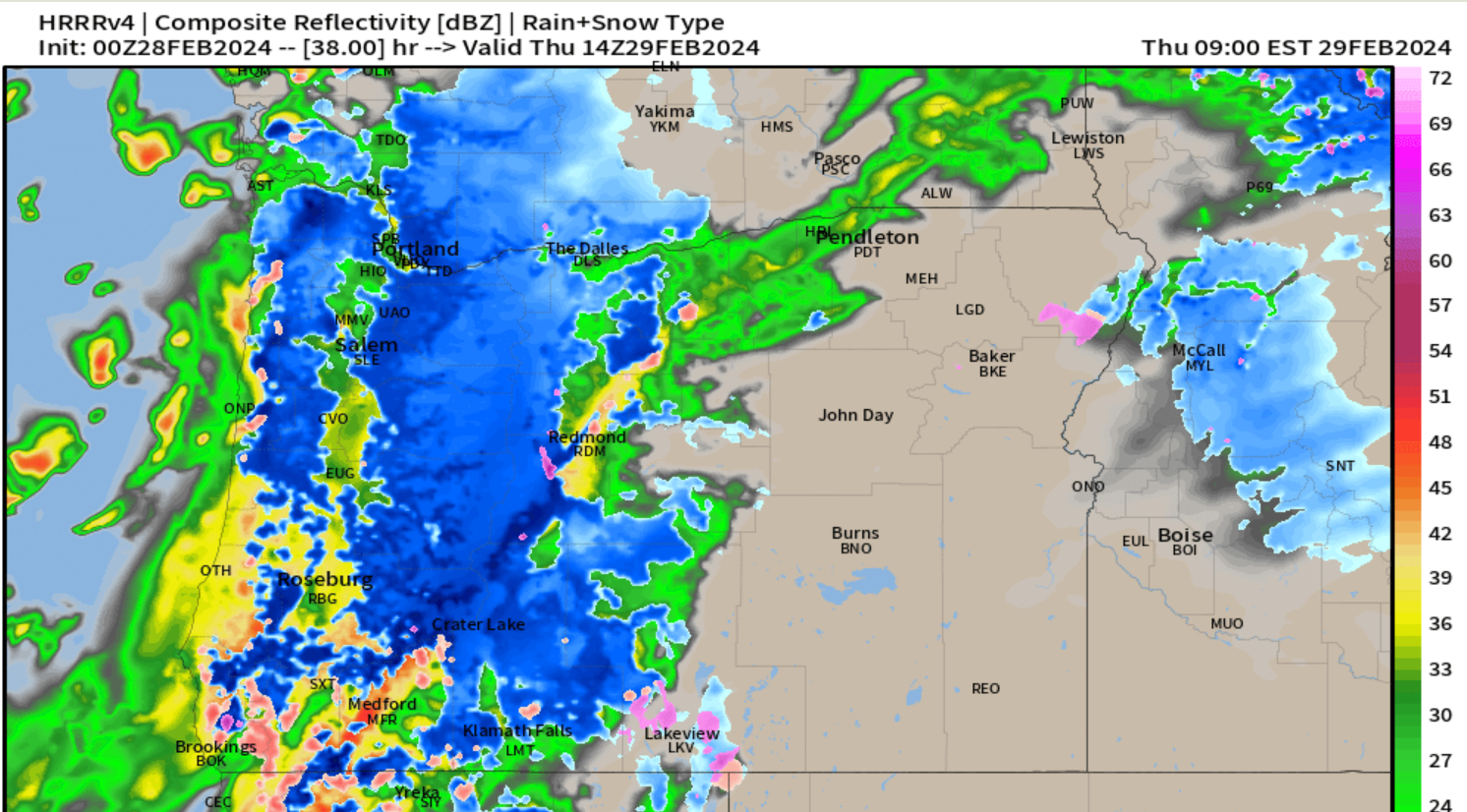
We have a full on washout occurring right now, and the chilly rain continues basically through the entire weekend with only brief breaks Saturday afternoon (maybe), and some breaks in the rain at times on Sunday. Roughly an inch and a half of rain will fall between now and Sunday night. Highs Saturday in the upper 40s to near 50°, and Sunday won’t be much better with highs around 54°.
Monday: Heavy showers with a few sunbreaks. High of 54°.
Tuesday: Showers and sunbreaks but with more sunbreaks than Monday. High of 58°.
Slight chance for a thundershower both Mon and Tue.
Wednesday: The showers end Tuesday night, and partly cloudy skies will lead to highs in the low 60s.
Thursday: Things start warning up with highs in the low 70s.
Fri – Sun: This might seem crazy, but each of these three days should end up with high temperatures around 80°. This means plan on a great three days of weather for outdoor activities next weekend.
The Cascades
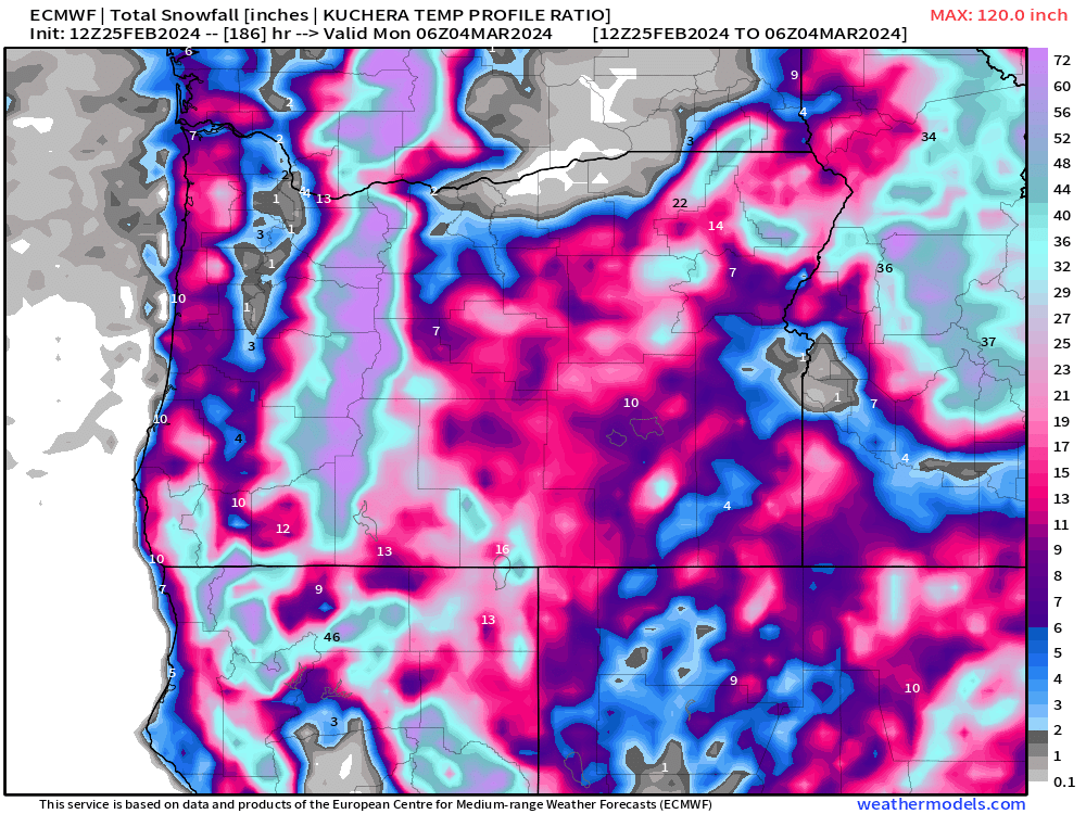
It’s almost that time of year where we don’t have to worry about mountain snowfall affecting travel, but we are not there quite yet haha! Expect 12 to 18 inches of new snow up in the Cascades tonight through Sunday evening. Several more additional inches will fall Monday, and then again on Tuesday a few more inches of snow before things calm down up there.
That’s all for now. Thanks for sticking with me as your weather guy even though posts have been sporadic lately.
I hope you all have a good and safe weekend making the most of the rain. Remember, it might seem like too much rain, but it is the rain which makes things so beautiful here. 🙂