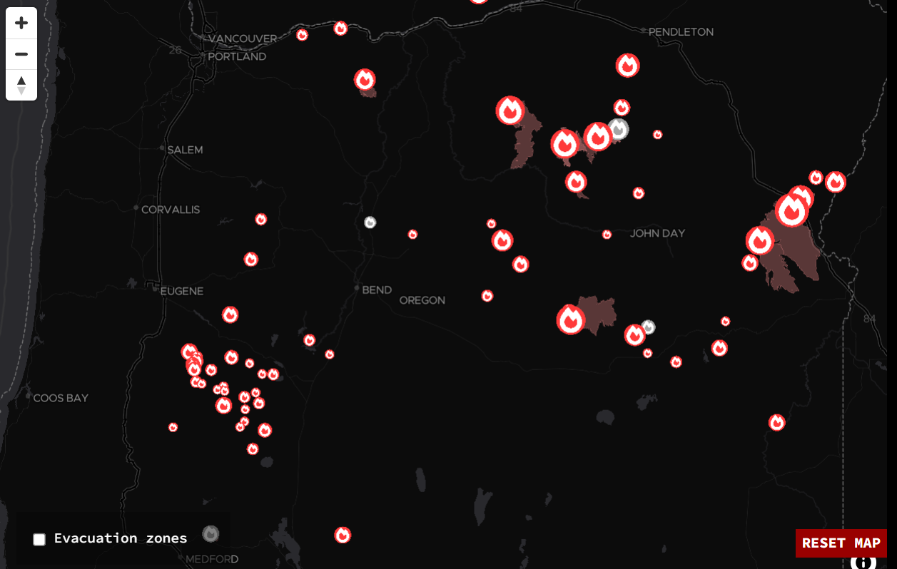
Nearly three weeks of intense heat earlier this month coupled with dry thunderstorms has lead to a devastating wildfire situation here in Oregon. Add in a few human caused fires (unfortunately), plus a rather poor forest management system, and just like that, we are in the midst of a terrible fire season. It may not feel devastating to us here in the Willamette Valley as we are not having ash or thick smoke descending upon us as in past years; but numerous large fires are occurring, and this map here shows them well.
Here’s a link to where this map came from in case you’re interested in learning more: https://projects.oregonlive.com/wildfires/map
Again, this is largely a result of brutal heat followed by multiple rounds of thunderstorms which put out lots of lightning. I remember when summer began nice and slow back in June providing hope we might escape the large fires this year; however, things changed fast and not for the better.
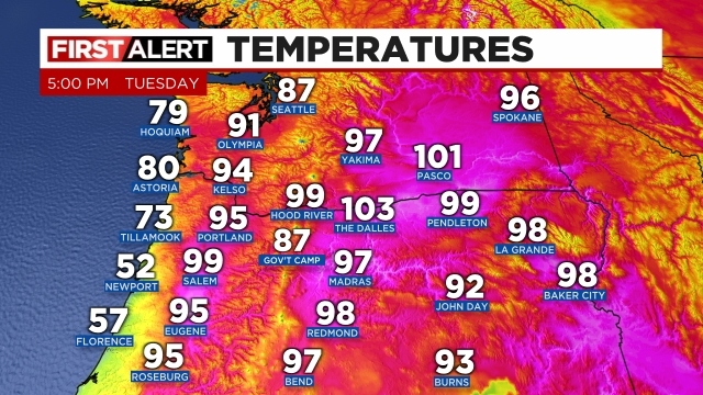
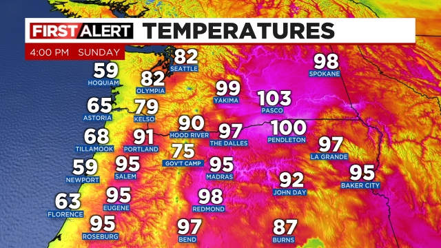
I felt it was important to share just how bad things are as I’ve noticed many people here in Salem have been rather oblivious to the current fire situation due to the lack of thick smoke. Salem is also currently on track for the warmest July on record. As of the 24th, we were an astounding seven degrees above normal for the month, but with “cooler” summertime weather forecasted for the remainder of July, we will see where we end up.
Much better news ahead!!!
Here is the really good news. We have a rare summertime “rainstorm” heading our way for next week. Indeed this is very rare to see in the dead of summer, but models are pretty set on Salem seeing widespread measurable rain next Monday and Tuesday.
Details
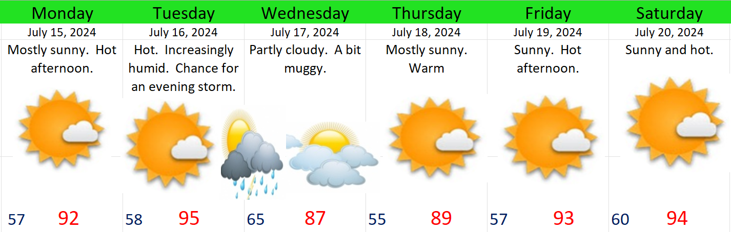
Now through Sunday: AM clouds with mostly sunny afternoons. Very comfortable temperatures each day with highs ranging from 82 to 88°.
Monday: The morning should start off dry, but showers and even some rain will move in during the afternoon and will last through the evening. Highs in the mid 70s.
Tuesday: A few showers with sunbreaks in between. Some showers could be on the heavier side. Highs again in the mid 70s.
Wed – Sun: The remainder of the following week will be warm, mostly sunny, and dry. Fairly normal summer weather. Highs on the upper end of “normal” topping out in the upper 80s to near 90°. Lows in the mid 50s.
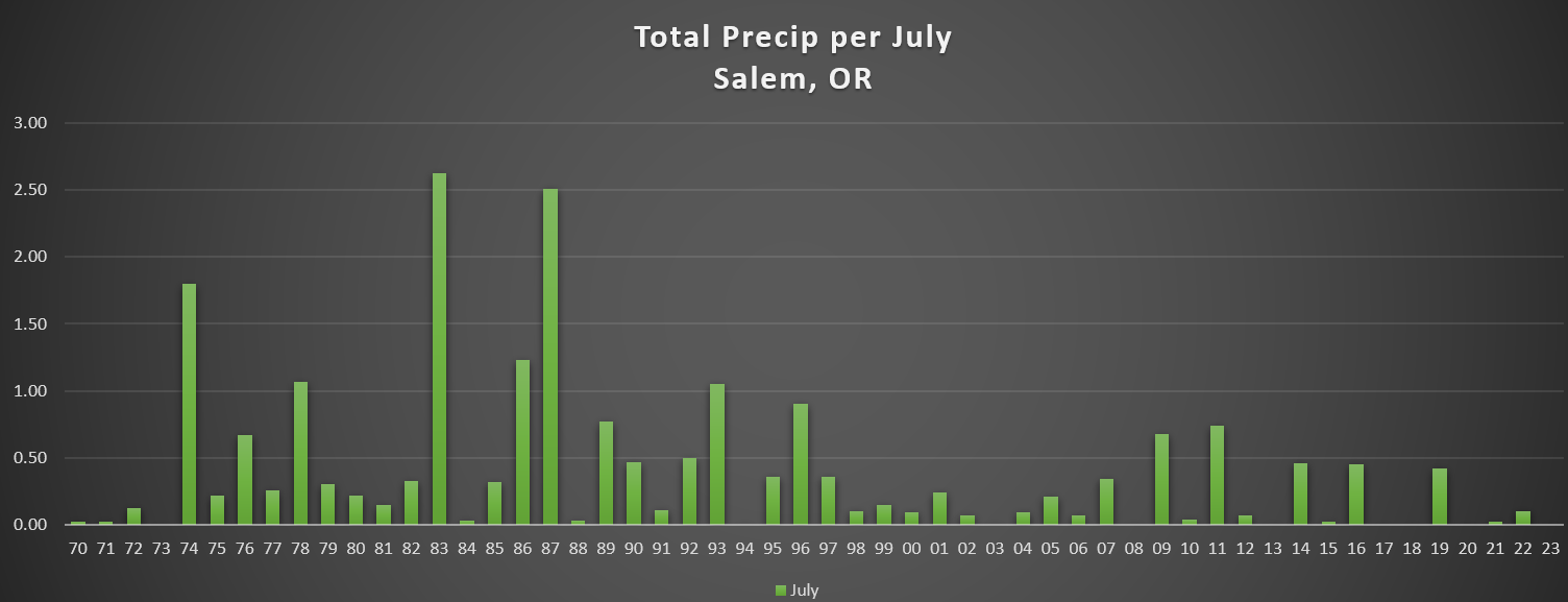
Summertime rain not associated with thunderstorms is very rare. The warm atmosphere, the stabilizing effect of the Pacific Ocean, and an extremely weak summertime jet stream in the northern Pacific all provide us with reliably dry summers. It’s true our summers have turned hotter and drier in recent years, but truth is, they have (for as long as we know) always been reliably warm and dry. I’m interested to see how this storm develops and how much rain we actually get out of it. To put into perspective how rare a rainy July day is around these parts, take a look at this graph below. It shows total rainfall here in Salem for the month of July going back to 1970.
Three things stand out to me:
1.) We had some unusually wet Julys in the 80s. Imagine the rough tomato crops those years. 😦
2.) Dry Julys are nothing new. If you go back even further in time, you would notice that Salem had four complete dry Julys during the decade of the 1950s.
3.) Rain in July has become less common over the past 25 years.
This won’t show on the graph, but 2019 was the last time we had more than a quarter inch of rain in one day during the month of July which again speaks to the rareness of this event. Of course it hasn’t happened yet, but odds are high we will pick up at least some rain next week.
Take care! 🙂