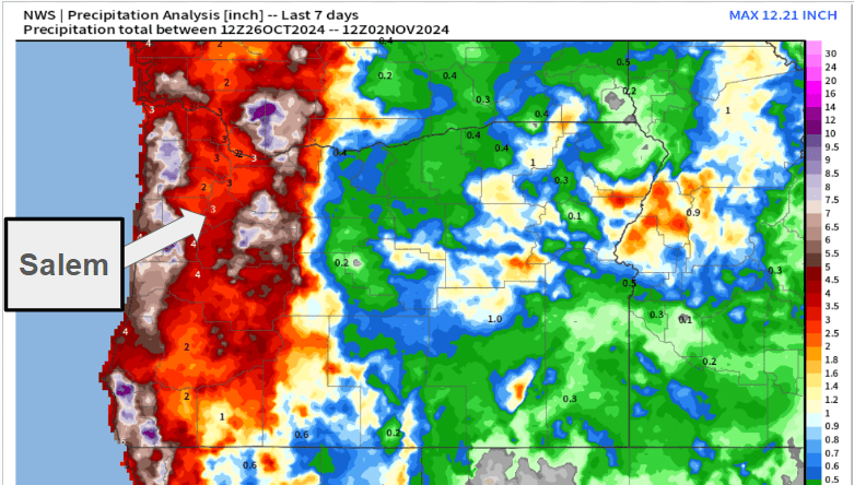
We are on day 15 in a row with measurable precip, so yes, it’s been a soggy November, and we have a couple more soggy days to go before drying out. In fact we should dry out real nicely just in time for Thanksgiving with dry weather leading up to the holiday, dry weather during, and mostly dry afterwards making for easier travel easier, and safer Cascade passes. One brief exception to the completely dry weekend would be a quick hitting batch of showers Friday. Details further below, but first, let’s start with a recap of our weather lately.
This past week went mostly to plan with the whole “bomb cyclone,” but with a few unfortunate blips. My forecast from last Sunday stated details for Wednesday verbatim as “Showers with some extended dry times mixed in during the afternoon. Highs in the low 50s.” Our high temperature was 53°, so a hit there, and the max wind gust in Salem with the storm was 38mph which fell right in with my forecast as well – another hit. Unfortunately, this is where the hits end. The “extended dry times mixed in…” didn’t exactly go to plan. For some of you, Wednesday was basically dry all day long, but for others, it was soaker.
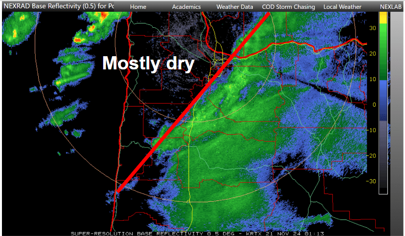
A band of steady precip trained close to the same position for almost 6 hours Wednesday! The forecasting models I use hinted at this happening, and I knew it was possible, but nothing showed it being quite that consistent. Most of west Salem, Amity, McMinnville, Dallas all had a mainly dry day; however, parts of south Salem, Stayton, Turner, and Albany experienced rain for much of the afternoon and early evening hours.
This is just one of the reasons why forecasting snow is so tough here. Imagine if that had been snow instead of rain. We would have been talking about a major snowstorm in Albany and even in parts of Salem while other parts of town got almost nothing, but since it was just another “rainy” day, nobody really cared if the forecast was off a little. So remember that the next time we have a tricky snow event to forecast.
Forecast details
Looking ahead it appears today and Monday will be a continuation of this chilly, cloudy, and rather damp weather. Highs today and tomorrow will top out only around 49 or 50° with periods of rain and occasional showers.
Tue: A good number of sunbreaks, and a chance for a couple brief showers.
Wed – Mon: An extended stretch of dry or at least mostly dry weather. This is perfect timing for travel plans, holiday activities, and maybe putting up Christmas lights! It will be a real treat to have several days of dry weather. Expect some very cold nights with lows in the upper 20s to low 30s, and chilly afternoons despite the sunshine as highs range between 44 and 48°.
There is a chance of a few showers Friday, but nothing big, long lasting, or real impactful. With rain increasing the further north you go into southwest Washington. This should be the only exception in what could be a fairly dry (for winter) stretch of days.
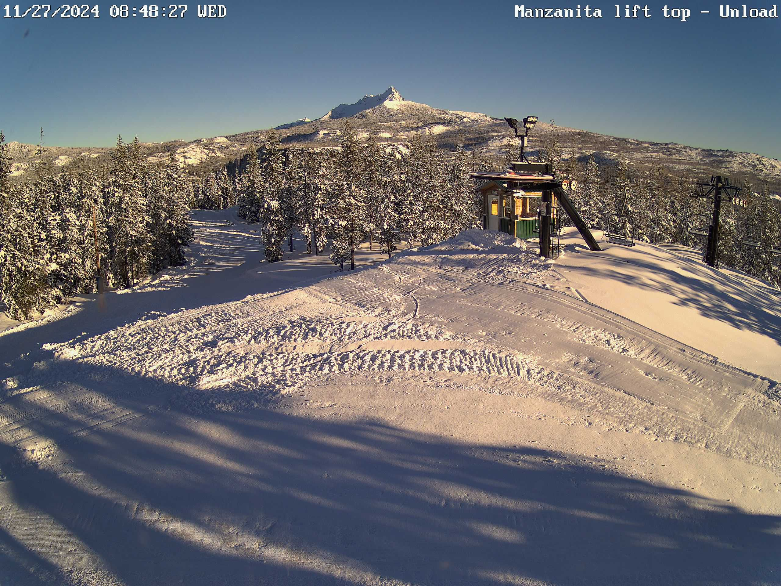
The Cascades
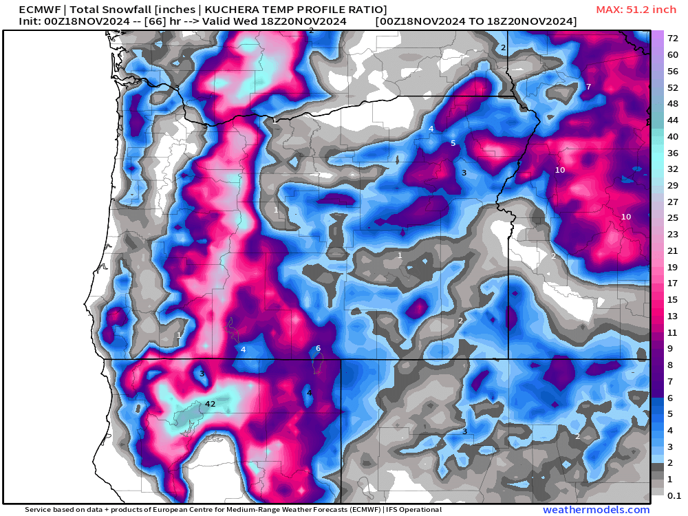
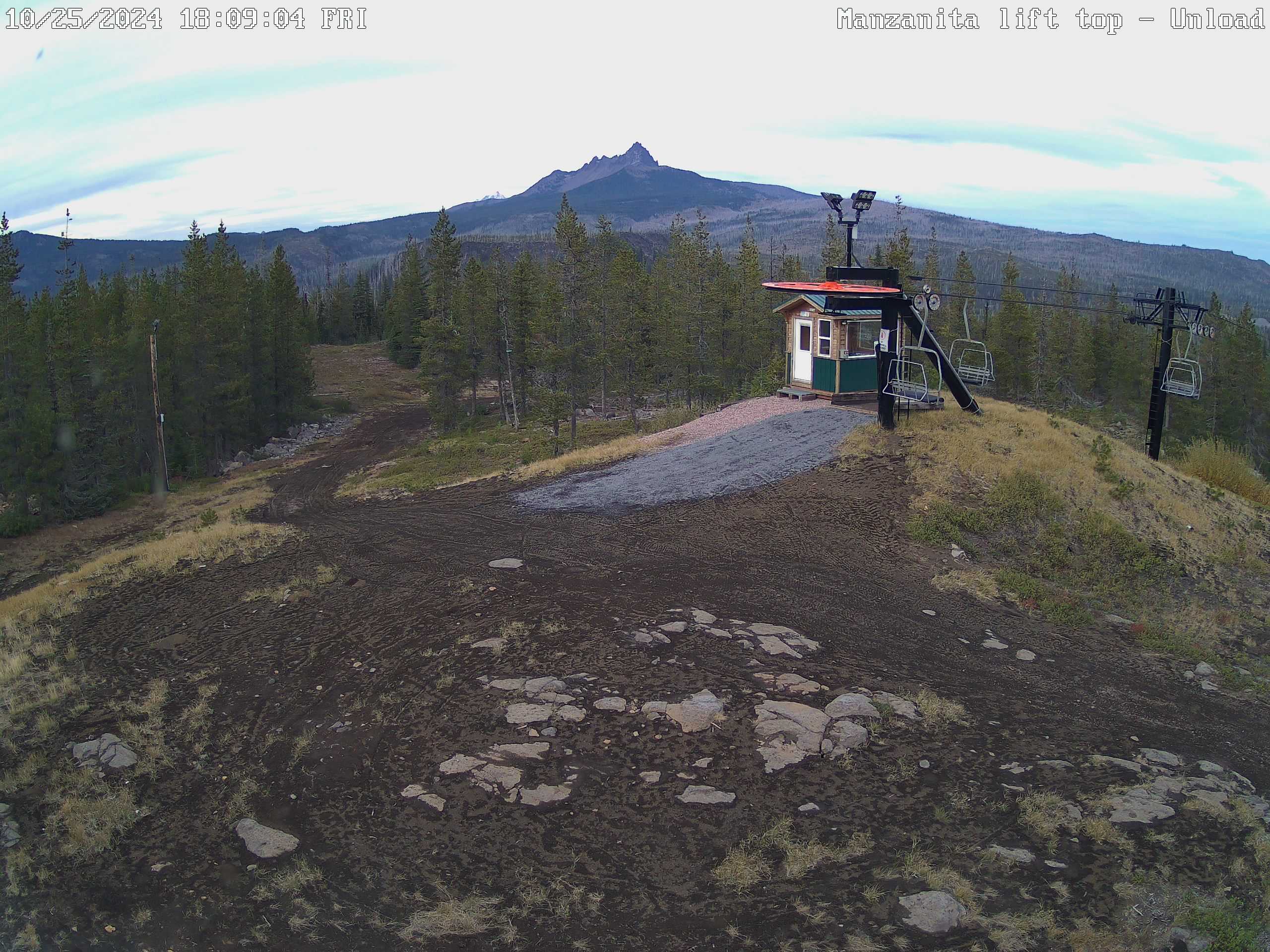
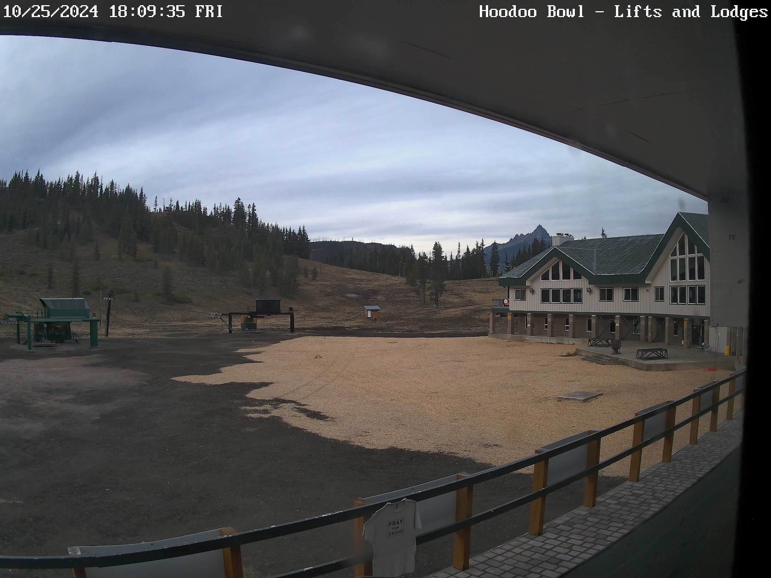
The Cascades are having an almost historic beginning to the snow season with Hoodoo reporting a base of 32 inches.
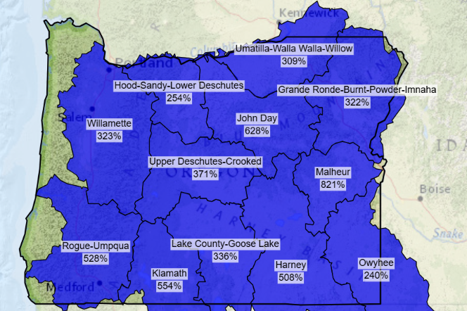
The snow water equivalent, which is essentially how much liquid water would be left behind if all the snow in one spot were to be melted down, is currently at near record levels for this time of year. As you can see, the entire state is doing incredibly well!
An excellent start to the ski season, and with another 5 to 10 inches on the way before Tuesday ends I can see a lot of people getting out and enjoying the slopes this holiday weekend!
I’ll continue to keep an extra close eye on the forecast. We have had a pretty active stretch of weather lately, and while things are calming down for the moment, the jet stream is still pretty active out in the pacific, cold air is building to the north, and it is only November…
Stay safe and healthy out there!