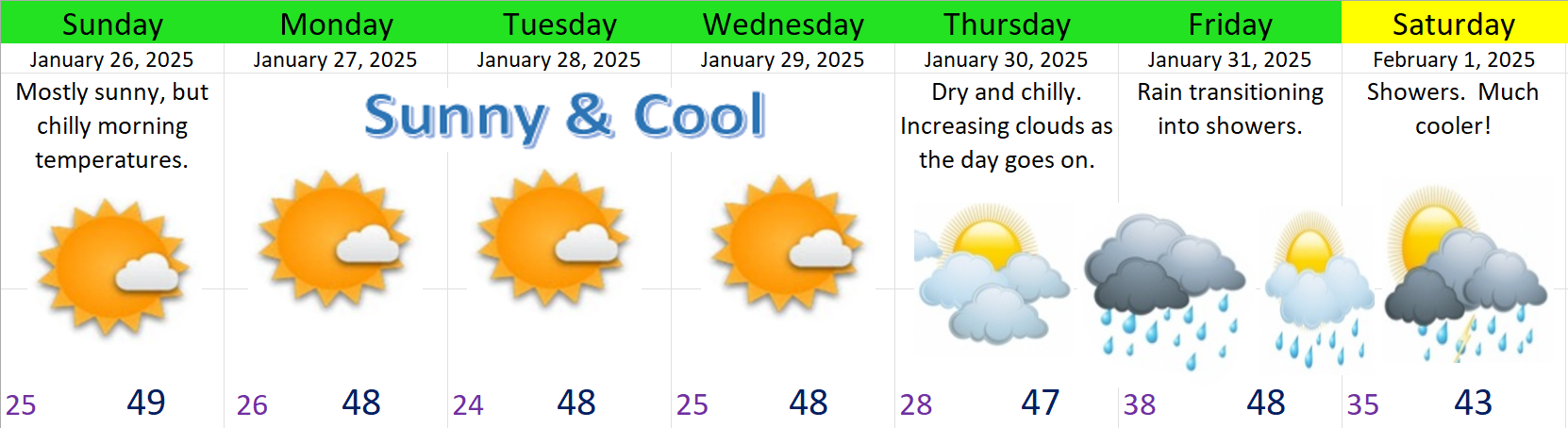
The super quick version
We have about 5 more days of dry weather before rain finally returns to our region Thursday night or Friday. Mostly sunny skies, cold nights, and highs in the upper 40s will continue through Wednesday. Thursday should be dry, but with increasing clouds, and actual rain returns late that night. Showers should continue through next weekend with lowering snow levels. Colder and possibly snowier weather is possible as we head into February. More on that at the end of this post. 🙂
Details
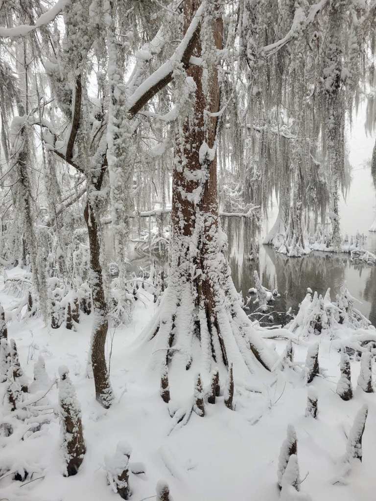
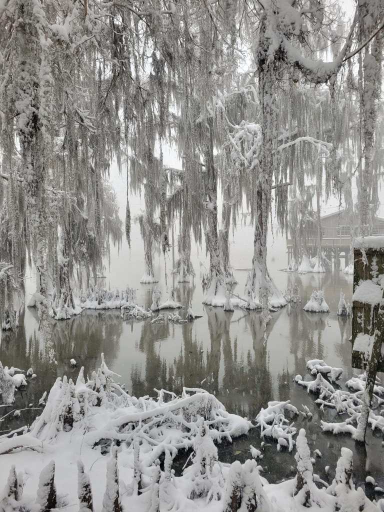
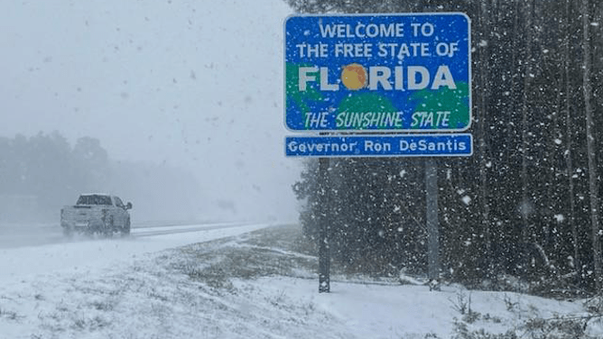
As you all know by now, the deep south had an extremely rare and historic snowstorm this past week. Actual blizzard conditions where observed in many locations from Louisiana to Florida. These photos of the snow covered and frozen bayou and blizzard like conditions along the freeway heading into Florida are just amazing and almost unbelievable.
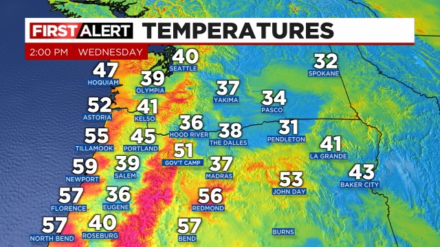
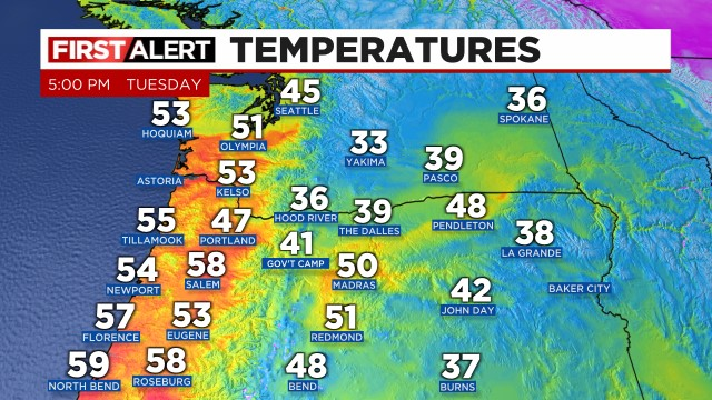
Here in Salem we got gently brushed (again) by that large mass of frigid arctic air. That is why our air has been dry, our days have been sunny with no more fog, and our nighttime lows have dipped well into the 20s several degrees below average. This weekend we are again getting brushed by a weak lobe of colder air. That’s the cause of the breezy winds we are seeing today out of the north. The result is colder lows well into the 20s with dry and sunny days.
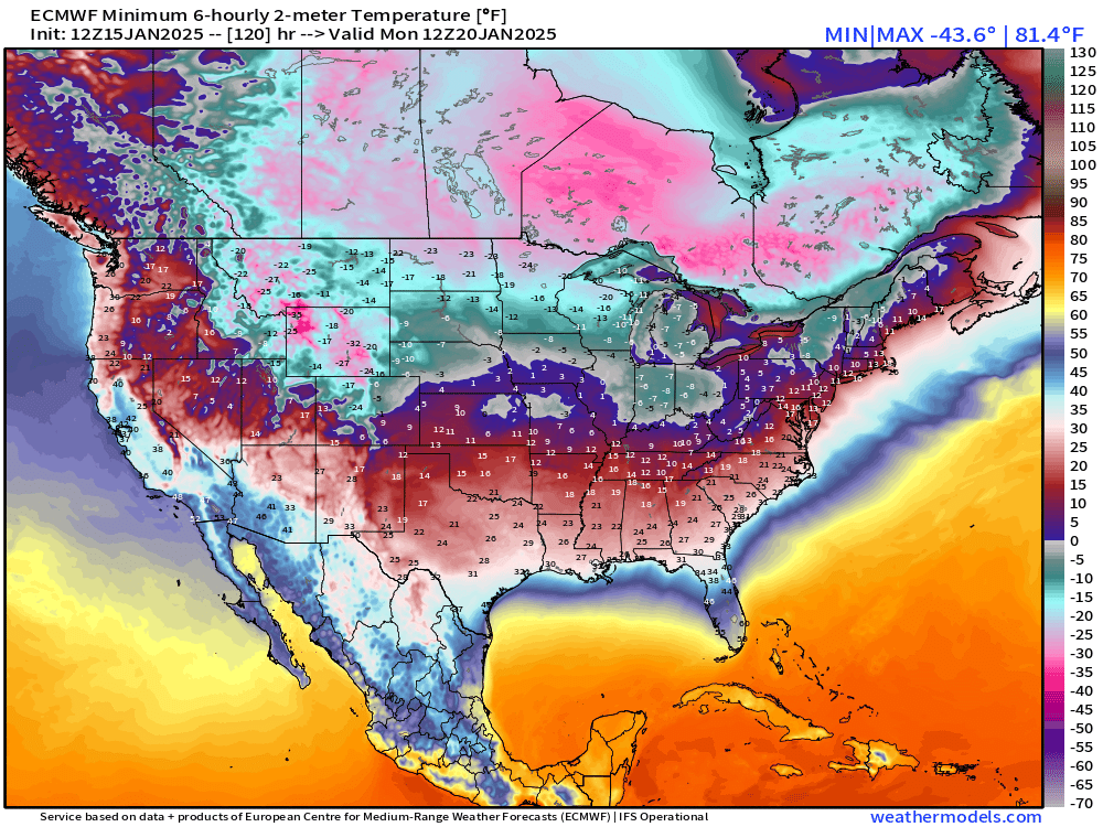
This satellite image shows just how sunny and clear the entire pacific northwest is at the moment. The snow cover in the mountains and higher elevations also really stands out.
Here’s the next 7 days
Looking ahead
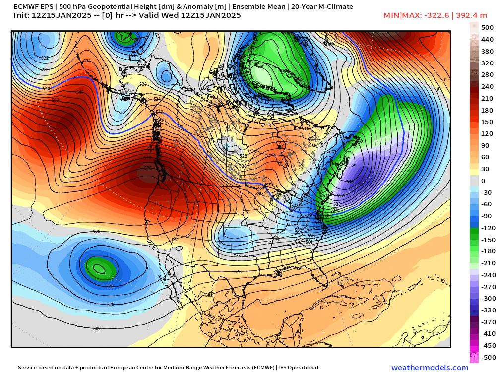
Ten days ago I put out a forecast mentioning the potential for colder (possibly snowy) weather later in the month. I was fairly vague because it was still a long ways off plus the weather models had a large spread of outcomes (disagreement) regarding where the cold air would end up. We now know it dove through the middle of the nation.
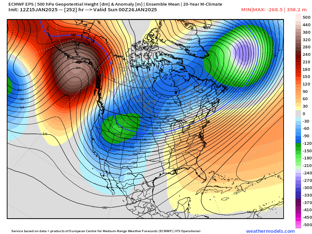
Next Sunday (Feb 2nd) models seem to be honing in on the colder arctic air moving MUCH closer to us, and possibly directly over us. When it’s more than 7 days out like it is at the moment, we look for consistency and trends. Below is a compilation of multiple model runs from the past few days showing the weather pattern up around 18,000 feet up in the atmosphere for Sunday morning February 2nd. Blue and or green shading is much colder than average, and the warm red and orange colors are just that – warmer than average lol… 😉
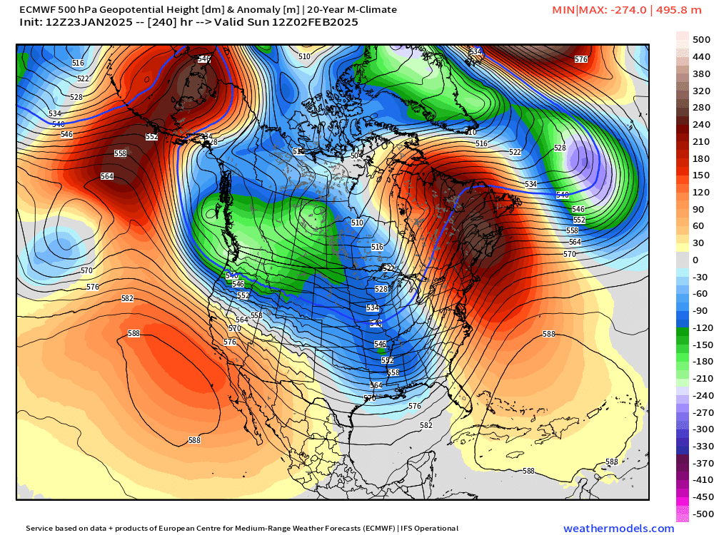
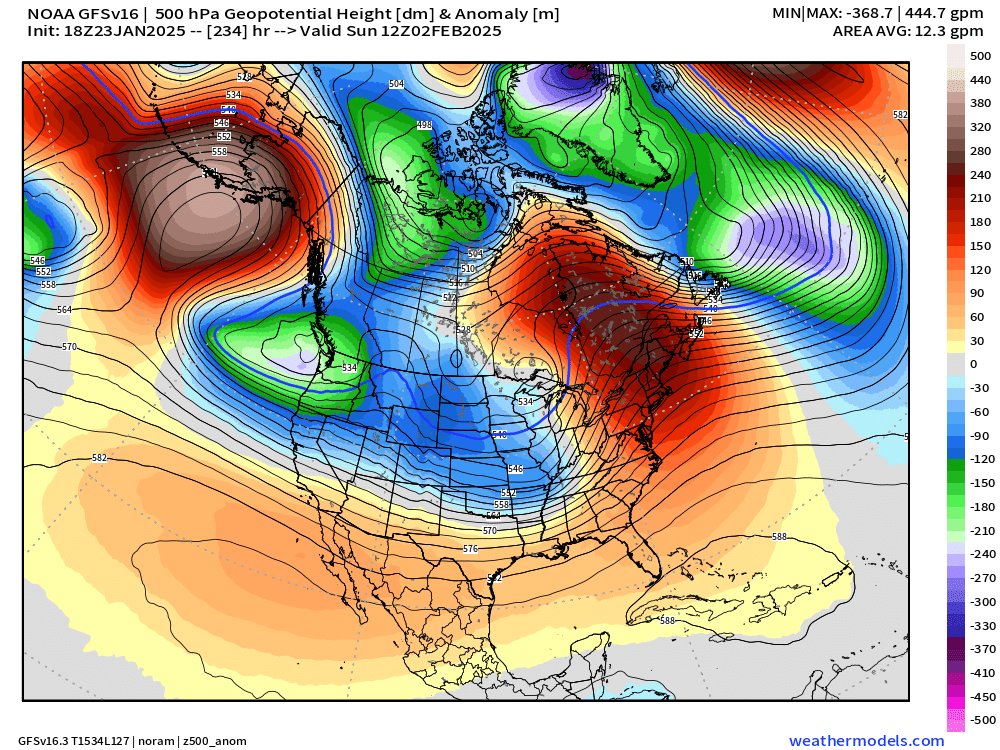
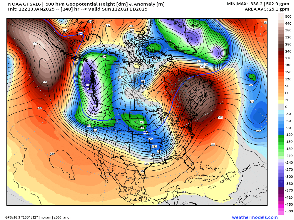
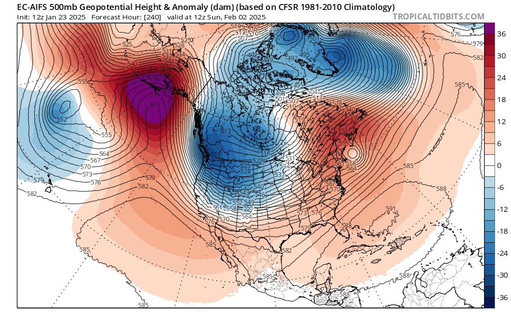

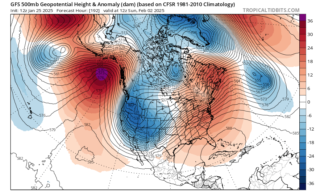
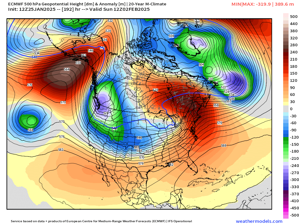
Definitely a clear trend for colder air here in Oregon, but how far south and how far west or east it goes will have a profound effect on our weather. Some of the solutions you see above would give us nothing but cold rain. Many of those solutions would put us in one of those tricky snow shower setups, and some of those would give us a full on snowstorm and or arctic blast. Odds are increasing that we will see something wintry, but still a little too early to get overly excited.
One more little piece of evidence telling us that something snowy might be heading our direction is this final chart which I’ve shared before. Each horizontal line going from left to right is a possible outcome for how many inches of snow Salem could see on those dates (the dates are located along the bottom). This model tends to overdue precip totals a little bit, so pay attention to lines showing 2 or more inches of snow.
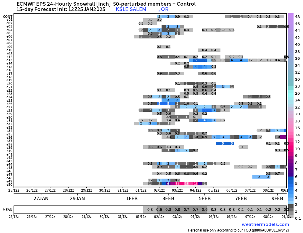
Typically during wintertime I will see maybe one to three lines showing snowfall, but when I start counting 20+ then I really start paying attention. Lots of time for things to change of course, but keep this one on your radar. In the meantime, stay safe, and enjoy the sunny and chilly weather!