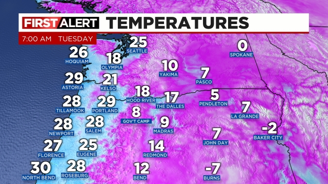
Less then 12 hours from now I anticipate Salem will be a winter wonderland with a coating of snow and maybe some freezing rain and sleet mixed in too. This is the perfect setup for snow and ice here in the valley. A cold northerly breeze is pumping in modified arctic air and very dry air too. This means our temperatures will drop even colder once the precip arrives very early Thursday morning. The process of the moisture taking or absorbing the heat out of the atmosphere is known as evaporational cooling.
Main message
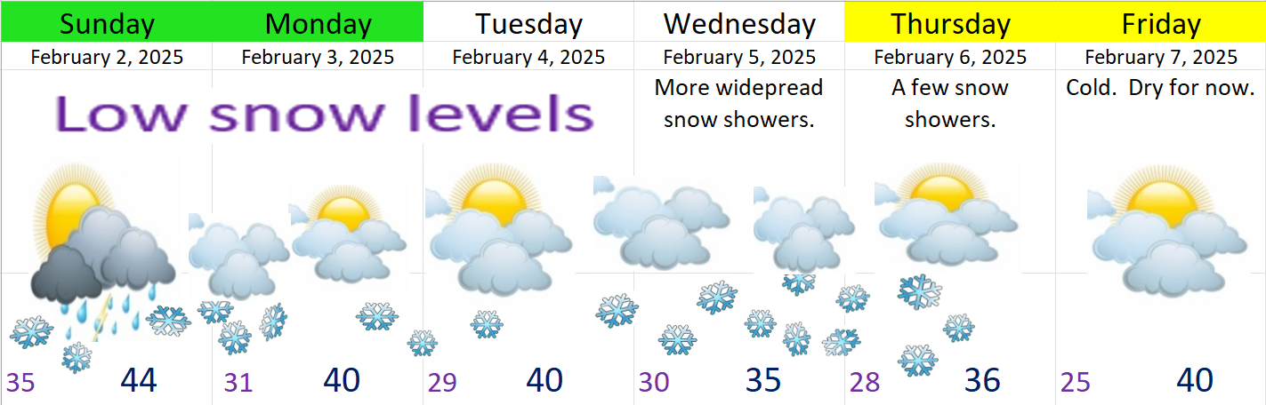
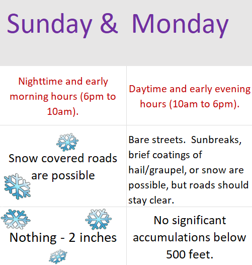
Precipitation begins around 4 to 7am Thursday morning. Expect widespread snow accumulations of 1 to 3 inches. Sleet and freezing rain could mix in. Snowy and wintry weather lasts through around 10 or 11am.
Between 11 and 4pm Thursday not much will be going on. Additional showers of snow or freezing rain are possible, but nothing long lasting or widespread. It’s also likely that we “warm” up above freezing for a few hours in the middle of the afternoon due to the increased sun angle and lack of precipitation falling. Should precip continue heavier than expected than the whole brief period of melting goes out the window… Expect poor travel conditions even if we get some melting!
Thursday night through about 10 or 11am Friday morning will feature another surge of moisture. This second wave has potential to really drop the hammer either in the form of heavy freezing rain, heavy snow, or a mix of both.
Bottom line is we have a solid snow and ice storm on tap beginning very early Thursday morning and lasting through the first half of Friday. Too soon to make the call for road conditions Friday night (Valentine’s Day).
More details
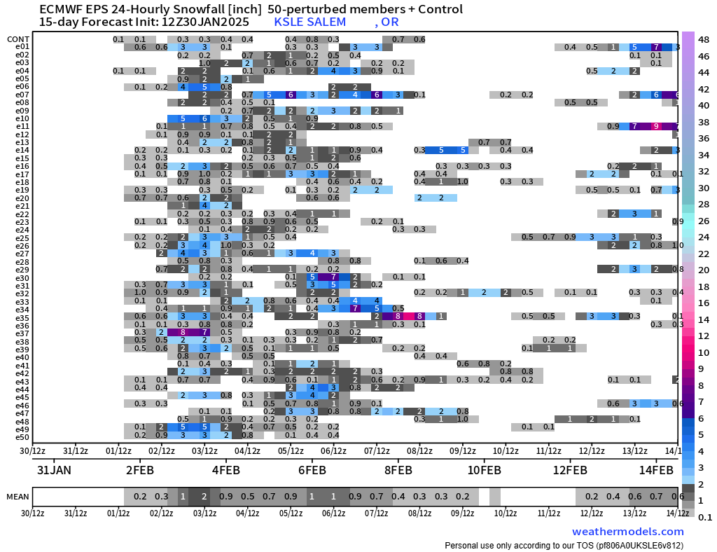
So I’m quite confident we have a snow and ice storm on the way, and I’m confident we will be more than cold enough for it to stick and accumulate on all surfaces. What is still up in the air is how much of precipitation falls all together, and how much falls as snow versus freezing rain. Check out how much precip this particular model has falling through Friday 8am.
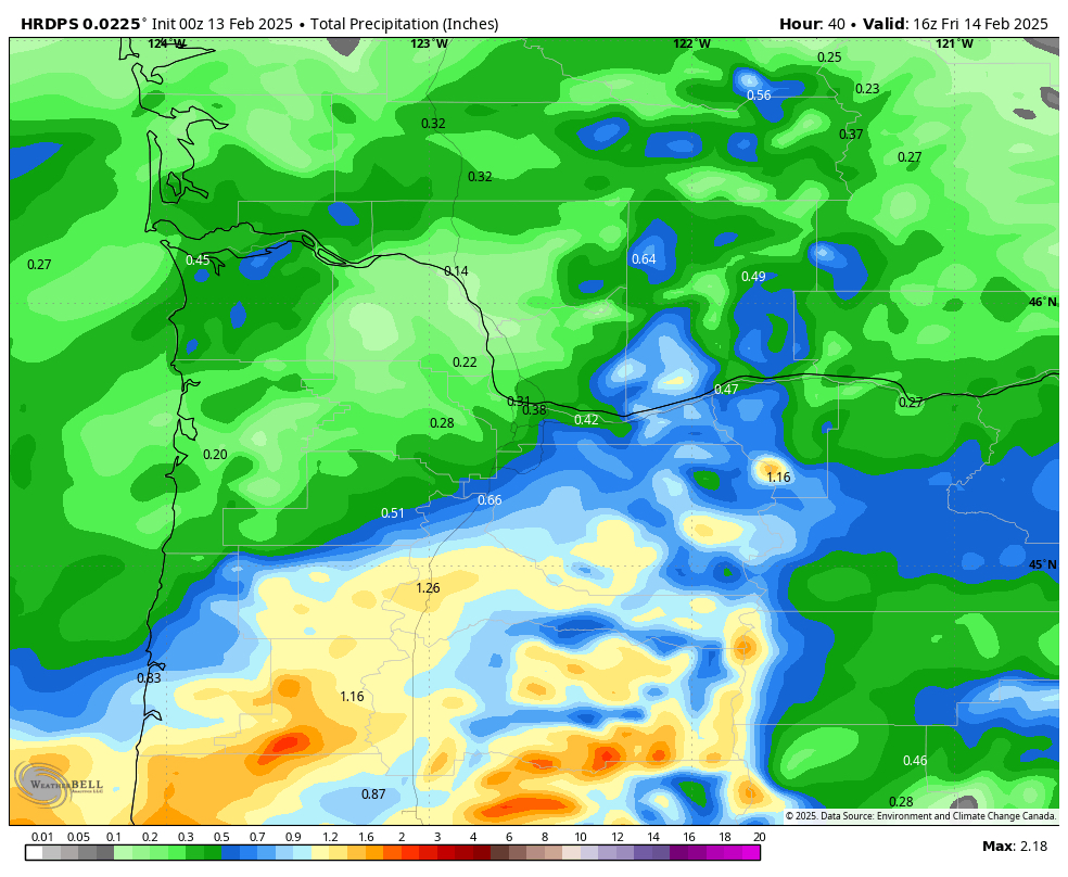
That could be a whole lot of snow, or a scary amount of freezing rain, or a mixture of both, but then we have other weather models showing not quite as much precip. This next image below also is forecasting total precip, but it cuts the total literally in half. Sure it still gives Salem a hefty total good for 5 to 7 inches of snow, but that’s only half of what that first image advertised.

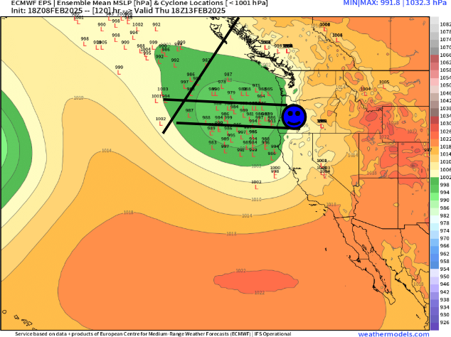
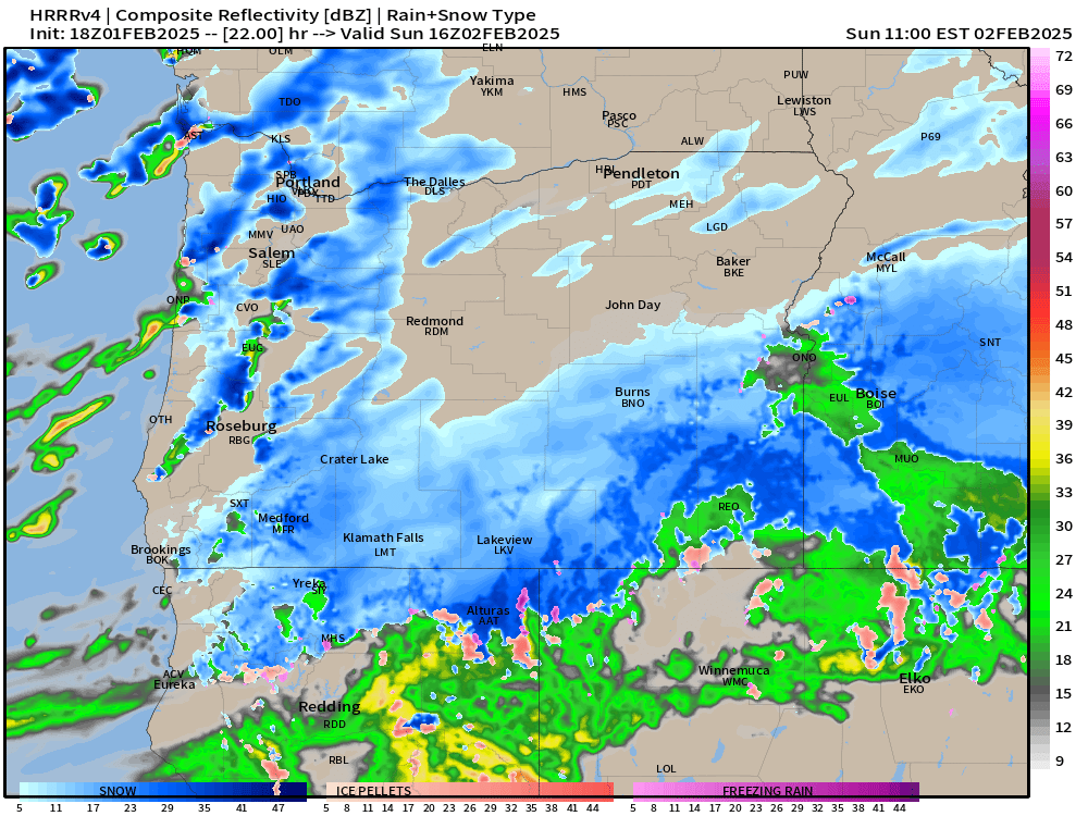
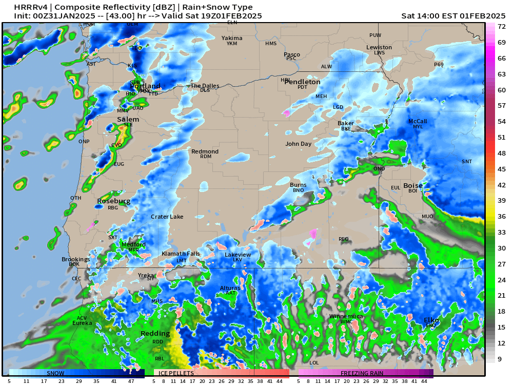
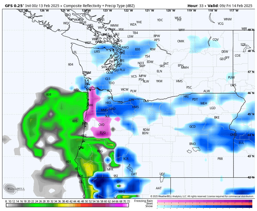
This next image shows that second batch of moisture directly over the Willamette Valley Thursday night into early Friday morning. The “SLE” is the Salem Airport. You can see how we are right on the edge of the freezing rain and sleet (pink coloring) and the heavy snow (blue coloring).
The important message is that we have a snow and ice storm on hand. How much do we get and is it more ice or more snow is a question we just can’t know this time around until it happens. Be prepared for icy roads, snowy conditions, and possible power outages. Truth is that around here it only takes an inch or two of snow to mess things up on the road anyway, so what’s an extra half foot between friends right? 🙂
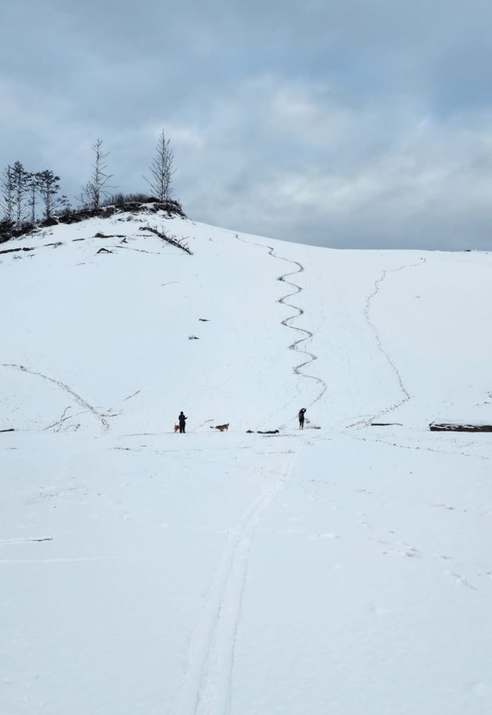
Stay safe and enjoy the snow and ice!