It’s a beautiful Thursday afternoon and temperatures are in the low 70s here in the mid Willamette Valley. I have a short update on our wet weather plus a look into next week and beyond below.
The forecast
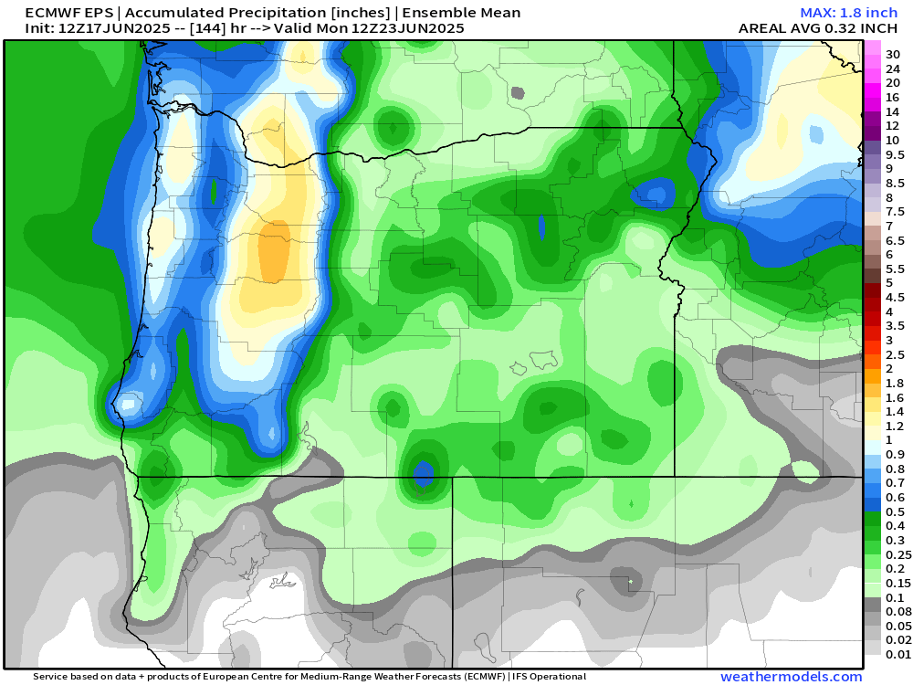
Our wet weekend is still very much on track. This weekend’s showers and rain show up very nicely on this ensemble chart. Remember, time goes from left to right on here and each horizontal line is a predicted outcome, and in this case, the outcome is precipitation. When viewing these charts we look for general agreement and trends.
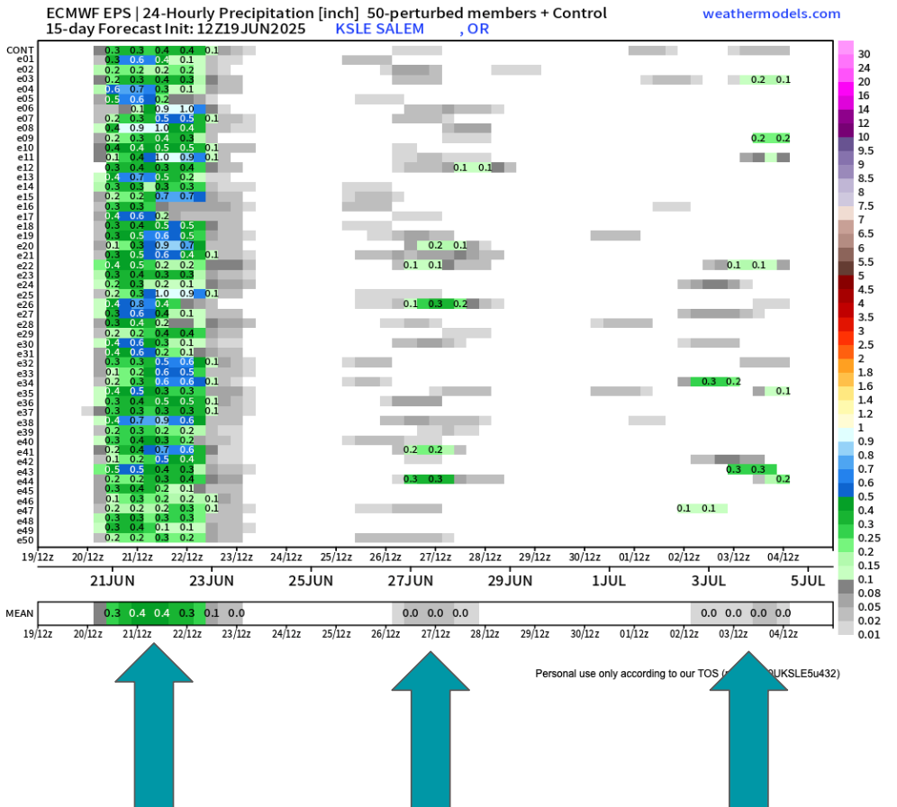
Besides the soaking rain this weekend, you can spot the real light rain/sprinkle chance showing up for next Thursday (the 26th). I also noticed a higher than usual number of ensembles predicting a little bit of rain maybe the first few days of July. I’ll keep a close eye on that.
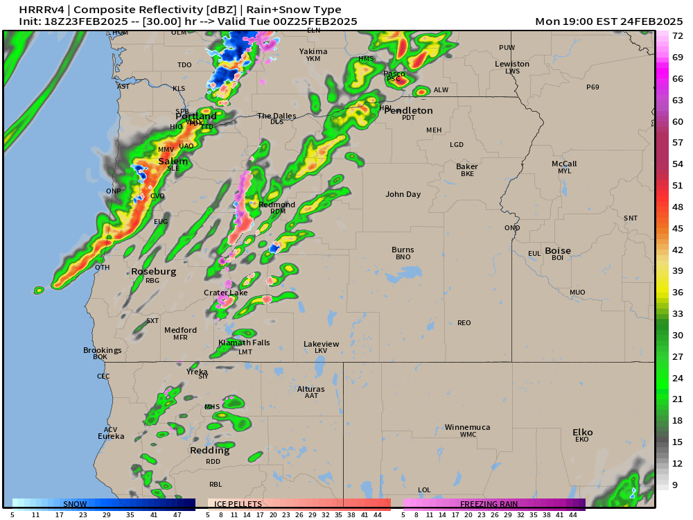
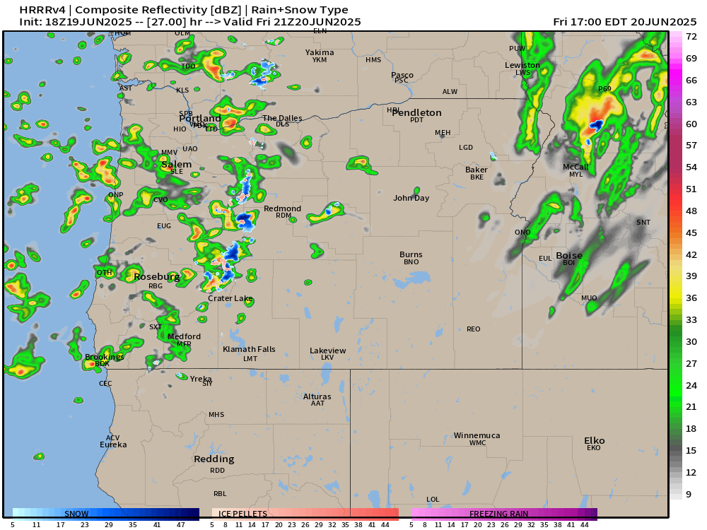
Friday will feature showers with just a few sun breaks here and there between showers. Quick hitting thunderstorms and heavy downpours are possible for all valley locations. The simulated radar image below does a good job depicting this scenario around 2pm Friday.
On Saturday we will actually see some steady rain during the morning/early afternoon hours before transitioning to a few showers later in the day. Again, downpours are definitely possible for all areas west of the Cascades. Steady rain will make it hard for high temps to top 60°.
Sunday: Expect this day to be mostly dry, but an isolated shower or two will require people outdoors to keep an eye to the sky. Overall a much better day weather wise for outdoor activities. Highs around 71°
Mon & Tue: Partly cloudy (more clouds during the morning hours) with lots of afternoon sunshine. Highs 80 to 83°
Wed: Increasing onshore flow again will lower highs back into the mid 70s with partly cloudy skies.
Thu & Fri: Could see another sprinkle or light shower (similar to what we just saw this past Wednesday) at any point during this time frame, but especially Thursday morning. Highs in the mid low to 70s with sun breaks mixed in.
Sat – Mon: June will finish on a warm note with highs in the mid to upper 80s and mostly sunny! A huge contrast to what we will experience this coming weekend.
Take care, enjoy the west weather the best you can, and don’t forget to pray for the people God puts on your heart today. Our world could use more prayer right now.