Wednesday is going to feel like a super early taste of fall. If you don’t want summer to be over yet, well don’t worry, summer weather is poised to make a quick return by the weekend. In fact, we could be looking at highs at or slightly above 100 degrees next Monday.
Details
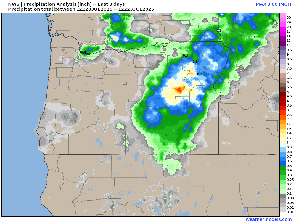
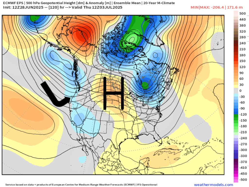
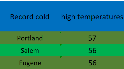
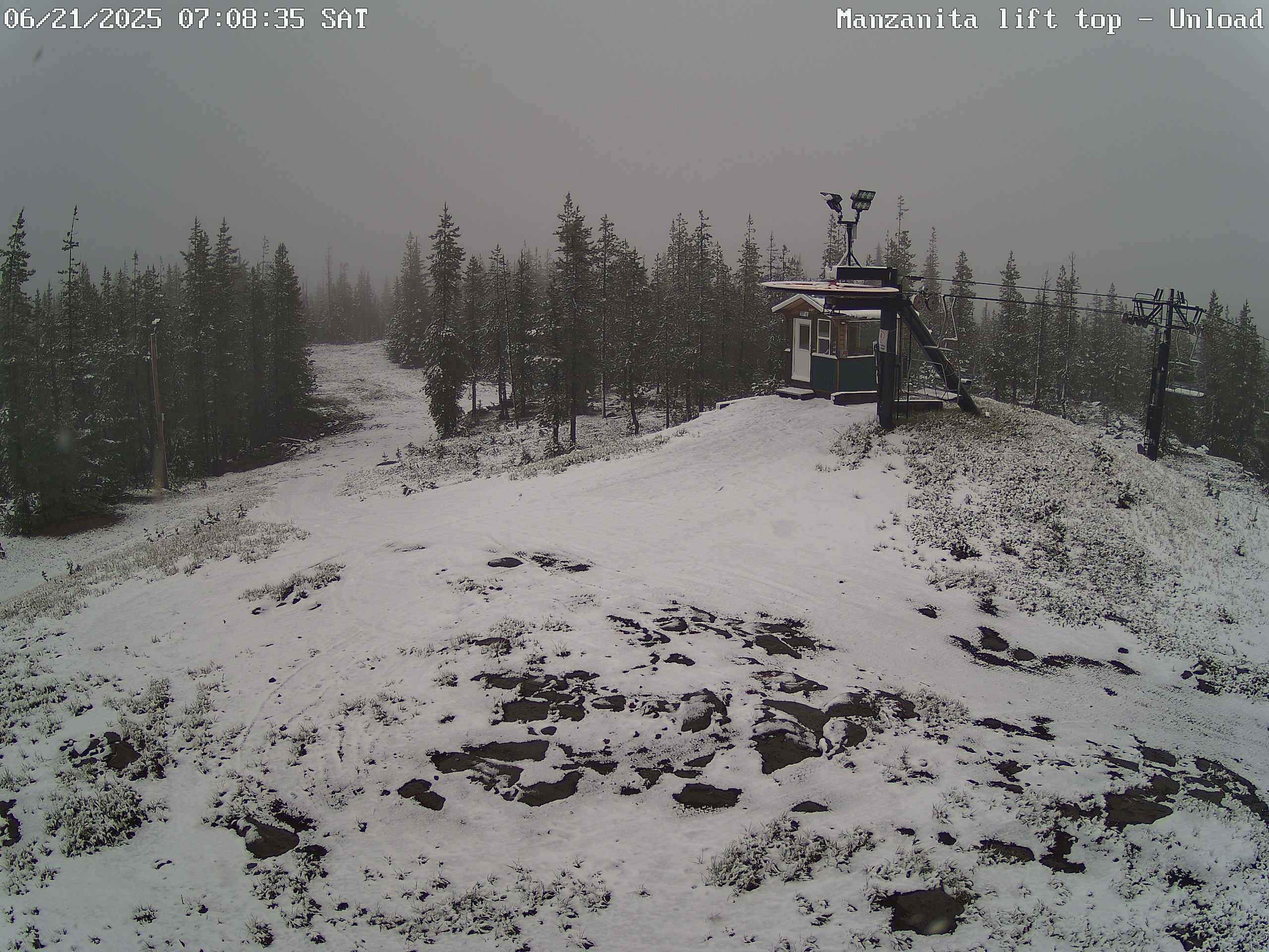
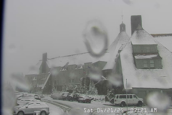
Wednesday: Showers and light rain push in before sunrise with scattered showers lasting on and off throughout the day, but lessening as we head into the afternoon. Highs just barely reaching 70 or so. Rain should fall for most locations west of the Cascades from Eugene northward. Western Washington and the Olympic Peninsula up there could see upwards of a half inch of rain or more. Great news for fighting fires burning that way!
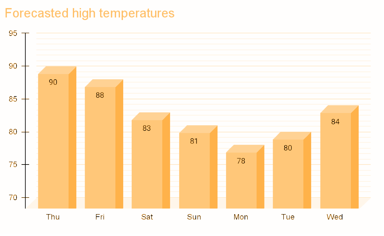
Thu & Fri: A few morning clouds with afternoon highs 80 – 84°.
Sat: Significantly warmer with highs in the upper 80s.
Sun – Tue: Highs in the 90s to 100°. It’s going to be a real hot stretch with lows only dipping to the mid 60s.
Next Wednesday we return to more usual warm summer weather with mid 80s for highs.
Enjoy the weather whiplash haha and stay safe out there!