The update I promised, and it’s one of the tougher updates I’ve ever done. Tough because so many people have plans this week for Christmas, and tough because I’m still not sure what will happen, and that can feel frustrating. The rest of today and Tuesday will feature more of the same: breezy at times, sunbreaks, showers. The steadiest rain will occur this evening around 4 to 8pm tonight. Now for the tough part.
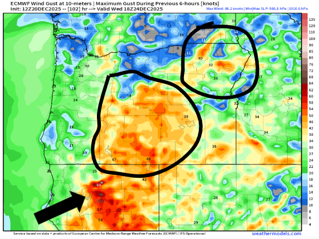
In my last update, I mentioned the potential for strong winds in the Cascades and over in central Oregon. It’s looking more likely that those strong winds could also move through the Willamette Valley. Please carefully read through these important highlights:
Highlights
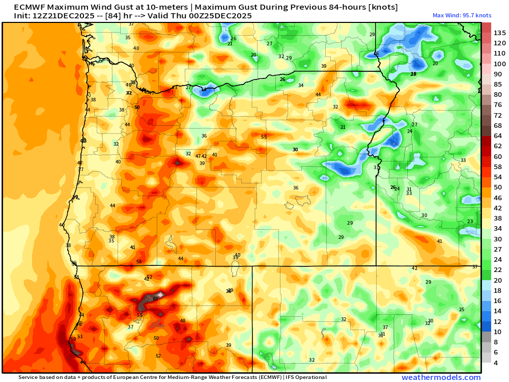
1.) A very small low pressure system is expected to move from south to north Wednesday morning. It’s small, but locations near the path will experience strong and damaging wind gusts. That part seems certain. The path the storm takes is still very uncertain.
2.) Understand that highways may close Wednesday and stay closed through at least part of Christmas day due to downed trees or power lines. Again, please consider traveling sooner rather than later if you have the option to avoid closed highways. If you end up leaving early and nothing happens, I doubt you will regret it, but if you miss celebrating Christmas with family because every highway crossing the Cascades is closed, then it’s a much sadder story.
3.) Because it’s Christmas this week, and due to the potential for disruptive weather, I will provide an additional update as soon as things become more clear.
4.) Be prepared for power outages on Wednesday that could last through the week.
5.) This will be a quick hitting storm (if it does hit us). Calm weather returns Wednesday evening. Thursday through next Tuesday (the 30th) look extremely calm. We just have to hope we either dodge this storm, or make it through it, and then it will be smooth sailing.
6.) Lastly, keep in mind nothing is final yet. More changes to come.
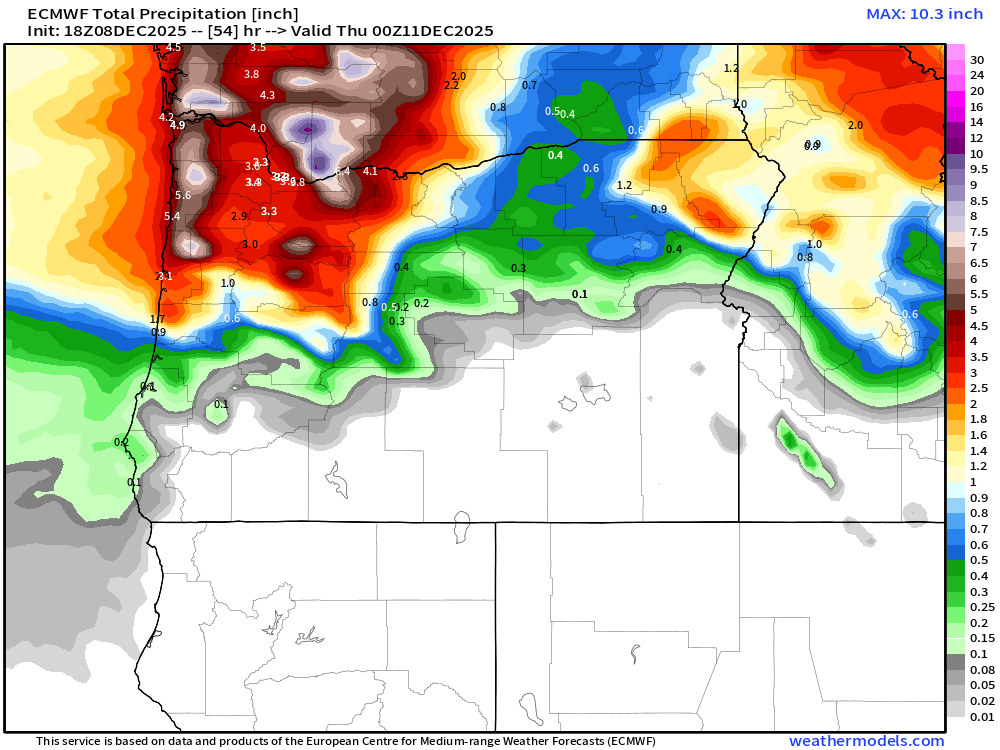
Below are three images showing top wind gust speeds for Wednesday. See why this is a tough call? Some of these outcomes would be devastating, some would limit the strong winds to the mountain passes and central Oregon still, and some would be no big deal whatsoever.


Rest of week details
Thursday (Christmas Day): Wet with light rain much of the day. High of 48°.
Friday and Saturday: Scattered showers with sunbreaks. Highs in the upper 40s.
Sun – Tue: Foggy, maybe some afternoon sunbreaks. Dry. Highs in the lower 40s, and lows near freezing.
The Cascades
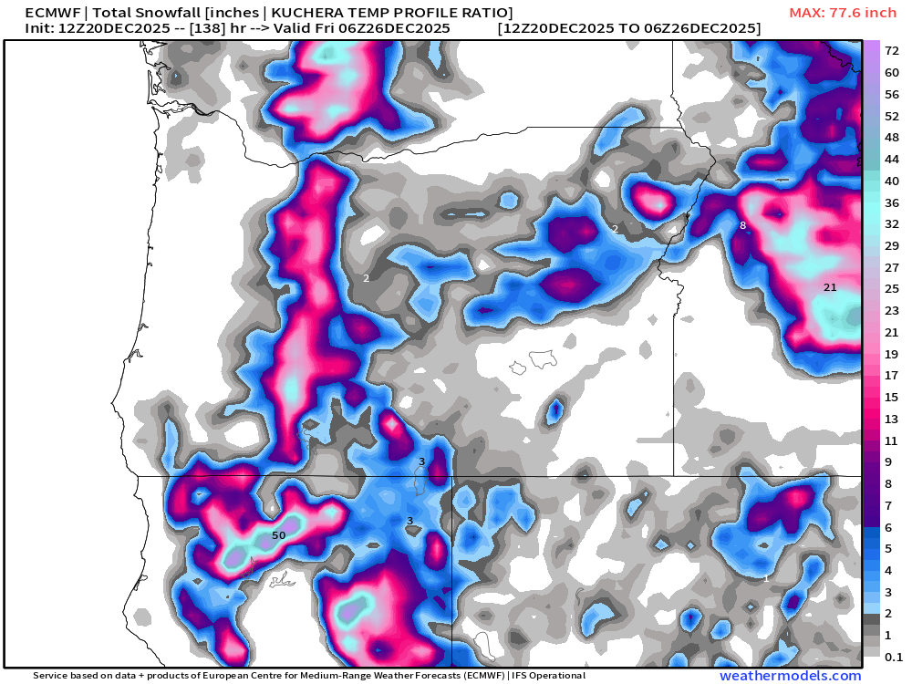
Christmas will probably be the snowiest day in the passes, but snow showers will persist through Saturday. Sunny and beautiful Sunday through next Tuesday! Unfortunately, I only see around a foot of new snow this week which is probably not enough to open new terrain.
Stay safe and keep an eye out for another update!