Stormy weather

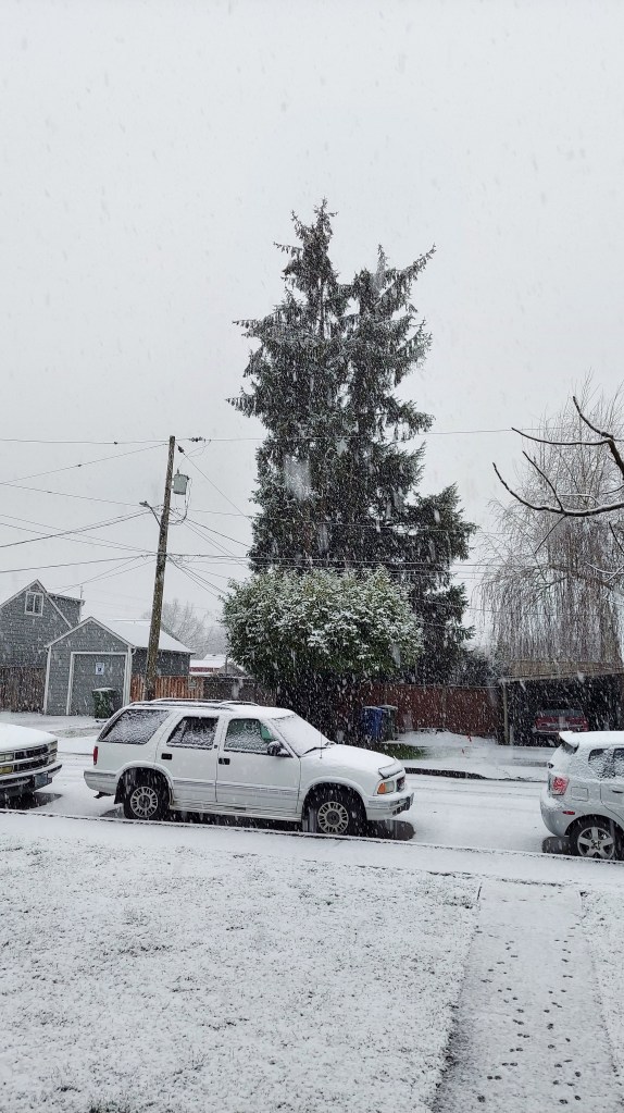
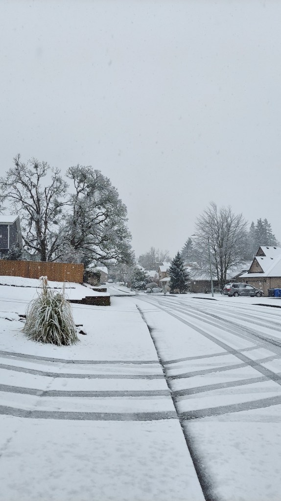
I hope you all are having a nice day and have enjoyed the nicer weather we have had lately. For too long we were locked into a chilly pattern which brought multiple chances for snow to the mid valley. Those snow events made for some challenging forecasts, and while I enjoy the snow and I’m happy with how most of the forecasts turned out, I’m glad to see nicer weather and a much needed break. 🙂

Of course it’s springtime here in western Oregon which usually means the breaks don’t last long, and indeed, our beautiful weather will come to an end this afternoon.

FORECAST

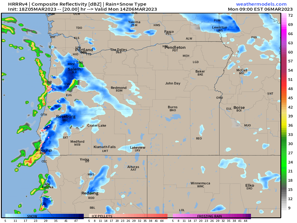
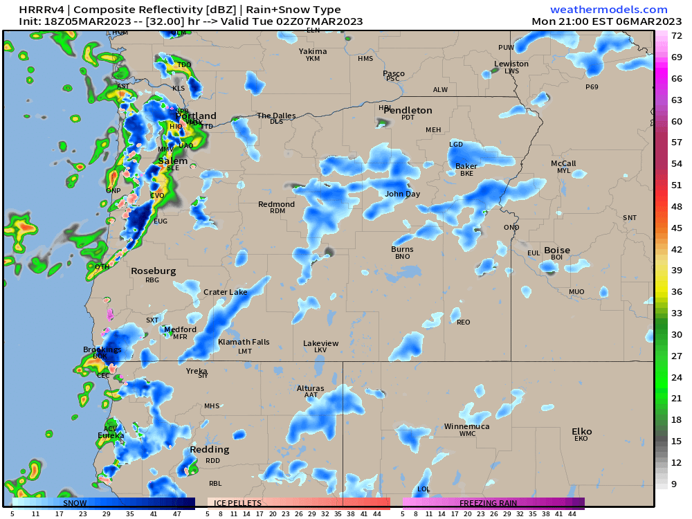
Today: Sunny until 4 or 5PM at which time showers and thundershowers will roll in from the west putting an end to our sunny and mild weather. In this particular pattern, the east side of the Willamette Valley has the highest chance of seeing downpours and thundershowers this evening; however, anyone could get soaked. Very hit and miss with the showers today, and that’s just the nature of this type of pattern. Whether you get a downpour or not, the mild weather will end today.

Thursday through Sunday

Expect the same type of weather all 4 of these days. Heavy downpours, sunbreaks, and hail showers. I’m also thinking anyone could see snow in the air (not really sticking that much) during the nights and early morning hours as cold air returns with this storm stystem. Locations in the higher hills outside of town have a better chance of waking up to a dusting of wet snow.

What seems more likely is significant hail accumulations. With an unstable airmass and very cold air aloft (up in the atmosphere), I’m thinking some of these downpours and thundershowers will drop quite a bit of small hail enough to briefly cover roadways which could lead to treacherous travel conditions.

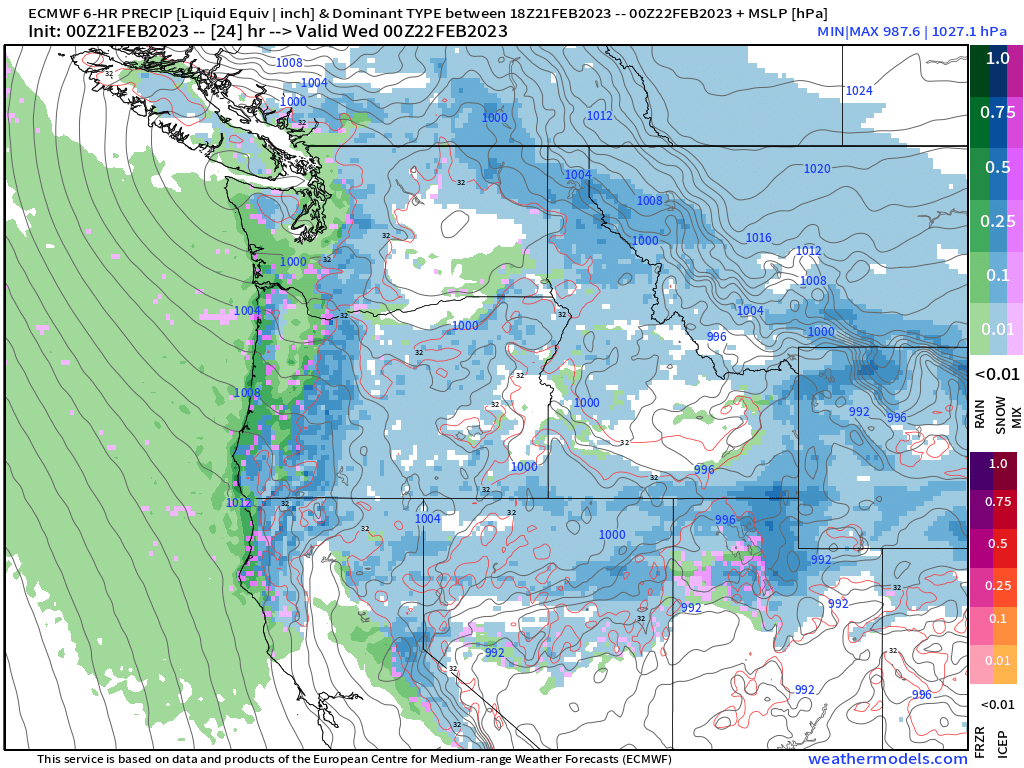
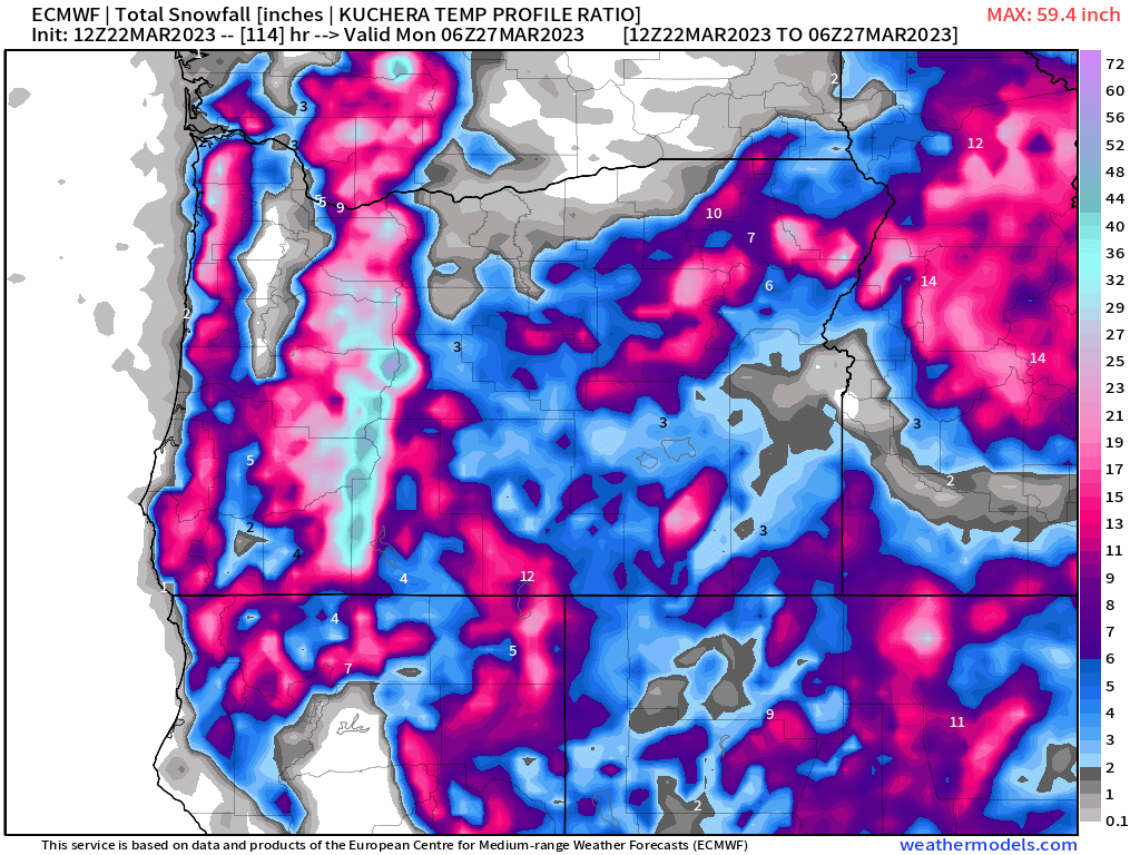
This map shows total snowfall in inches through Sunday evening. Both the Coast Range and the Cascades will see plenty of snow. The Cascades in particular should pick up some 2 to 3 feet of new snow with more on the highest peaks. This map also shows Salem getting about a trace of snow which in reality means nothing more than snowflakes in the air.

Again, there is a larger threat that hail could cover the streets and surfaces this week than snow.

Lows each morning will be 33 to 36 degrees and highs will likely stay in the upper 40s, and coupled with the hail and downpours, it should be a wild few days.

I’ll have an updated forecast later this week with any updates as well as a look at our spring break.

Take care!! 🙂

Another chilly and busy week

We are having a hard time shaking the cold and wintry weather this year. I mean, it seems to be like that a lot of years, but this year we are having an especially difficult time. Our average high this time of year is 55°. We won’t even be close. In fact, we will likely barely scrape 50 degrees this week.

We are in a cold and showery pattern, and last night was a perfect example of what could happen any night this week. Late Saturday evening a band of showers moved over Newport and Lincoln City dropping the snow down to sea level in both locations. Here’s a traffic cam pic from around 8:30PM showing fairly heavy snow falling over Highway 101.

Much of the city ended up getting a nice coating of snow. Many residents down in the Eugene area also woke up to snow this morning. We remain locked in this same chilly and stormy pattern for the rest of today, Monday, Tuesday, and Wednesday. Keep in mind today will almost certainly be the cloudiest day of the next 4 days.

HIGHLIGHTS

Each day will feature sunbreaks (perhaps quite a few), but each day will also feature downpours of rain, graupel, and hail. Thunder is possible as well. The tricky part is that should an organized group of heavier showers move through during the evening/overnight hours, anyone could see an inch or two of snow. Lows each morning will be around 30 to 33 degrees, and highs should reach the upper 40s.

This chilly and showery pattern is depicted well on these simulated radar images. Basically this model (which I like to use often) guesses exactly where precipitation will occur, how heavy it will be, and what type of precipitation will actually be falling. The greens, yellows are light to moderate rain, and the oranges and reds indicate very heavy rain. Blue represents snow with the darker blues standing for heavy snow.

This first image is for 6AM Monday morning.

This shows a big snow shower moving directly over Salem just prior to the morning commute. Of course if that band of snow shifts slightly to the north or south then we end up with nothing. Very similar to last week in that where the bands of snow setup will determine who does and who doesn’t get accumulating snowfall during the overnight hours.

This next image is for 6PM Monday evening.

This gives a good indication of what our afternoons each day this week will look like. Notice the strong line of convection (heavy showers) stretching from Portland down to around Eugene. I imagine hail, graupel, and heavy rain occurring with this line of storms all thanks to the very cold and unstable air up in the atmosphere fueled by sunbreaks earlier in the day. The rule of thumb in this pattern is: the more sunbreaks you get with a chilly and moist unstable atmosphere in place, the more likely you are to “pay for it” later with heavy showers/downpours or even a thunderstorm.

Hopefully you’re catching my drift here. Lots of showers and sunbreaks with heavier showers increasingly likely during the afternoons and early evenings. Showers will remain possible at all times of the day and night and that’s where are chance for snow comes in.

Any snow that falls would not add up to more than an inch or two at the very most, and it would melt very quickly as the days are growing longer, the sun sits higher in the sky, and we have no arctic air to keep us really cold during the daytime hours.

Looking further ahead

Thursday through next weekend could end up being quite stormy with some potentially strong systems effecting our region. The main impacts at this time look to be heavy rain in the valley, and lots of mountain snow. Too early to know how low snow levels will be and how much rain we get etc. Just keep in mind that some bigger storms could be aimed at us the second half of this week.

The Cascades

The mountains are doing great with all this chilly and wet weather. Tons of snow up in the Cascades right now. I believe Hoodoo Ski Area is a little over 81 inches at their base. According to this chart it appears the snowpack in every region in Oregon is doing really well with more on the way and again, no sign of warm weather yet.

Expect snow showers over both the Cascades and Coast Range this week with sunbreaks at times. Should be great skiing weather! I’ll keep an eye on the forecast for the end of the week as there could be a lot going on then. In the meantime enjoy this cold showery pattern and stay safe out there! 🙂

Snowy landscape

Lots of beautiful pics from around town of the snow this morning. Very wintry out there with heavy snow falling early this morning. Here are a few snowy pics from earlier today.

Do you realize our average high temps for this time of year are in the mid 50s? We are running way below average. Here are regional temps as of noon.

Forecast

The rest of today and tonight: Snow showers will pick up this afternoon and early evening. Anyone could see another coating of snow on all surfaces at all elevations (even the valley floor) with this final band of enhanced snow showers. Locations on the east side of the valley like Stayton, Sublimity, Turner etc. stand the highest chance of seeing a fresh dusting of snow before we dry out. Lows tonight are headed for the lower 20s which means any location with snow or slush on the roads still will freeze solid.

Wednesday: We start off frozen and cold, icy in places, but dry. Highs in the mid 40s.

Thursday: A cold rain with lots of mountain snow. 4 to 8 inches of snow in the Cascades above 1500′. 2 to 5 inches of new snow in the Coast Range. Highs in Salem in the mid 40s.

Friday: A chilly morning with lows right around freezing. At this time not anticipating big problems this day, but I’ll watch it closely. A batch of showers this morning could spell issues again.

Saturday: This looks to be our next real shot at widespread snowfall. This is several days away still; however, it has potential to deliver, so I’m watching it closely.

Okay stay safe out there!

More snow tonight, for some…

More snow is on the way for at least some of us here in the mid Willamette Valley, and just like what we have seen several times over the past week, elevation will play an important role in who gets snow and who doesn’t.

Timing

Late tonight (after 1 or 2AM) through Tuesday morning.

What to expect

 The higher hills around the valley including west and south Salem as well as the hills both up towards Amity and outside of Silverton could see up to 4 inches tonight.  Anyone, even locations down to the valley floor could also pick up some accumulating snow tonight; however, I’m thinking 2 inches is probably the max amount anyone on the valley floor gets with this storm.   Because of the showery nature of this system, there will also be locations that just don’t get any snow, but it’s close to impossible to nail down those places ahead of time.

There should be a bit of moisture to work with tonight through Tuesday morning aiding our chances for snow. Additionally, the airmass as a whole is colder tonight than the previous two nights adding to my confidence that someone in the Willamette Valley picks up a few inches of snow tonight. Where these bands of precip/snow setup will determine the big “winners” for getting snow, but everyone should prepare for snow to impact your morning commute Tuesday.

Time to see what happens, but my best guess is telling me the Salem area stands a decent chance of seeing accumulating snow tonight/Tuesday morning.

Recap

Anyone could see up to 2 inches of snow with 3 to 4 inches likely once you get around 5oo feet or higher. Some neighborhoods could miss out on the snow, but I have a feeling tomorrow more of us will see snow than those who don’t.

Of course the mountains will continue to get hammered with snow. Expect another 8 to 12 inches up in the Coast and Cascade Ranges.

The remainder of Tuesday here in Salem will be very chilly with temps in the upper 30s to around 40 coupled with additional showers of rain and snow. Maybe a snow shower or two Tuesday night before we dry out for Wednesday morning. Expect a widespread freeze Wednesday morning with lows in the upper 20s. Brrrr! Winter is just not done yet.

More wintry weather

Today was a perfect example of the battle taking place between the increasingly strong sun angle and longer days versus the frigid airmass. I’ve been watching the forecast closely still, and yes, there are numerous chances for more snow coming up these next several days; however, because of the time of year, it does get harder and harder for snow to really stick during the daylight hours. Not impossible as we saw up in Portland this past Wednesday, but certainly more difficult than say the middle of December. Keep these things in mind as timing of storms will be important in factoring how much snow we get over the next couple of weeks, and yes, you read that right – the next couple of weeks. Strong signals on the forecast charts indicating that the pacific northwest stays in a very chilly pattern for the foreseeable future.

Alright, enough chit chat lol. Time for a forecast. 😉

Tonight/Sunday: As far as snow goes, I’m thinking we get a lot of snow in the air with maybe some slush during the middle of the night, and up to an inch of snow in the highest hills around town. During the day expect periods of rain and showers/brief downpours. My gut is telling me this will be nothing real exciting here in Salem as we will have too much of a south wind keeping us warm enough for just rain. The image below actually conveys my feelings pretty well. Blue is snow, greens and yellows represent rainfall, and it shows Salem right in the battle zone of rain and snow. It’s very rare for us to get a lot of snow when we are in that “battle zone.” Plus, like I mentioned earlier, a southerly breeze will keep us just warm enough.

Now, the Portland metro area will likely be a very different story as they could easily see an inch or two of snow before finally warming up Sunday morning as the south wind will have less of an influence up there.

Sunday during the day will feature rain and or rain/snow mix, but nothing that accumulates below say 1000′. Tons of snow up in the mountains though, with 8 to 12 inches falling between now and Sunday night!!

Below is a cool satellite image showing the snow cover on Friday. Notice a pretty substantial gap in snow coverage between the Portland metro area and Salem, and then very little snow south of the Salem area. Remember, Salem sits just below the 45th parallel line and is flanked by hills to the west and south.

Cool to see and look at. The Coast was also hit extremely hard by snow with nearly 8 inches falling in Lincoln City! Check out this snowy looking highway 101 in downtown Lincoln City. A rare sight for sure!

That’s all for tonight. I know there are many more chances for snow coming up this week, and you should plan on snow possibly effecting your lives at times in the coming days, but I just can’t tackle all that tonight haha, so stay tuned for future updates and take care. 🙂

Tuesday morning update

It’s always interesting to see things progressing in real time versus what is forecasted, and on a personal note it’s both exciting and really nice to see things working out at least close to what I had in mind lol. So far so good. Today will certainly be a wild day for some of you with gusty winds, hail, downpours of rain, plus tons of snow up in the mountains. Tonight temps cool off even more dropping the snow level close to the valley floor. Anyone could see snow tonight/Wednesday morning, but the larger and more significant chance for snow comes Wednesday night through Thursday morning. More on that later.

First let me show you a few images which will really help convey our weather for the next 3 days. This first image is for 4PM this afternoon. Basically what I see here are gusty winds as indicated by the tight isobar lines on the map, and it’s true, winds will be gusty today, especially higher up in foothills and mountains. Next, I see lots of blue in the Cascades which equals lots of snow up there, but I also see a skinny strip of blue in the Coast Range telling us the snow levels will indeed be very low.

Next is an image for 4AM Wednesday morning. This shows a bit of pink between the Coast Range and the Cascade Range which indicates even lower snow levels. This could easily be a 2 hour delay type of day as snow falls in the higher hills. This will be a showery setup, so even valley floor locations could see sticking snow in this scenario if a heavy shower were to pass over; however, the higher hills around town are definitely favored in this situation. Overall I expect nothing to an inch or so here in Salem, but probably little more than that.

At some point Wednesday evening a new low pressure system forms offshore. Very cold arctic air will be pulled from the north as well as from the east through the Columbia River Gorge. This sets us up nicely for widespread snow. By the time we reach Thursday morning (roughly 4AM), we are in well within a band of snow thanks to this perfect combo of cold arctic air from the northeast and moisture wrapping around a low pressure system. A storm like this could give anyone in the Willamette Valley several inches of snow. Trying to figure out where the heaviest bands of snow set up is tricky, but for the moment is seems like locations between Albany to Portland have a good shot at scoring some decent snowfall. Check out the image below showing this potential.

Lastly, here’s a quick glance at what temps were as of 7AM this morning across the region.

Have a safe and wonderful Tuesday! 🙂

Monday morning update

I’ll have a nice more detailed update either tonight or early Tuesday morning. There is a LOT going on, and the next 3 days are going to be pretty wild by our mellow Oregon standards.

Tuesday

Salem area: Frequent showers/downpours with heavy rain, hail, and graupel (mix of snow and hail essentially) are all likely during the day Tuesday. Sunbreaks in between, and gusty winds 30 to 35mph at times. Some thunder is even possible. A wild day for sure!

The Coast Range: Snow levels will be low Tuesday – roughly 1000′, but lower at times which means Coast Range highways and roads will likely see heavy snow through the course of the day. The jet stream will be ripping Tuesday aiding orographic lift which always helps enhance precipitation in the mountains. 3 to 6 inches of snow on Tuesday in the Coast Range.

The Cascades: These mountains are going to get hit especially hard. High winds coupling with heavy snow all day long Tuesday will make for awful travel conditions. I highly recommend you do not travel this day if possible. Looking at 1 to 2 feet of new snow this day depending on elevation with wind gusts up to 45mph at times.

Wednesday and Thursday

Snow levels will lower to near the valley floor this day as onshore winds lighten up and colder air moves in. All this happening while snow showers move ashore. Anyone could see snow this day; however, accumulations will be spotty below 500 feet. I hold the chances for Salem seeing measurable/accumulation snow this day HIGHER than what we saw last week when we had our flirtation with snow. All day long snow and rain/snow mixed showers will fall with sunbreaks here and there in between.

Meanwhile it will be a second day of very snowy passes both in the Coast and Cascade Ranges. Another 4 to 8 inches in the Coast Range, and another foot or more in the Cascades.

At some point Wednesday evening, we switch to an even colder northeasterly wind which will transport frigid air from the north into our region. A new low pressure system forms somewhere just offshore along the edge of this arctic boundary setting the stage for widespread and heavier snow here in the Willamette Valley.

Between Wednesday night and Thursday morning anyone in the Salem area could pick up a few inches of new snow with this storm as it slides south. Seems like Thursday could end up being a rare snow day around here, but again, timing and the exact location of this low will determine how much snow falls and where it falls, so stay tuned for those updates.

Phew! It’s going to be a wild few days, so get ready!