The week ahead

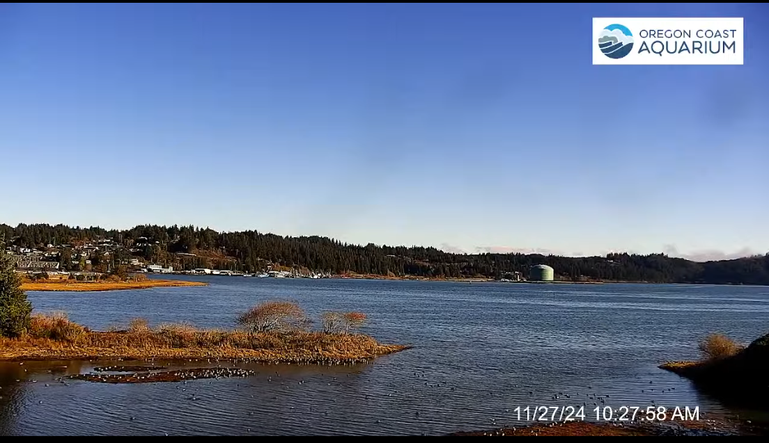
After more than ten days of dry weather, rain finally returned Saturday. Showers with a few sunbreaks are on tap for the rest of today. We dry out Monday through Wednesday. A weak storm on Thursday, and then a stronger storm likely for next Friday night and Saturday. Details below.

Details

Today: Showers with brief sunbreaks in between. Highs in the upper 40s to near 50°.

Mon – Wed: Fog and low clouds are likely each of these days. Highs will vary though depending on fog. Best guess would be near 40 give or take a few degrees. Lows Tuesday and Wednesday will be in the 28 to 32 degree range .

Thu: Dry start and then rainy and damp in the afternoon. Lots of cloud cover and chilly. High 45°.

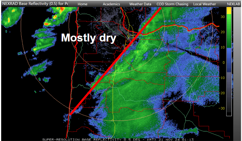
Fri: A mostly dry day in between storm systems. Lows will start out near freezing thanks to the clearing skies, and highs will only reach the mid 40s. Rain moves in Friday night.

Sat: Watching the potential for a much stronger storm to impact the region this day. I’ll be watching closely with updates to follow. Right now, high winds along the coast seem pretty likely, but depending on the strength and track of the storm, strong winds could also impact the valley. Wintry weather in the Columbia River Gorge is another possibility with this storm, so stay tuned!

November 2024

In other (old news), November 2024 has come to a close, and here are the stats.

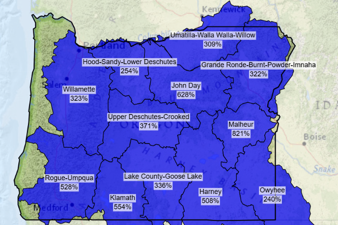
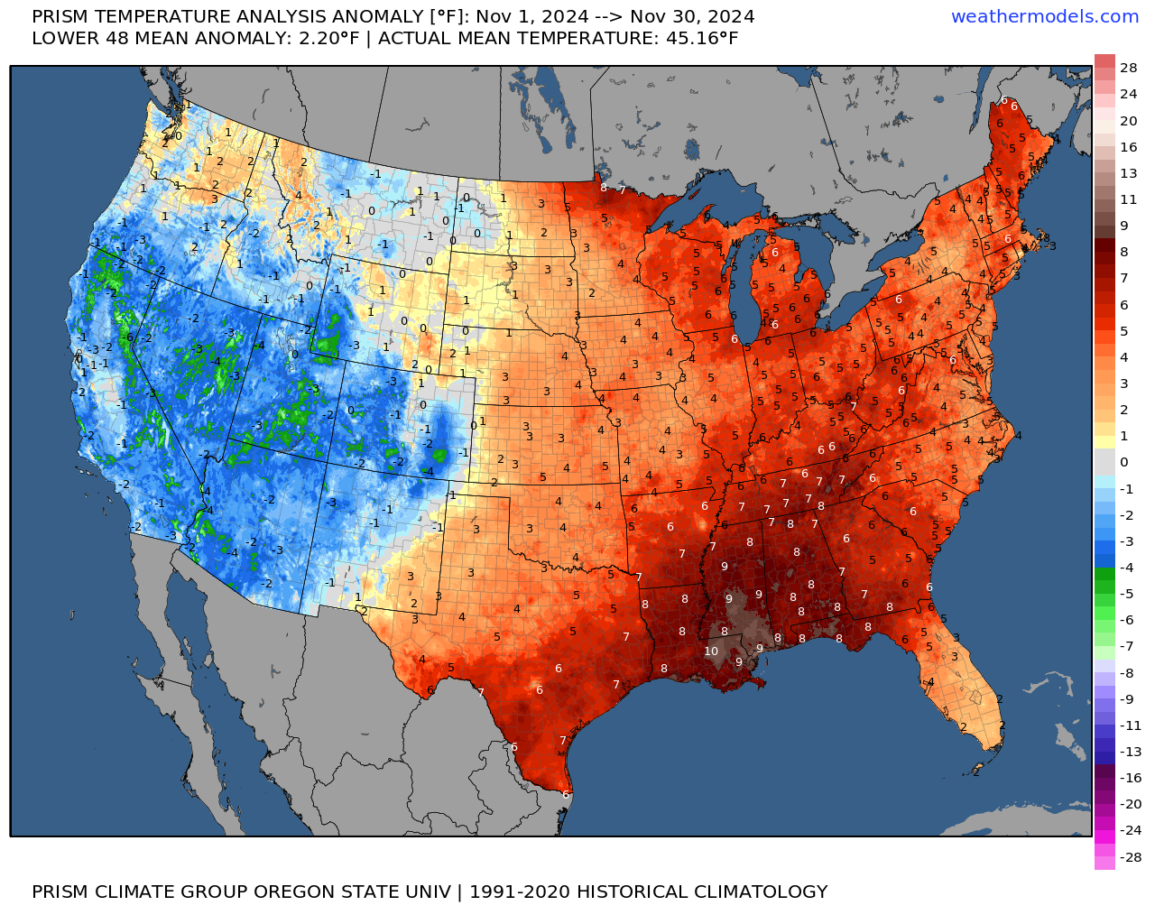
November was slightly warmer than average at 1.3 degrees above normal. November was also wetter than average despite the dry end to the month. We ended up with 7.17″ of rain which is 1.22″ above normal or 120% of average.

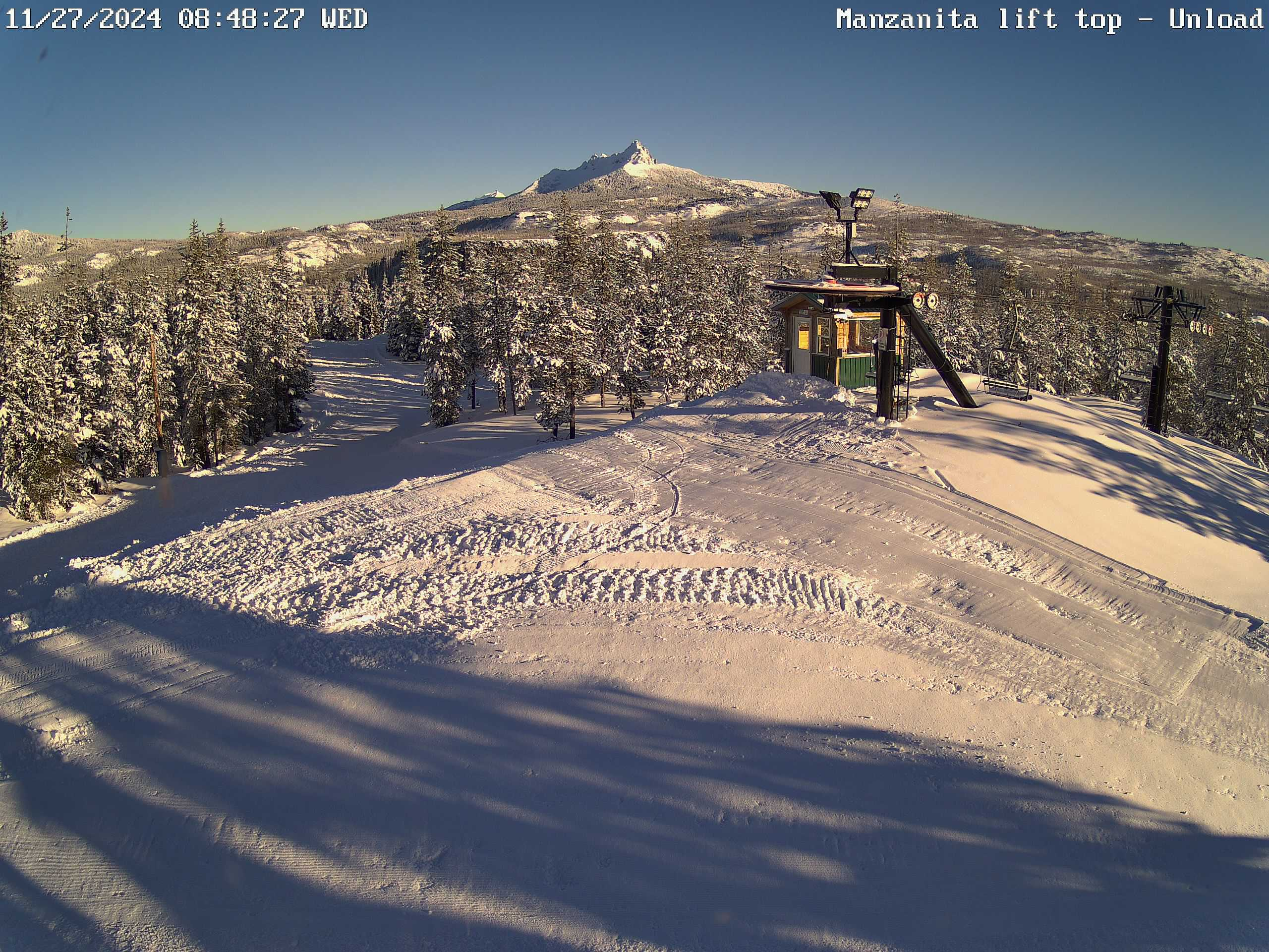
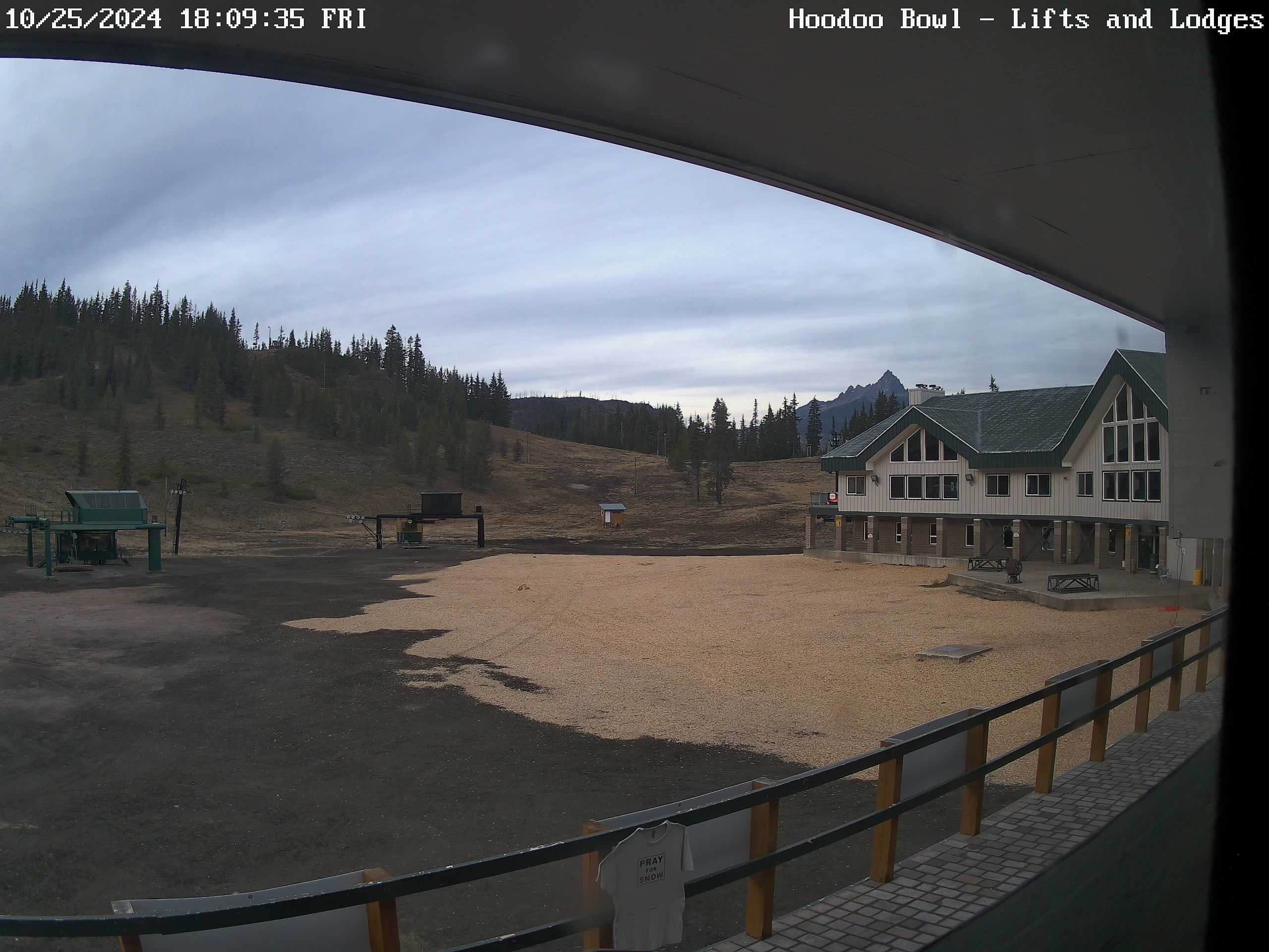
Nothing super remarkable happened in November. The highlights for our immediate region would be the early snowpack and start of the ski season. Other than that, nothing real big took place. We avoided the worst of the “bomb cyclone.” We also were spared the heaviest rain. Southern Oregon was not so lucky and experienced some flooding mid month.

Overall a little warmer and wetter than average. At the national level, one can see that much of the country was on the warmer side with the intermountain region and southwest being the main exception.

How do we stand so far this December? Well, temperature wise it has very much flipped with the eastern US experiencing some extremely cold weather so far this month.

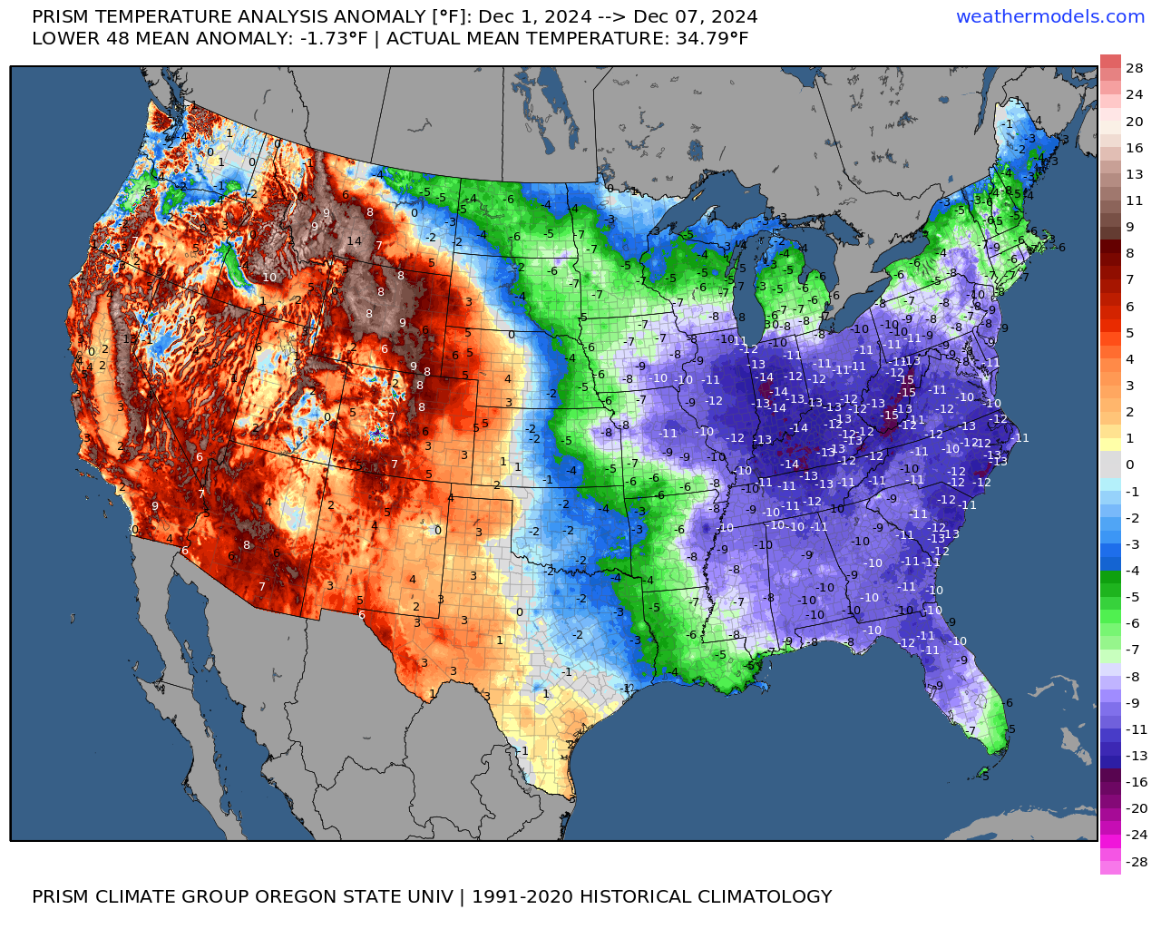
As a weather guy, something interesting I notice are the pockets of below average temperatures found out west surrounded by much warmer temperature anomalies. The Willamette Valley, some of the valleys east of the Cascades, and the Snake River Valley in Idaho are all running colder than normal due to the strong inversions we have been seeing. Meanwhile, the mountains around us have been warmer than average. Goes to show what some pesky fog and low clouds can do.

That’s all for today, but keep an eye out for a storm update later this week. Stay safe and healthy out there! 🙂

Chilly dry weather

We are now entering into what will be a long stretch of dry weather. It may not feel dry with the cold damp fog hanging over our heads, but no additional rain is expected between now and at least next Wednesday (December 4th). Excellent news for people traveling by road! Our dry spell will be marked with fog that lasts for long periods of the day, or in some cases the entire day, occasional sunbreaks, and chilly temperatures.

Expect widespread frost possible each morning over these next several days with many of us seeing our first hard freeze of the year at some point this week. These strong ridge setups in the dead of winter are tricky because if the fog holds then temperatures can also hold steady throughout the day, but if the airmass manages to dry out a little then we could see a wider rang of temperatures.

For now I’m going with lows of 28 to 33 degrees – again depending on the extent of fog, and highs in the low 40s. Today will actually probably be our “mildest” day of the week as we are just entering into this inversion pattern. Our temperature as of 10:45AM is already a “balmy” 43°.

Remember, in these inversion setups both the coast and the Cascades are often times clear and sunny. Not warm, but escaping the fog can be nice. Here’s a snapshot of Newport Bay courtesy of Koin News and the Oregon Coast Aquarium.

Next we have a beautiful sunny picture from Hoodoo earlier this morning. Brilliant sunshine up above the inversion, and with 34 inches of snow at their base they are all set to open this Friday per their website. A great start to the year!!

God created a pretty incredible world, and I hope we can both take care of it and enjoy it. Stay safe, have fun, enjoy the people around you, and happy Thanksgiving!!

Mostly dry Thanksgiving break

We are on day 15 in a row with measurable precip, so yes, it’s been a soggy November, and we have a couple more soggy days to go before drying out. In fact we should dry out real nicely just in time for Thanksgiving with dry weather leading up to the holiday, dry weather during, and mostly dry afterwards making for easier travel easier, and safer Cascade passes. One brief exception to the completely dry weekend would be a quick hitting batch of showers Friday. Details further below, but first, let’s start with a recap of our weather lately.

This past week went mostly to plan with the whole “bomb cyclone,” but with a few unfortunate blips. My forecast from last Sunday stated details for Wednesday verbatim as “Showers with some extended dry times mixed in during the afternoon. Highs in the low 50s.” Our high temperature was 53°, so a hit there, and the max wind gust in Salem with the storm was 38mph which fell right in with my forecast as well – another hit. Unfortunately, this is where the hits end. The “extended dry times mixed in…” didn’t exactly go to plan. For some of you, Wednesday was basically dry all day long, but for others, it was soaker.

A band of steady precip trained close to the same position for almost 6 hours Wednesday! The forecasting models I use hinted at this happening, and I knew it was possible, but nothing showed it being quite that consistent. Most of west Salem, Amity, McMinnville, Dallas all had a mainly dry day; however, parts of south Salem, Stayton, Turner, and Albany experienced rain for much of the afternoon and early evening hours.

This is just one of the reasons why forecasting snow is so tough here. Imagine if that had been snow instead of rain. We would have been talking about a major snowstorm in Albany and even in parts of Salem while other parts of town got almost nothing, but since it was just another “rainy” day, nobody really cared if the forecast was off a little. So remember that the next time we have a tricky snow event to forecast.

Forecast details

Looking ahead it appears today and Monday will be a continuation of this chilly, cloudy, and rather damp weather. Highs today and tomorrow will top out only around 49 or 50° with periods of rain and occasional showers.

Tue: A good number of sunbreaks, and a chance for a couple brief showers.

Wed – Mon: An extended stretch of dry or at least mostly dry weather. This is perfect timing for travel plans, holiday activities, and maybe putting up Christmas lights! It will be a real treat to have several days of dry weather. Expect some very cold nights with lows in the upper 20s to low 30s, and chilly afternoons despite the sunshine as highs range between 44 and 48°.

There is a chance of a few showers Friday, but nothing big, long lasting, or real impactful. With rain increasing the further north you go into southwest Washington. This should be the only exception in what could be a fairly dry (for winter) stretch of days.

The Cascades

The Cascades are having an almost historic beginning to the snow season with Hoodoo reporting a base of 32 inches.

The snow water equivalent, which is essentially how much liquid water would be left behind if all the snow in one spot were to be melted down, is currently at near record levels for this time of year. As you can see, the entire state is doing incredibly well!

An excellent start to the ski season, and with another 5 to 10 inches on the way before Tuesday ends I can see a lot of people getting out and enjoying the slopes this holiday weekend!

I’ll continue to keep an extra close eye on the forecast. We have had a pretty active stretch of weather lately, and while things are calming down for the moment, the jet stream is still pretty active out in the pacific, cold air is building to the north, and it is only November…

Stay safe and healthy out there!

Wild weather

Lots to cover tonight (Sunday night) in the weather department, so let’s dive right in.

Short version

Showers and downpours for Monday. Chilly temperatures will lead to snowfall in the Coast Range Monday through Tuesday morning. A powerful storm arrives Tuesday evening bringing strong winds to the coast, gusty winds in the valley, and periods of moderate to heavy rain. Rainfall will be frequent Thursday through Sunday leading to at least some flooding. More details below.

Details

Monday: Showers, sunbreaks, and some heavier downpours are likely. Morning lows in the upper 30s, and a high of only 45°.

Tuesday: Showers transition into steady rain late in the afternoon or early evening hours. Gusty winds 25 to 35mph are also expected Tuesday evening through Wednesday morning. High of 49°.

Wednesday: Showers with some extended dry times mixed in during the afternoon. Highs in the low 50s.

Thu – Sun: There is no one big storm I’m watching for the time being, but rather multiple waves of rain and mountain snow which are predicted to traverse the region during this time. The impacts include the possibility for strong winds, higher chances for some creek or river flooding, but no major flooding, and no flooding on the Willamette is expected this week. Other impacts to be expected include ponding on roadways where leaves have clogged drains, localized flooding in general low lying areas and typical flood prone areas, and continued snowfall up in the mountains. Highs ranging from 50 to 55°.

Sunday (November 17th) was the 8th day in a row with measurable rainfall, and when its total gets officially recorded we will have well over 4 inches of rain for the month so far putting us well above normal. Seasonal creeks are beginning to fill up, and rivers around the area have been slowly, but steadily rising. It’s for those reasons I’m a little more concerned about flooding than usual despite the lack of any major rainstorms in the current forecast.

I had the opportunity to hike Silver Creek Falls today and I got to see firsthand how high those creeks are flowing, which again, adds to my elevated concern for at least some flooding this week.

The jet stream is extremely active right now, and appears to stay active the for foreseeable future with no sign of any long dry or calm stretches of weather. I will do my very best to keep you all updated, especially if I see something concerning or impactful.

The Cascades will continue to see heavy snowfall now through early Wednesday morning before the snow level rises with the warm sector of the Wednesday storm. This estimated snowfall map shows upwards of 24 to 30 inches falling above 4000 feet between this evening and Wednesday morning!

There you have it! No boring weather here for the time being. Stay safe and have a great Monday!

Wet week in review and a look ahead

As promised, this week has been very winter like with lots of rain, chilly temperatures, and at times, gusty winds. Below is a county map of Oregon showing total rainfall over the past 7 days. Most of the Willamette Valley has picked up around 3 inches of rain since last Saturday!

The other big change over the past week has been the well advertised increase in mountain snow. Hoodoo had a 15 inch base early this afternoon with 4 to 8 inches of new snow expected this evening through Sunday morning.

Looking ahead

Tonight: Showers increasing through the evening. Lows tonight in the mid 40s.

Sunday: Mostly dry with some a little bit of sun, and only a slight chance of a shower. Highs into the upper 50s.

Monday: Rain returns as a quick moving cold front sweeps in from the northwest. PM sunbreaks and showers. Highs in the mid to upper 50s.

Tuesday (Election Day): Highs around 57° with a fair amount of sunbreaks, and a slight chance for a brief shower or two.

Wed – Fri: Lots of fog. This time of year can be incredibly foggy, especially after having so much rain. Expect widespread fog each of these three days. Lows will likely bottom out in the 35 to 38° range and highs 49 to near 50 degrees assuming we get some afternoon sunbreaks. Lows could dip to freezing for areas that receive a little more clearing at night.

Next weekend: Rain appears likely, but obviously subject to change being several days out.

No big storms on the horizon at this time, and nothing real out of the ordinary for early November. No signs of any big warm rainstorms to wash away our early snowpack either as temperatures remain a little cooler than normal in the coming days.

October 2024

October may have ended on a cooler note, but overall it was quite mild being 2.8 degrees warmer than normal. As far as precipitation goes, we finished the month above average with a total of 3.8″ to kick off our new water year. Average for October is 3.47″. Over 2 inches of that rain fell during the final week of the month.

Have a great and safe rest of your weekend!

Winter weather arriving

The coming week is going to feel extremely winterlike as three separate storms move through bringing periods of widespread rainfall, mountain snow, showers, a few thundershowers, and highs in the 50s all week long.

Below is a map showing the 500mb heights compared to normal for Sunday through Thursday of this coming week ( a five day average). Basically, this is a reflection of the weather 18,000 feet up in the atmosphere. Blue means lower pressure and colder than usual, and the orange and red colors indicate higher pressure and warmer than average conditions.

This is a classic La Nina pattern with the cold trough centered directly over the pacific northwest, and it’s the reason why we tend to see more snow opportunities during La Nina. Here we see a large ridge of high pressure over the Pacific Ocean to our west, and on the backside of that ridge (where Oregon is located at) cold storm systems slide down from the gulf of Alaska. This same pattern in December through February would bring snow chances to Salem, but since it’s still October, we are “off the hook” for them moment. Just watch for this pattern to reoccur as the winter goes on. For now, let’s focus on the week ahead. Here’s the next 7 days with additional details below:

Saturday: Lots of clouds with showers at times all day long. High of 64°. A much stronger cold front moves through Saturday night bringing steady rain (heavy at times), some gusty winds to 30mph, and colder temperatures. Sunday night could be a real soaker!

Sunday: Showers and sunbreaks. A few showers could be quite heavy. A brief thunderstorm is also possible along with small hail.

Monday: A second day of showers and sunbreaks as we remain under a cold upper level low. An chilly unstable airmass coupled with sunbreaks will provide more opportunities for downpours and thundershowers.

Tuesday: Perhaps one of the driest days of the coming week, but no less winterlike. Lows will start out in the upper 30s. Brrrrrrrrr!! Widespread fog is also fairly likely. Fog or no fog, some afternoon sunbreaks should pop through. While the vast majority of Tuesday should be dry, I can’t rule out a stray shower or two, especially near the Coast Range or Cascade foothills.

Wednesday: The day begins chilly and dry, but with increasing clouds. Steady rain moves in during the afternoon.

Thursday: Another day of showers and sunbreaks with a few stronger thundershowers mixed in.

Impacts on day to day life

This coming week will be soggy, cold, gray, and very winter like and that may feel like quite a change from what we have seen lately. The second impact this week is the potential for localized street flooding with some of the stronger thundershowers and downpours this week. I looked back at my own personal weather records and I see October is one of the top months for localized flooding due to the combination of both heavy rain and clogged street drains. This week could feature more of that.

Third, don’t be surprised to see a report or two of a funnel cloud or weak tornado between now and this time next week. Oregon is not known for tornados, but we do have a sort of “tornado season” when weak tornados or funnel clouds become more likely. The active and chilly pattern we will be in this week is conducive to seeing funnel cloud activity.

The image below is barrowed from Mark Nelson over at Fox 12 Oregon (the best weather team in Oregon other than yours truly haha). It shows our “tornado season” (if we can call it that) peaks in October. Keep in mind the tornados we have are almost always extremely weak compared to those found in Texas and the Midwest, but still, I found this a little interesting.

Finally, the Cascades will see multiple rounds of snow this week. Monday and Thursday will probably be the snowiest days up in the passes with 4 to 8 inches Sunday night through Monday, and an additional 4 to 8 inches Thursday. Let’s check on how these locations look a week from now, but imagine they will be pretty wintry by then!! 🙂 The image on the right is the lodge at Hoodoo, and the left image is the top of the Manzanita chairlift at Hoodoo.

Take care and have a great and safe weekend!

Excellent early fall weather!!

The weather lately has just been amazing. Nice sunny afternoons with cool mornings and evenings. Today we are seeing a few extra high clouds which has made it feel a little on the muggier side; otherwise, it’s pretty great!

Monday: Similar to what we’ve seen the past few days. A cool start to the day with lows in the 50s before warming up to near 80°.

Tuesday: A warmer version of Monday. Highs will approach 90°. The big difference between a 90 degree day in late September and a 90 degree day in July is the length of time we are at/above 90. By the time you start to feel the heat Tuesday, the atmosphere will already begin to cool off again thanks to the lower sun angle and the shorter day.

Wednesday: A dry start. I’m fairly confident the day will begin dry; however, a quick moving cold front will hit during the afternoon hours bringing a period of heavier rain and a slight chance of a thunderstorm. Highs near 70 right around noon before the rain moves in cooling us back to near 60 by evening time.

Thursday: Cooler and dry. Fog is possible to begin the day. Lows start off near 50. Highs around 73°.

Friday: A few more showers possible – especially during the first half of the day. Dry evening. Highs in the low 70s.

Next weekend looks great with highs in the mid to upper 70s. The lows will be on the colder side though dipping down to the mid to upper 40s.

Have a great evening and wonderful Monday!!