
Okay, one more time this week we have a mediocre chance at seeing some slushy snow tonight through Thursday morning. Currently, it looks like the west side of the valley will see the best chance for a little accumulating snow while the east side of the valley might not get much of anything – rain or snow.
All valley locations fall under this forecast of nothing to three inches (max) with most of us being in the nothing category with west side locations having a better chance than east valley locations. Details below:
Details
Tonight’s storm is forecasted to head right up into the coastline and then move almost directly south instead of pushing inland. The result? Moisture is concentrated and heavier along the Coast Range and western valley locations while leaving the eastern valley mostly dry. I’ve provided a few maps to illustrate what I’m thinking.
This first map is an estimated radar image for 10PM tonight. Look at all the snow up and down the Coast Range? Impressive. Maybe 2 to 4 inches in the Coast Range tonight.
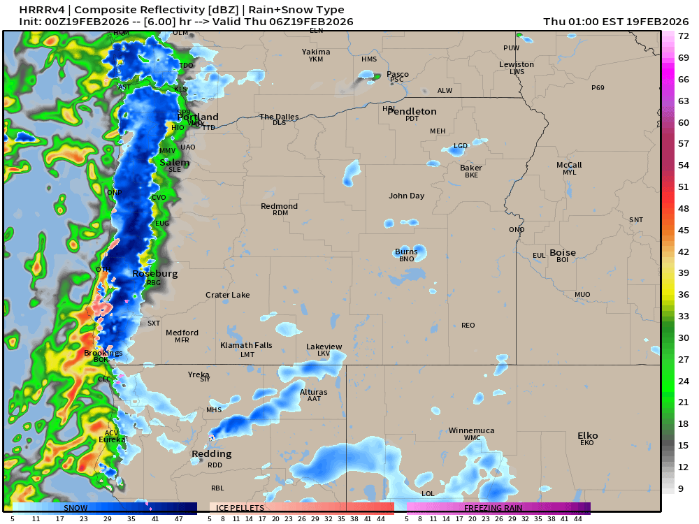
Can you see the sharp cutoff of precip from west to east? East of Salem looks almost dry.
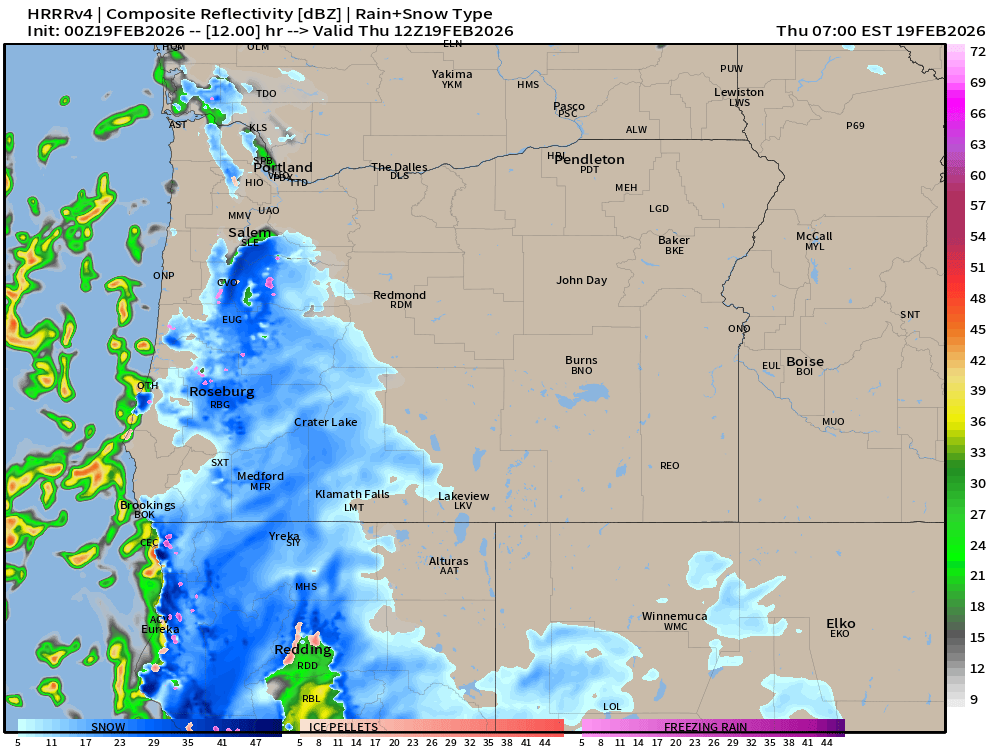
Then look at 4am Thursday morning. Snow falling just south of Salem as this storm moves southward and away from us. You see why a location like Silverton might not get hardly any precip at all in this setup.
Snow forecast
Dallas, south Salem hills, Independence, Monmouth, Corvallis, McMinnville, Amity, and locations around these towns: Nothing – two inches.
Elevations above 1000′ in the western Willamette Valley and near the Coast Range could see up to three inches.
East valley locations including Keizer, most of Salem, Woodburn, and Silverton: most likely nothing. Too much south wind also, which typically kills snow chances for the lowest elevations.
Locations south of Highway 22, such as Sublimity and Stayton, Scio, Jefferson, Lebanon etc. have a higher chance for a slushy coating, but little more than that.

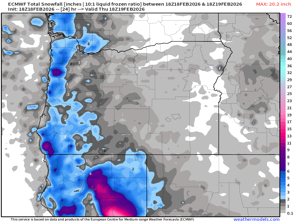
Here’s another snowfall map, and again, hard pressed to find snow generally east of I-5 unless you are south of Salem towards Eugene. This model overdoes snowfall totals, so ignore the gray.
Models aren’t perfect, and maybe someone ends up with a surprise, but don’t count on it. Plan on Thursday being a normal regular day of school and work, and if you really want snow, well then hope this storm moves a little further east.
Mountain report
I hear Hoodoo is opening on Friday. No word on Willamette Pass, but they are hoping! Hoodoo is up to 27″ which is the highest base they’ve had since early January (sad I know). A few more inches for Thursday and Friday, and then an additional 2 to 3 inches Saturday morning.
Stay safe and enjoy whatever ends up happening! 🙂
