
Very short post on this rainy and windy night providing a heads up for what should be a stormy Wednesday and chilly couple of days.
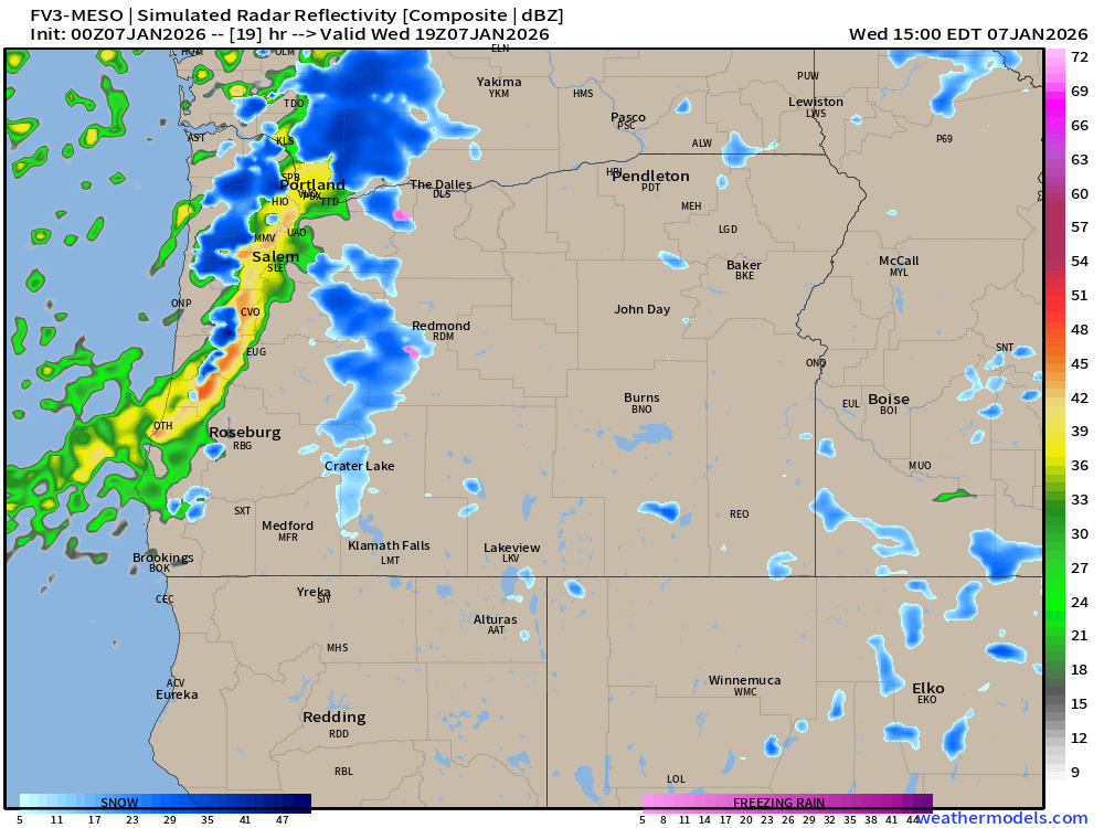
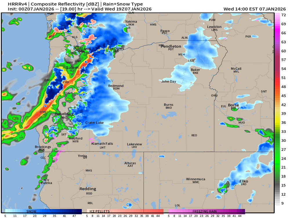
Wednesday in particular looks stormy. Gusty winds to 40mph, small hail, downpours, thunder and lightning, and even some wet snow are all possible Wednesday. Brief sunbreaks between showers, but plan on intense downpours ruling the day. Here’s couple of estimated radar images revealing what looks like a line of heavier rain moving through roughly between 9AM and noon Wednesday. Click for a closer look. 🙂
Snow levels drop to 1000 to 1500 feet Wednesday evening through Thursday morning. Coast Range locations and communities up the Santiam River Canyon (Mill City, Gates etc.) could all see a little dusting of wet snow during this time frame. Salem’s high on Thursday will top out only around 43°.
Cascade passes get the brunt of this series of storms with 18 to 26″ of snow falling now through Friday morning. Now through Wednesday night will be the worse travel times, but snow showers continue right into Friday morning before finally tapering off. Hopefully this will be enough for ski resorts to open up.
We have a mostly dry weekend ahead for the mountains which would make getting to the snow and ski parks much easier come Friday afternoon through Sunday.
Stay safe and happy Wednesday! 🙂

Thanks, as always!
LikeLiked by 1 person