
Today went mostly as planned. Here are the fresh rain totals as of 8pm. Check out the intense rainfall totals along the coastline and to the north of Portland!
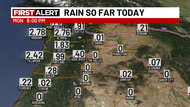
As expected, a steep rise in totals as one heads north. Even within Salem, totals have varied quite a bit with more than half an inch so far in northeast Salem, while the airport is only at 0.28″.
What’s ahead?
The heaviest rain of the entire event has been advertised to show up tonight, and will last on and off through Tuesday. Basically the firehose of moisture will be pointed more directly at Salem over the next 24 hours. By Tuesday night, it will have moved back to our north again, which means Salem could end up being mostly cloudy with just a few sprinkles/periods of drizzle on Wednesday. Steadier rain will continue to linger up around Portland on Wednesday.
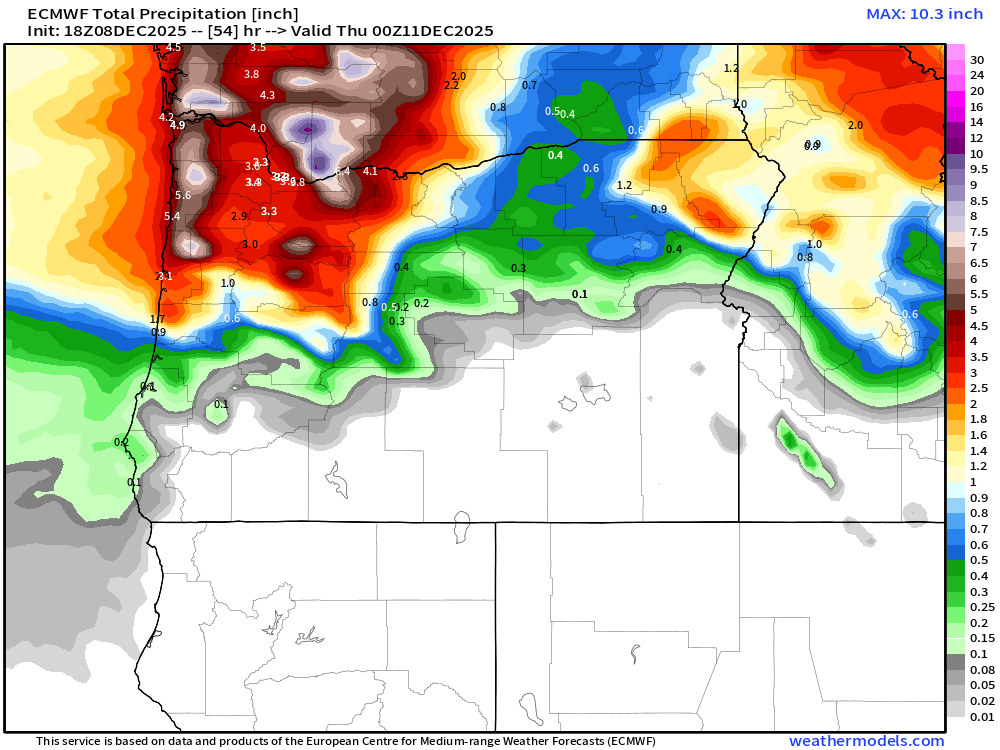
Some flooding is still quite likely from Salem northward tonight through Tuesday night. The next image shows the estimated rainfall totals through 4PM Wednesday.
Bottom line
The wind should die down dramatically later tonight (midnight), but until then, strong gusts could knock out power for a few of us. Heavy rain, low visibility at times, standing water on roadways, flooding creeks, and flooding in low lying areas will all be issues for us over the next 24 hours. Mudslides are also possible in the hills and steeper areas around the region. Let’s see what happens, but I think Tuesday is going to be a wild day around the area.
Rest of the week
Just a few scattered light showers for Thursday, and both Friday and Saturday should be dry with highs in the low 50s. Rain returns on Sunday.
I hope it was a great Monday, and I hope Tuesday is even better! 🙂 Stay safe out there!!
