
Many of the details from my previous post are still valid. As is the case with weather, there are almost always some last minute twists and turns. I’ve got what I think are all the important details for you right here. 🙂
Important highlights
- Steady rain develops Monday and lasts through Wednesday.
- The heaviest rain for Salem will take place Monday night through Tuesday evening.
- Flooding risk here in the valley is highest Albany to Portland. Heaviest rain totals farther north.
- Less rain south of Albany. This will really be an Albany – Corvallis and northward event.
- Much lighter rain (for Salem) is now more likely Wednesday.
- Portland metro will continue to see heavier rainfall during the day Wednesday.
Additional details
I’ve compiled three separate rainfall forecasts showing totals through 4AM Wednesday morning. There will be more rain on Wednesday, but the heaviest amounts should be over by then. This also gives you a really good visual of where the heaviest rain can be expected. Clearly, there is a steep increase in rainfall the farther north you go.
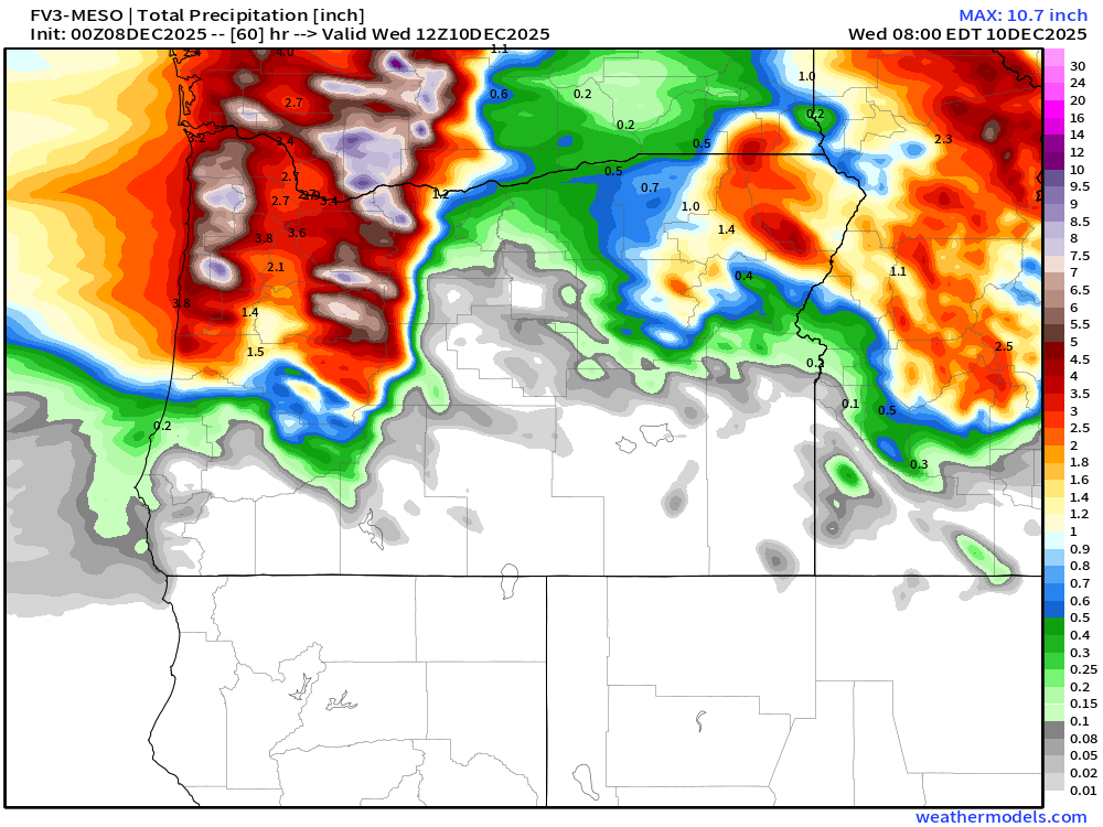
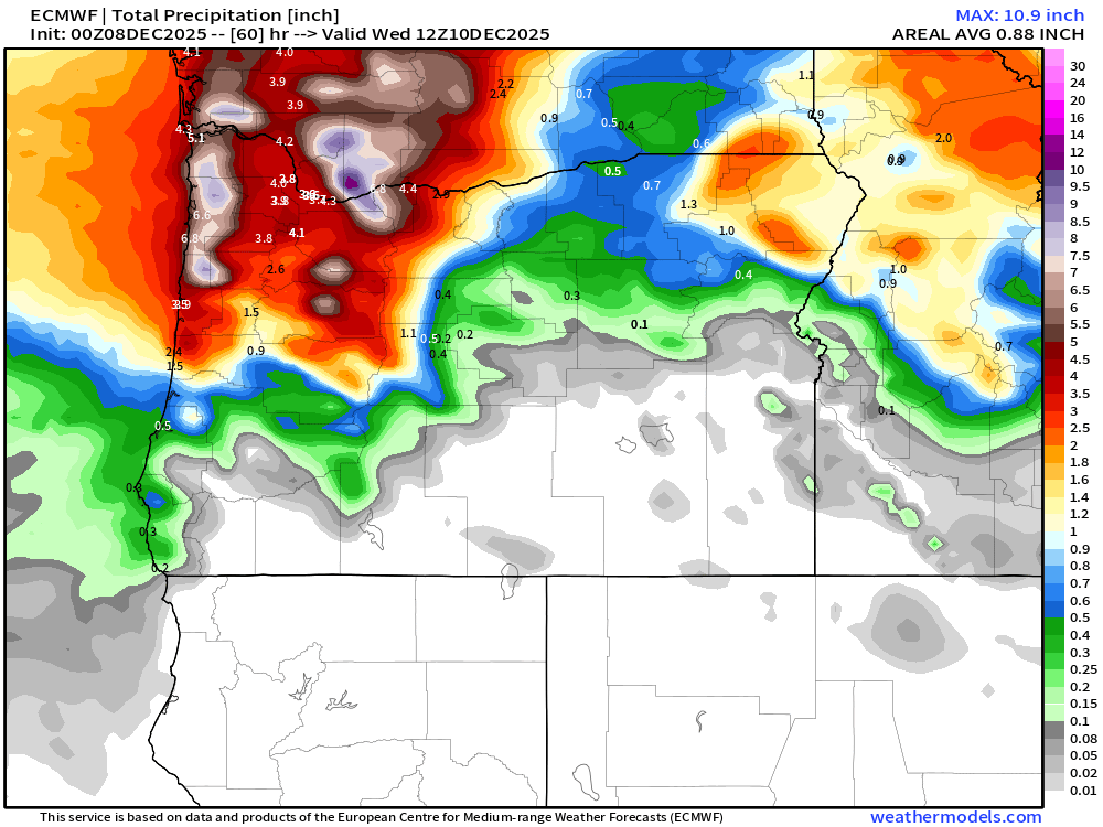
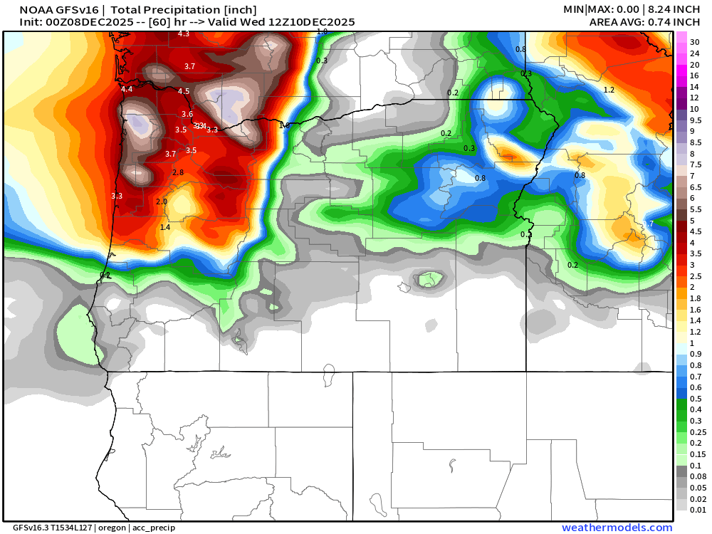
Looking at those, and combining a few other factors into my forecast, and I think 2 to 3 inches of rain is a safe bet for the Salem area. Much more the higher up in elevation you go, more out along the coast, and more the farther north you go. Locations from Albany down to Eugene will probably escape with an inch to 2 inches.
Flooding specifics
My thoughts on flooding potential have narrowed as well. Seems like the focus of the heaviest rain will be just north of Albany up to Portland, so rivers roughly between those two cities have the highest shot of reaching flood stage. The risk of river flooding drops off quite a bit as you head closer to Eugene and points south.
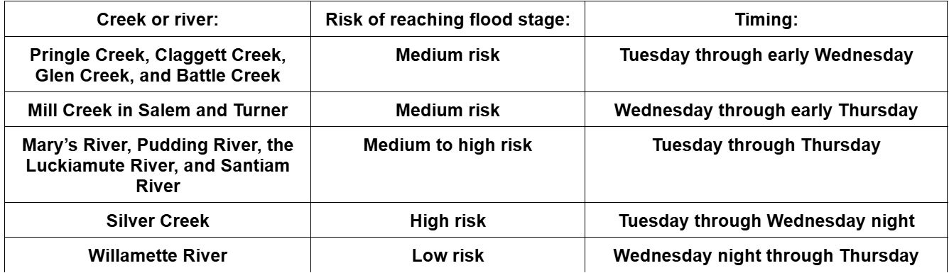
I will add that flooding on our small urban creeks greatly depends on rainfall rates, and we really can’t be 100% sure about such things. If we do get flooding on our local creeks, it will happen Tuesday which is when Salem will see the heaviest rainfall rates.
That’s all for the forecast. Please join the Bryan Weather Alert Community on Discord. It’s a great place to receive short and important updates to the forecast when I don’t have time for these longer posts, plus you can share your own local weather conditions on there (if you wish to), and lastly, it’s an excellent and easy spot to share weather related photos. Bryan Weather Alerts on Discord
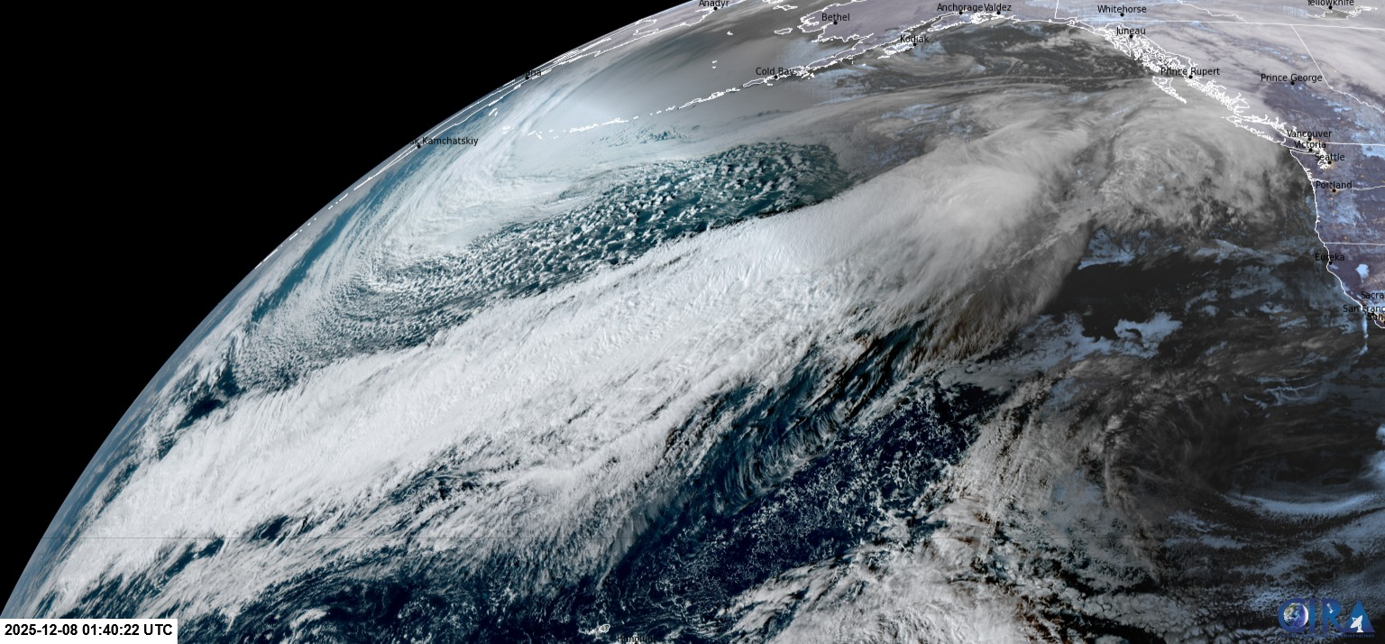
Lastly, I leave you with this really, REALLY cool satellite image showing the absolutely massive and extremely long atmospheric river which is about to be aimed right at Oregon. Yes, this looong stretch of clouds will slide south towards Oregon, and will be responsible for bringing us rainfall over the next 3 to 4 days.
Stay safe and have a great Monday!
