
Headlines
- Steady rain lasts all night long adding up to around half an inch.
- Winds turn gusty Wednesday – 30 to 40mph.
- Thunderstorms with stronger gusty winds and very heavy downpours are likely through Wednesday night. An additional half inch or more of rain is possible from these heavy showers.
Details
Sometimes in my forecasts I casually reference weather events from past dates, but then I have to remind myself that most normal people don’t keep such detailed weather records as me lol… Well, this time I’m only asking you to remember back two Saturdays ago which was the day we experienced gusty winds, heavy downpours, a few power outages, and some lightning. I think this Wednesday will be very similar.
Where and exactly when the heaviest showers and thunderstorms hit is impossible to know, but once again I’m relying on this estimated radar image (valid for 2pm) to give us a general idea of what we are looking at. Take a look!
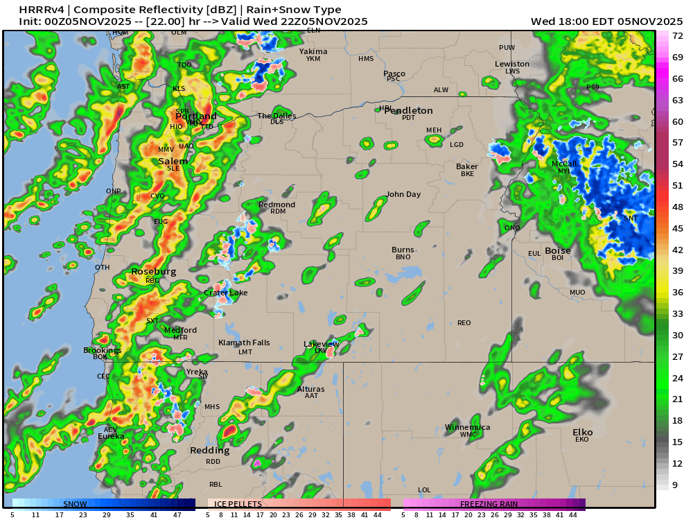
Bright orange and red colors indicate heavy rain, and this clearly shows a good chance for numerous heavy showers/storms across much of western Oregon Wednesday. Storms could cause winds to briefly gust higher than 40mph, dump very intense/heavy rainfall, and even put down some lightning strikes. Watch for ponding on local roadways as well due to clogged drains.
The Coast
Coastal locations even have a slight chance of a funnel cloud or, if it touches ground, a tornado. This is the time of year is when the coast can see some of these weak funnel clouds or tornados. Rare, but they do happen more often in fall here. I’ll bee keeping an eye out for reports from the coast. Of course, this storm is also lining up perfectly with our first round of King Tides for the winter season. This makes it easier for large waves to travel higher up the beaches. Storm watching is a TON of fun here. Just be careful out there! 🙂
The rest of the forecast
Thu: More rain much of the day.
Fri: A few leftover showers.
Sat & Sun: Completely dry.
Mon & Tue: Slight chance for a little rain, but no big storms.
Highs ranging from the mid to upper 50s.
Still no real threat for mountain snow at the pass level this week, so I’m not worried about that affecting your travel plans.
Okay, enjoy the rainy night, and stormy Wednesday!
