
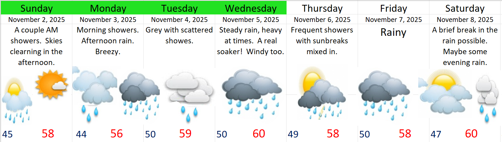
Can you believe it’s almost Friday and the end of October? Time to look ahead at the forecast for this weekend (many of you want to know), plus the forecast for next week, and at the very end I have a fun little weather history tidbit for you.
I’ve combed through the weather models searching and searching and I cannot find a single completely dry 24 hour period after Friday through at least the next ten days! Eventually we’ll see dry weather again, it always comes back, but it’s very clear we are entering full on rainy season mode here in western Oregon. We have a lot of rainy, grey, and damp November weather on tap with only very short respites here and there.
Extended forecast
Highlights
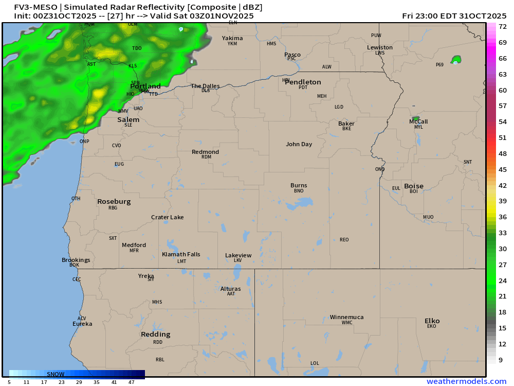
Friday: The first half of the evening looks dry . Late evening activities could get rained on. Rain will begin earlier in the evening the further northwest you go. So the Portland metro could see a rainier Halloween evening than Salem. Locations south and east of Salem could easily stay dry well through midnight. If you’re wondering why apps keep on changing their forecasts for this Friday it’s because it just doesn’t get much closer than this. The estimated radar image for 8pm Friday night shows a band of rain just to our northwest. Move that sucker 25 miles closer and we have a very wet evening. See how tricky that is?
Saturday: Wet with rain much of the day.
Sunday: This is it! It could be mostly dry during the daylight hours Sunday, so take advantage of it! 🙂
Mon – Tue: Wet at times, but nothing real wild.
Wednesday: This storm looks a little more impactful with heavier rain likely, and possibly some gusty winds.
Thursday & Friday: It seems like another pretty wet storm system will move in at some point during these two days bringing steady rain and possibly more gusty winds.
Impacts
None of the storms this coming week appear capable of producing really strong winds. Instead plan on typical run of the mill 30 to 40mph gusts. Should this change, then I would of course do my very best to inform you. Right now the biggest issue weather will have on your day to day life (other than getting soaking wet outside) is the likelihood of clogged/backed up drains creating ponding on roadways and in some parking lots. As far as mountain snow goes, well I don’t see very much at all over the next 8 days. These storms will be on the mild side. This means wet and rainy Cascade passes.
Some fun weather facts for you all. I looked back into the history and record books, and I found out that in 1935 it snowed 5 inches officially at the Salem Airport on Halloween making it the earliest snowfall in Salem on record.
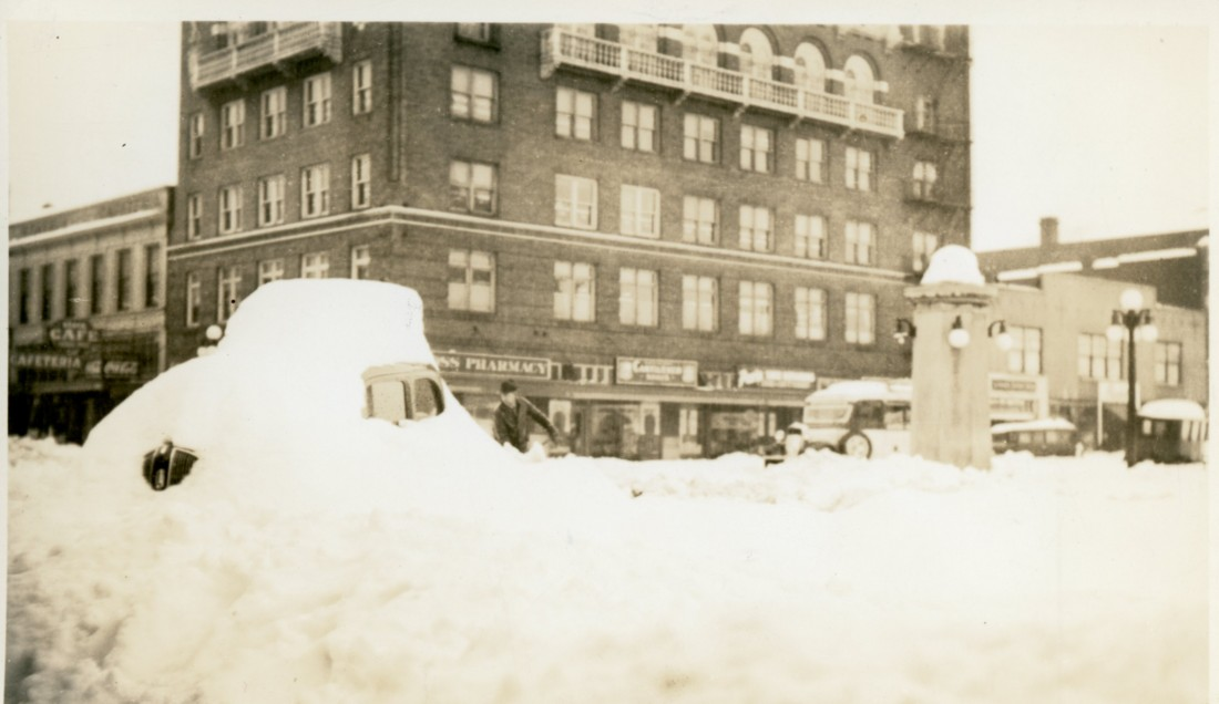
As far as the single snowiest day in Salem’s recorded history goes, it appears the record was set in 1937 when 25 inches fell between January 31st and February 1st. There are several documents (journals, weather reports etc.) indicating that up to 33+ inches fell in parts of south Salem in just those two days alone! Check out this photo from downtown Salem after the storm. Keep in mind this all happened after 6 to 12 inches of snow had already fallen during the week prior.

And this next photo was taken on State Street in downtown Salem after the storm.
What would happen if that took place today?!?!? I suppose every winter brings with it new opportunities for something wild to happen, and since Friday marks the earliest snowfall on record here, I figured it’s time to start keeping an eye out for snow…. Or, we could end up with a snowless winter which happens far more often than big snowstorms around here. ![]() Time will tell…
Time will tell…
Okay, stay safe out there, remind your kids to be respectful and mindful of people, property, and cars when running around from house to house in search of candy (sounds a little weird when you think about it lol), and of course, have fun! 🙂
