
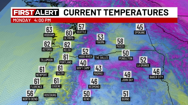
The wind today has been gusty! Wind gusts pushing 35mph here in the Salem area, and higher near Portland. The pattern we are in is actually the same type of pattern that would give us arctic air had it taken place in say December, but instead it’s just a little chilly. Temperatures as of 4pm under a full sky of sunshine are barely reaching the low 60s, and take a look at those 40s and 50s east of the Cascades. Brrrrrrrrrrr!!
For those of us who, for whatever reason, hold off as long as possible to turn on the furnace each year, I believe this past weekend was your time to finally crack. A lack of solar radiation due to thick cloud cover, cooler high temperatures, and a much wetter/damp airmass all combined to give us the coldest weather of the season thus far yesterday. Our high on Sunday was only 56° with periods of rain before we plunged into the lower 40s last night. It gets even colder though. Come Tuesday & Wednesday mornings, our lows dip into the mid 30s across for the first time in over 5 months! Frost will be possible, especially in the more outlying areas. Highs Tuesday and Wednesday will reach the mid to upper 60s under full sunshine.
More clouds around Thursday and Friday, and a very slight chance for a few sprinkles on Friday.
Dry Saturday with increasing clouds. Rain moves in Saturday night and next Sunday will be a wet day with rain and showers.
The Cascades
It looks like winter on the ski webcams today. Check out Hoodoo from earlier!
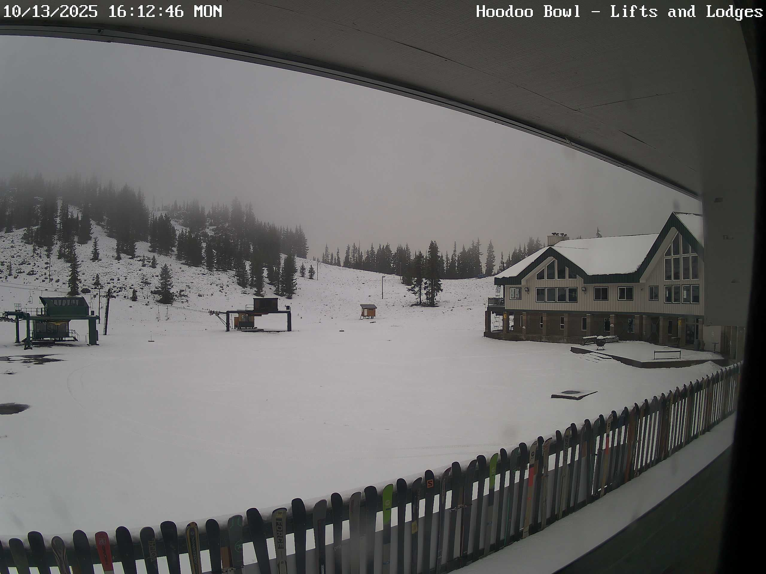
It looks like a solid 4 to 8 inches fell at Hoodoo (depending on elevation), and even more fell at Timberline over on Hood.
The rest of the week looks dry up on the mountains, breezy at times, but for the most part plenty of sunshine. Only exception would be maybe a few sprinkles Friday. Next chance for mountain snow will come on Sunday.
Take care, stay safe, and enjoy the beautiful sunshine!!
