
Time for a quick Independence Day forecast.
The quick version
Sunday through Tuesday: Very warm. Highs 90 to 92°.
Wednesday: More reasonable with mostly skies and highs around 83°.
Thursday through Sunday: Highs in the upper 70s to low 80s with cool mornings starting out in the lower 50s each day and more cloud cover, especially during the morning hours.
Details
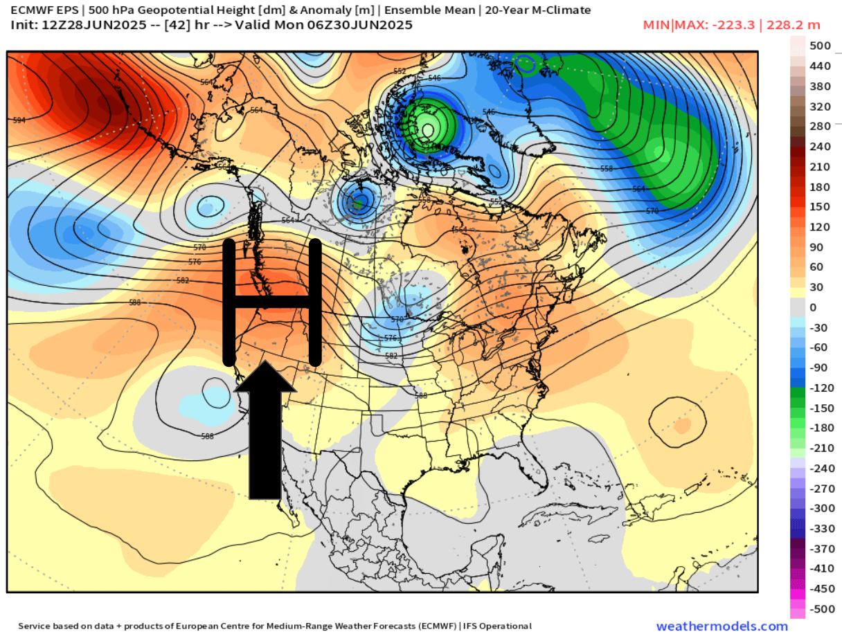
For the next three days we will be under the influence of a high pressure bringing us very warm weather. The map below shows this very nicely with the warm airmass centered directly above Oregon Sunday night.
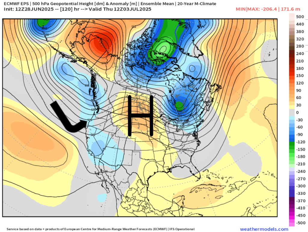
The second half of the week will be dominated by marine onshore flow. This next map illustrates this well showing the high pressure being pushed to the east allowing cooler air from the ocean to move inland early Thursday morning.
Overall, it’s looking mostly dry the next 7 days with some minor exceptions, and depending on your travel plans, these exceptions could effect you.
Exception #1. A few thunderstorms and showers are likely in the Cascades and in central Oregon Monday through Wednesday.
Exception #2. Drizzle and a few sprinkles are possible along portions of the coast specifically Thursday through Sunday. During those four days the onshore flow is stronger which will bring in marine air. During summertime, these setups can produce very light (and spotty) precipitation along the coast and even in parts of the Coast Range.
So, after a few very warm days to begin the week, we return to the stronger onshore flow which will return temperatures back to normal or even slightly below normal just in time for the 4th of July weekend. Much more comfortable than the scorcher we saw last Independence Day. 🙂
