
Highlights
Tue: Warm and dry with mostly sunny skies.
Wed – Fri: Cooler with lots of clouds and chances for sprinkles/light showers.
Sat – Mon: Warmer again with mostly sunny skies.
Wet weather recap
The rainy weather did not disappoint. In fact, Friday and Saturday were the rainiest back to back days since the first week of April! The map below shows rainfall totals from the weekend.

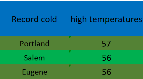
A solid half inch to inch in the valley and over an inch to two inches up in the foothills and mountains. The low pressure and steady rain was accompanied by chilly temperatures too. Record low high temperatures were set on Saturday all over the valley.
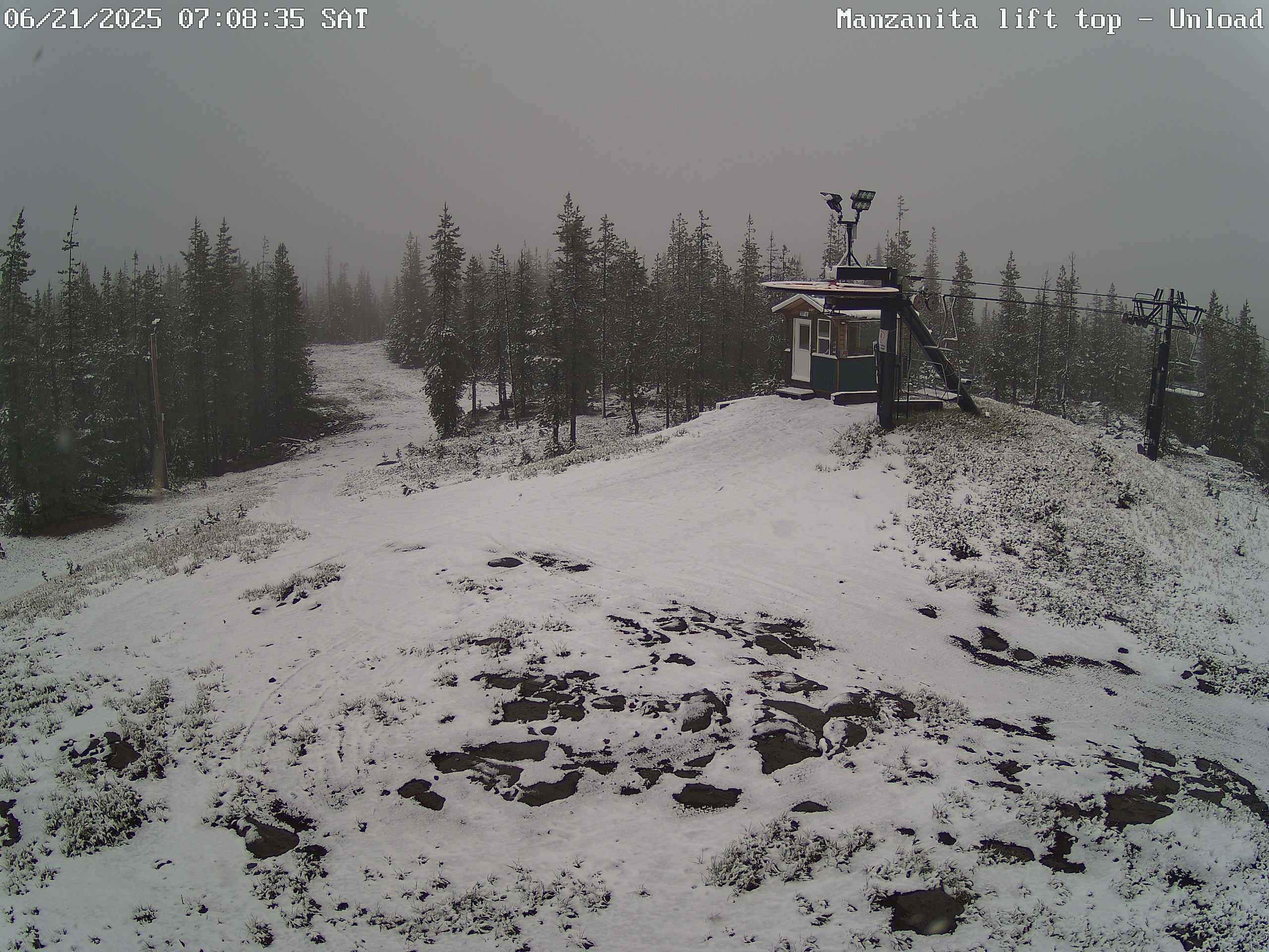
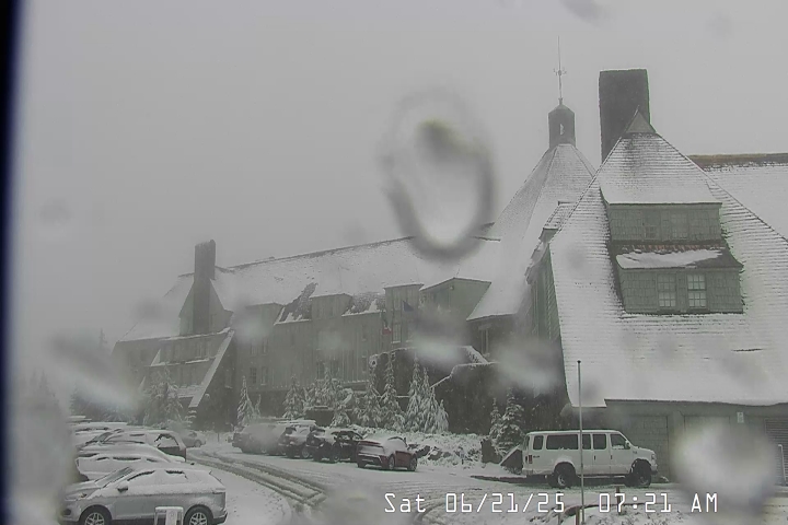
Snowfall also made it’s way to the Oregon Cascades. These two images show snowfall on Hoodoo and up at Timberline Saturday morning. Fun to see snow falling up there on the first full day of summer!
Forecast details
Tue: Very similar to the weather we saw today. Highs in the low 80s.
Wed – Fri: Each day will feature a very slight chance of drizzle or a few light sprinkles. Nothing widespread or heavy. Lots of cloud cover with sun breaks mixed in at times. Highs in the low 70s and early morning lows 53 – 55°. Best chance for any light showers or sprinkles looks to be Wednesday and Thursday with a lower chance on Friday.
Sat: Sunshine returns with highs in the lower 80s and mostly sunny skies. A real nice day after a refreshing start that morning with lows in the low 50s.
Sun & Mon: Sunny and warm with highs in the mid to upper 80s.
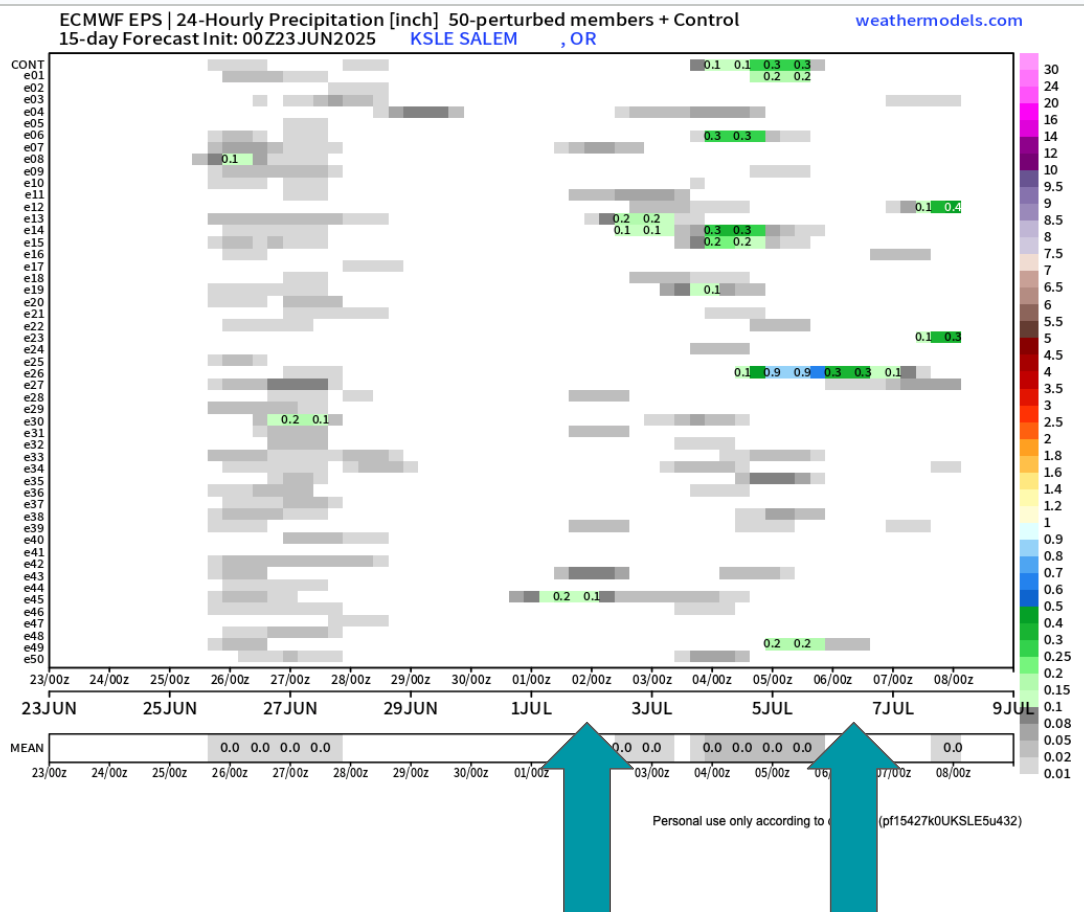
Looking further out to the first week of July it still appears we could have another shot at a few showers. Too far out to say with certainty, but there are enough individual members (horizontal lines) calling for rain at some point during the first week of July that it has my attention.
The biggest take away I see is that there is no sign of hot weather the next two weeks. Some upper 80s, but nothing prolong or real significant. I’ll keep an eye on that 4th of July forecast, but in the meantime enjoy the nice weather.
