
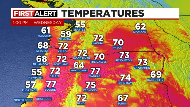
Enjoy, but don’t bee fooled by the beautiful and warm sunny weather. Thunderstorms will become quite numerous at some point later this afternoon through the evening hours. Current temps across the region show the very warm atmosphere which is a prime ingredient for storms in this type of setup.
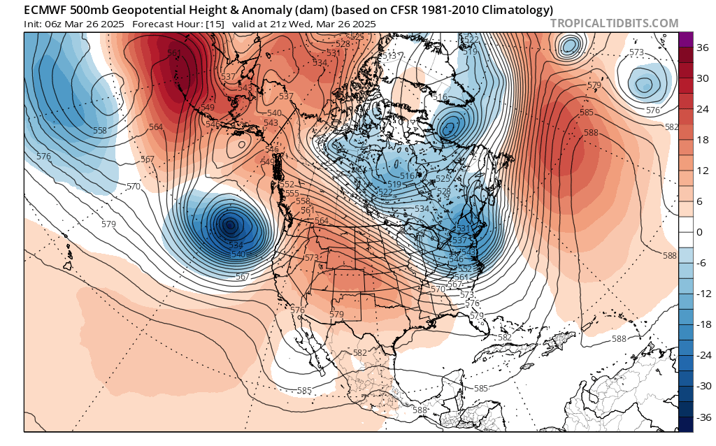
Lots of 70s out there and temperatures are still climbing. Meanwhile, 18,000 feet above us, a “bowling ball” of cold air, strong winds, and precipitation is heading towards us from the southwest. You can see it represented fairly well on this chart below:
The satellite image from early this afternoon shows this well with Salem (where the red arrow is pointing to) is firmly in the sunny and warm sector ahead of the cold front which is moving up as indicated by the blue arrow.

The cold front sweeps northeast later this afternoon and evening sparking numerous thunderstorms and downpours along it. Some of the storms could be severe which is extremely rare for our area. Large hail, damaging wind gusts of 55mph or higher, heavy rain, and dangerous lightning are all possible with the storms. Not every location will see such strong or severe storms, but everyone will see at least a period of very gusty winds (40mph or higher, and some intense downpours as the front moves through and temperatures drop nearly 20 degrees this evening!! Truly some wild and possibly dangerous weather for some of us between now and 8pm tonight.
The main message is be prepared for conditions to go downhill quickly when these storms do fire up and make their way up the valley, and don’t let the calm weather now fool you. Power outages, ponding of water, and downed trees are expected in at least some areas later today with the stronger storms.
Rainy and at times windy weather will continue on and off through Friday before we dry back out for the weekend.
Be safe out there!
