
We have a rare threat for strong to severe thunderstorms for Wednesday afternoon. Thunderstorms around here are hard to predict and pinpoint, but plan on storms possibly effecting your daily plans tomorrow (Wednesday) with widespread showers/downpours by late afternoon and early evening.
All the ingredients are coming together to create a very unstable atmosphere Wednesday afternoon as a cold front pushes through what should be a fairly mild and humid environment. The biggest threats with this particular setup would be of course lightning (cloud to ground), but also very strong gusty winds (gusts could exceed 50mph with some of the storms), and large hail. I won’t make predictions for how large the hail will be, but I’ve never seen Salem get placed into the severe Hail Outlook by NOAA, so there must be something to that.
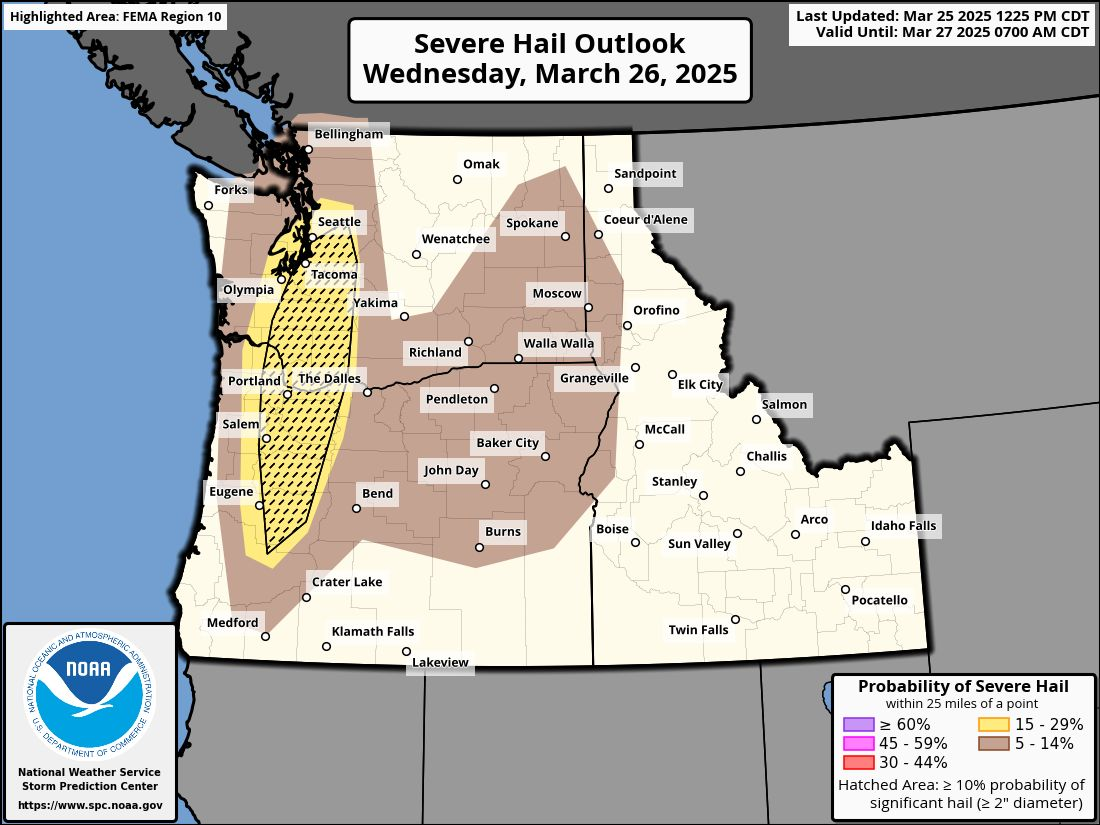
I don’t have much experience forecasting severe thunderstorms since we hardly ever get storms here, but I’m passing along what I’ve seen, and the setup does look as though it could produce intense storms with large hail. I suppose if you have the option, I would pull the car into the garage for the afternoon. Might force some of us to clean out our garages Wednesday morning making for a win win situation…. 😉 🙂
North and east of Salem stand the highest probability for storms (especially stronger storm cells), but anyone roughly from the Coast Range eastward could get hit by a thunderstorm.
Thursday will be windy with periods of rain and additional showers, and Friday looks like a soaker as well.
Saturday looks mostly dry with just a slight chance for an isolated shower, but overall a good day for outdoor activities, and Sunday looks dry until the evening when rain again returns to the picture.
Take care, and stay safe!!
