
The quick version is we have multiple strong weather systems aiming for our region. Periods of heavy rain and gusty winds will be common now through Sunday. This will be a typical northwest Oregon rain and wind pattern, but at a slightly more extreme level, and with very few breaks between storm systems. More details below!

Details
Today: In between storms and mostly dry until evening. Rain moves in tonight. Expect around half an inch of rain and wind gusts 20 to 25mph.
Tuesday (Christmas Eve): Showers and sunbreaks as we sit between storms. Around a quarter to half an inch of additional rainfall. Mainly dry during the evening.
Wednesday (Christmas Day): Dry morning. Rain moving in during the afternoon and lasting through the remainder of the night. Over an inch of rain is expected with this storm and wind gusts 40 to 45mph are likely with isolated gusts to 50mph!
Thursday: Steady rain through much of the day with gusty winds at times.
Friday – Sunday: Three more separate storms will arrive one right after the other with very little time in between. 2 to 4 inches of additional rainfall. Winds will continue to be strong with each storm. Wind gusts generally 40 to 45mph- isolated gusts to 50mph.
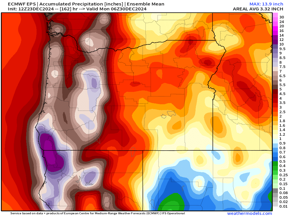
Add all that rainfall up and we could easily see at least 4 inches of rain this week. Flooding will slowly, but steadily become more of an issue for people living near flood prone creeks, streams, and low laying areas as soils become increasingly saturated.
Below is a map showing the estimated mean total precipitation through Sunday. This gives Salem 4+ inches of rain and several inches more in the mountains.
The good news is some of that rain in the mountains will fall as snow limiting our flooding chances. Here’s the mean total snowfall map for the same period of time.
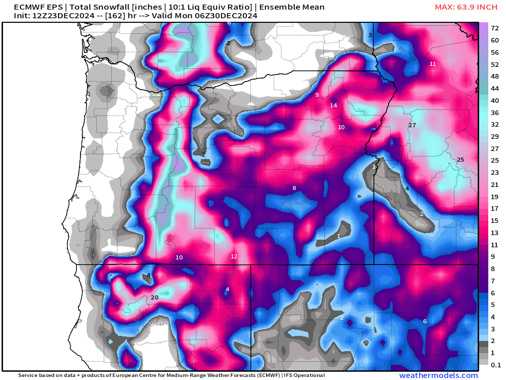
The Cascade ski resorts should pick up a couple feet of snow by Sunday night. The issue is that warmer rain will briefly interrupt this nice snowpack building Thursday night and again on Saturday as snow levels climb above 5000′. Fortunately, we finish the weekend (Sunday) with low snow levels to sorta help top off the mountains with a nice fresh coating of new snow. Worst travel times through the Cascades will be tonight, Wednesday night, Thursday, and again on Sunday.
The Coast
The windiest times will be Wednesday night and early Thursday with gusts up to 65mph!
Thursday night will bring a second round of strong winds. Gusts with this storm should range 50 to 60mph.
Friday night will bring a third round of strong winds. Gusts 45 to 55mph.
Swells will generally stay above 25 feet now through Saturday night! This will be a very extended period of high seas out along our coastline. Swells could reach upwards of 40 plus feet at times later this week. So have fun, but watch out if you head to the coast!
Merry Christmas and have a safe and wonderful time celebrating the birth of our Savior!!
