
Lots to cover tonight (Sunday night) in the weather department, so let’s dive right in.
Short version
Showers and downpours for Monday. Chilly temperatures will lead to snowfall in the Coast Range Monday through Tuesday morning. A powerful storm arrives Tuesday evening bringing strong winds to the coast, gusty winds in the valley, and periods of moderate to heavy rain. Rainfall will be frequent Thursday through Sunday leading to at least some flooding. More details below.
Details
Monday: Showers, sunbreaks, and some heavier downpours are likely. Morning lows in the upper 30s, and a high of only 45°.
Tuesday: Showers transition into steady rain late in the afternoon or early evening hours. Gusty winds 25 to 35mph are also expected Tuesday evening through Wednesday morning. High of 49°.
Wednesday: Showers with some extended dry times mixed in during the afternoon. Highs in the low 50s.
Thu – Sun: There is no one big storm I’m watching for the time being, but rather multiple waves of rain and mountain snow which are predicted to traverse the region during this time. The impacts include the possibility for strong winds, higher chances for some creek or river flooding, but no major flooding, and no flooding on the Willamette is expected this week. Other impacts to be expected include ponding on roadways where leaves have clogged drains, localized flooding in general low lying areas and typical flood prone areas, and continued snowfall up in the mountains. Highs ranging from 50 to 55°.
Sunday (November 17th) was the 8th day in a row with measurable rainfall, and when its total gets officially recorded we will have well over 4 inches of rain for the month so far putting us well above normal. Seasonal creeks are beginning to fill up, and rivers around the area have been slowly, but steadily rising. It’s for those reasons I’m a little more concerned about flooding than usual despite the lack of any major rainstorms in the current forecast.
I had the opportunity to hike Silver Creek Falls today and I got to see firsthand how high those creeks are flowing, which again, adds to my elevated concern for at least some flooding this week.


The jet stream is extremely active right now, and appears to stay active the for foreseeable future with no sign of any long dry or calm stretches of weather. I will do my very best to keep you all updated, especially if I see something concerning or impactful.
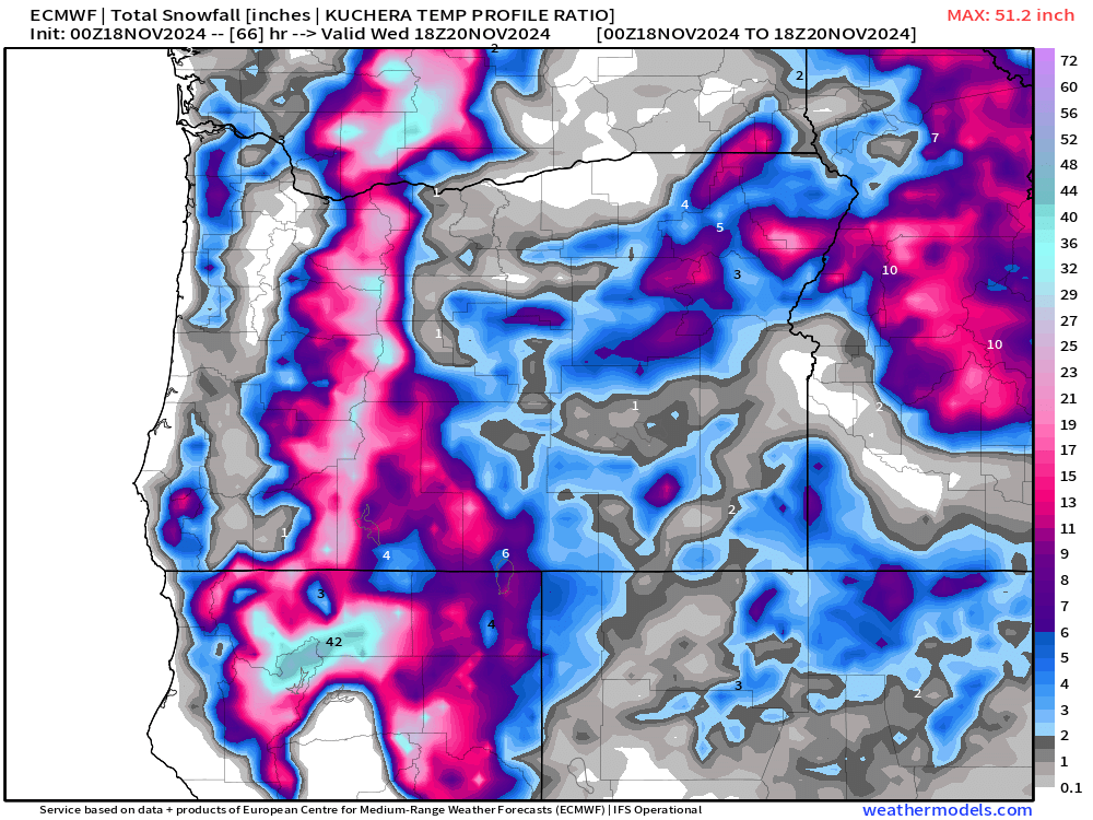
The Cascades will continue to see heavy snowfall now through early Wednesday morning before the snow level rises with the warm sector of the Wednesday storm. This estimated snowfall map shows upwards of 24 to 30 inches falling above 4000 feet between this evening and Wednesday morning!
There you have it! No boring weather here for the time being. Stay safe and have a great Monday!
