
The coming week is going to feel extremely winterlike as three separate storms move through bringing periods of widespread rainfall, mountain snow, showers, a few thundershowers, and highs in the 50s all week long.
Below is a map showing the 500mb heights compared to normal for Sunday through Thursday of this coming week ( a five day average). Basically, this is a reflection of the weather 18,000 feet up in the atmosphere. Blue means lower pressure and colder than usual, and the orange and red colors indicate higher pressure and warmer than average conditions.

This is a classic La Nina pattern with the cold trough centered directly over the pacific northwest, and it’s the reason why we tend to see more snow opportunities during La Nina. Here we see a large ridge of high pressure over the Pacific Ocean to our west, and on the backside of that ridge (where Oregon is located at) cold storm systems slide down from the gulf of Alaska. This same pattern in December through February would bring snow chances to Salem, but since it’s still October, we are “off the hook” for them moment. Just watch for this pattern to reoccur as the winter goes on. For now, let’s focus on the week ahead. Here’s the next 7 days with additional details below:
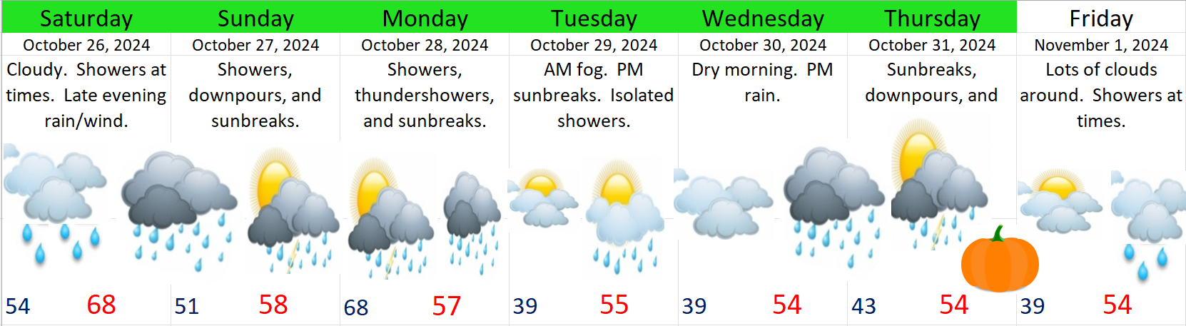
Saturday: Lots of clouds with showers at times all day long. High of 64°. A much stronger cold front moves through Saturday night bringing steady rain (heavy at times), some gusty winds to 30mph, and colder temperatures. Sunday night could be a real soaker!
Sunday: Showers and sunbreaks. A few showers could be quite heavy. A brief thunderstorm is also possible along with small hail.
Monday: A second day of showers and sunbreaks as we remain under a cold upper level low. An chilly unstable airmass coupled with sunbreaks will provide more opportunities for downpours and thundershowers.
Tuesday: Perhaps one of the driest days of the coming week, but no less winterlike. Lows will start out in the upper 30s. Brrrrrrrrr!! Widespread fog is also fairly likely. Fog or no fog, some afternoon sunbreaks should pop through. While the vast majority of Tuesday should be dry, I can’t rule out a stray shower or two, especially near the Coast Range or Cascade foothills.
Wednesday: The day begins chilly and dry, but with increasing clouds. Steady rain moves in during the afternoon.
Thursday: Another day of showers and sunbreaks with a few stronger thundershowers mixed in.
Impacts on day to day life
This coming week will be soggy, cold, gray, and very winter like and that may feel like quite a change from what we have seen lately. The second impact this week is the potential for localized street flooding with some of the stronger thundershowers and downpours this week. I looked back at my own personal weather records and I see October is one of the top months for localized flooding due to the combination of both heavy rain and clogged street drains. This week could feature more of that.
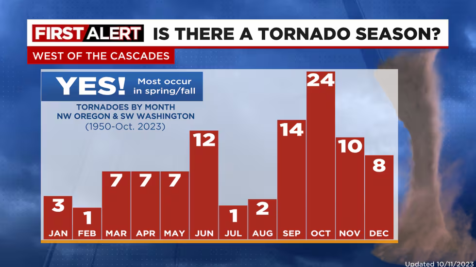
Third, don’t be surprised to see a report or two of a funnel cloud or weak tornado between now and this time next week. Oregon is not known for tornados, but we do have a sort of “tornado season” when weak tornados or funnel clouds become more likely. The active and chilly pattern we will be in this week is conducive to seeing funnel cloud activity.
The image below is barrowed from Mark Nelson over at Fox 12 Oregon (the best weather team in Oregon other than yours truly haha). It shows our “tornado season” (if we can call it that) peaks in October. Keep in mind the tornados we have are almost always extremely weak compared to those found in Texas and the Midwest, but still, I found this a little interesting.
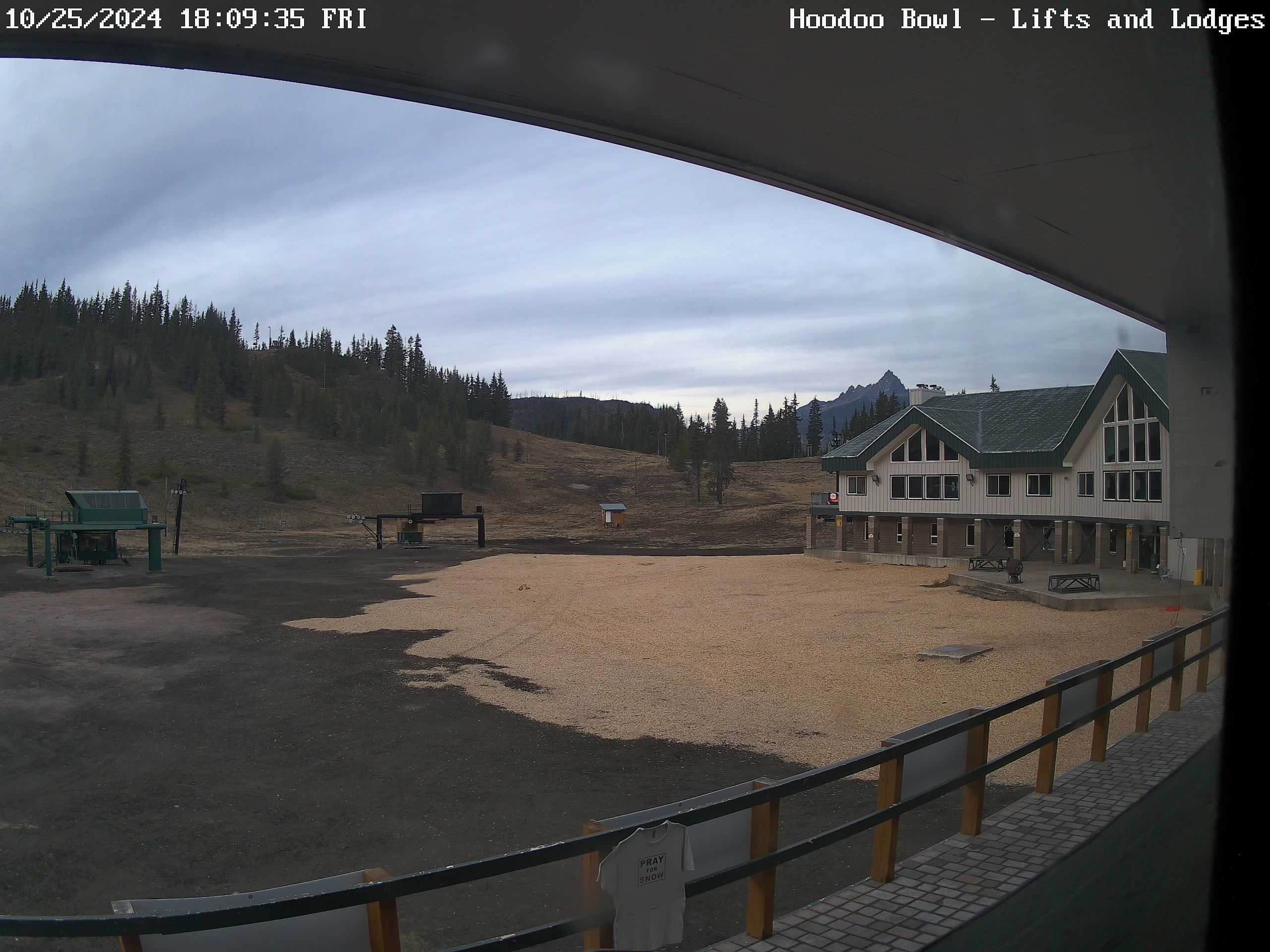
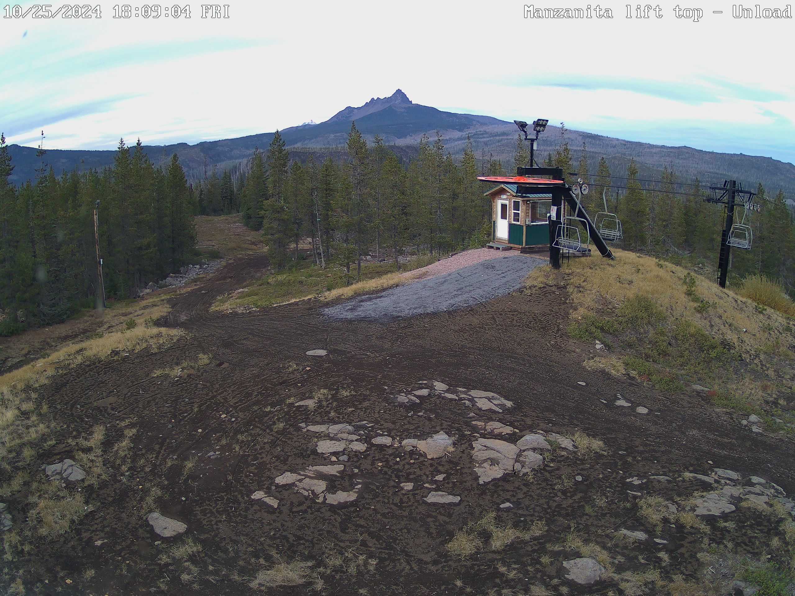
Finally, the Cascades will see multiple rounds of snow this week. Monday and Thursday will probably be the snowiest days up in the passes with 4 to 8 inches Sunday night through Monday, and an additional 4 to 8 inches Thursday. Let’s check on how these locations look a week from now, but imagine they will be pretty wintry by then!! 🙂 The image on the right is the lodge at Hoodoo, and the left image is the top of the Manzanita chairlift at Hoodoo.
Take care and have a great and safe weekend!
