
Well, last night’s post is already off track a little. Thunderstorms and showers are already rolling up the valley. Clearly, the very unstable atmosphere is doing its thing.
This does NOT change the forecast for later. Stronger storms are still expected to hit later this afternoon and last through the evening. I’ve basically copied and pasted the update I did last night down below. Just wanted to acknowledge that we are having storms earlier than predicted, and that the bigger and more widespread storms are still on track for later today. Updates different from last night’s post are highlighted in green.
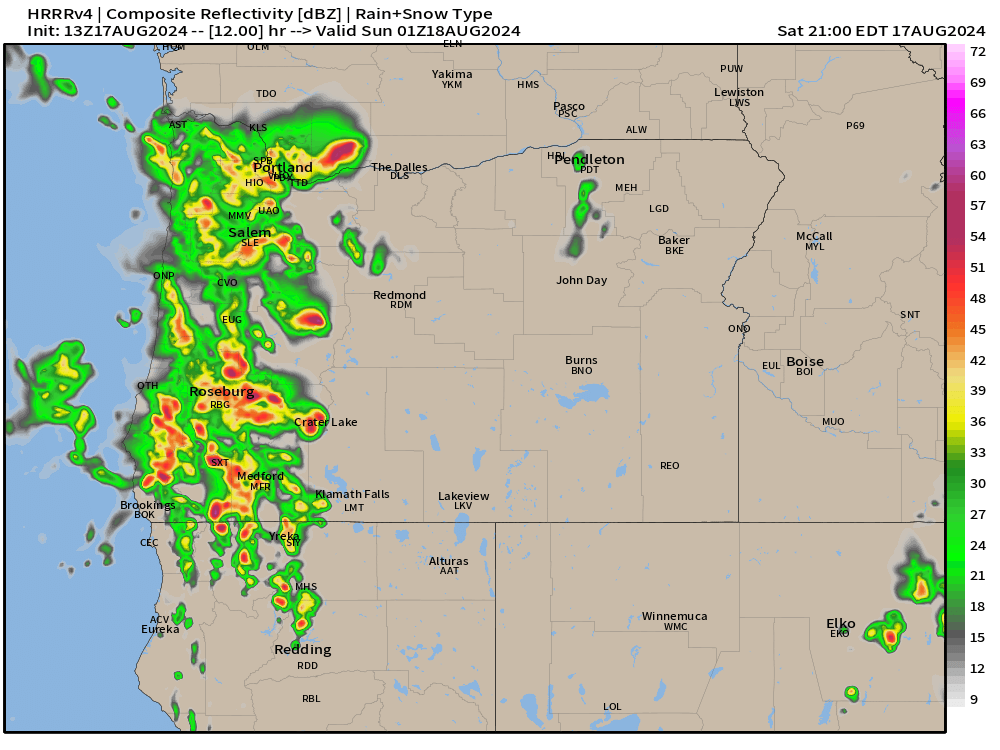
At some point between 2pm and 5pm powerful storms will roll up the valley from the south/southeast. Storms could last well through the evening with some weather models hinting at a second round of storms sometime shortly after sunset. Impacts will include gusty winds above 40mph in some locations, heavy rain, localized flooding, and numerous lightning strikes. Hail could be present in these storms too. This is about as close as we can get to a mid west type of storm. Here’s an updated estimated radar image for 6pm today showing more widespread storms rolling through the valley.
By Sunday morning we will see a return to calmer weather. It will be cooler with more clouds at times with a slight chance of a shower, but no thunderstorms or anything wild.
Mon – Sat: Much of this coming week will be dry, but clouds will be more frequent and highs will generally stay in the upper 70s to near 80°. Additionally, there will be a slight chance for showers almost each day. The majority of this coming week will be dry, but the risk for a shower will be present. Best chance for more significant rain will be Thursday and Friday.
Stay safe!
