
The weather is about to take a turn to the wild and even dangerous side if you will. This will be a quick post, but the threat for intense and possibly even severe thunderstorms here in the Willamette Valley warrants a post.
Details
Saturday will start off like a usual summer day with plenty of sunshine and warm temps. Temperatures should climb into the lower 80s. An upper level low spinning off of our southwestern coast will put into play all the ingredients necessary for strong thunderstorms to form: high moisture content, warm temps, and strong forcing throughout the atmosphere.
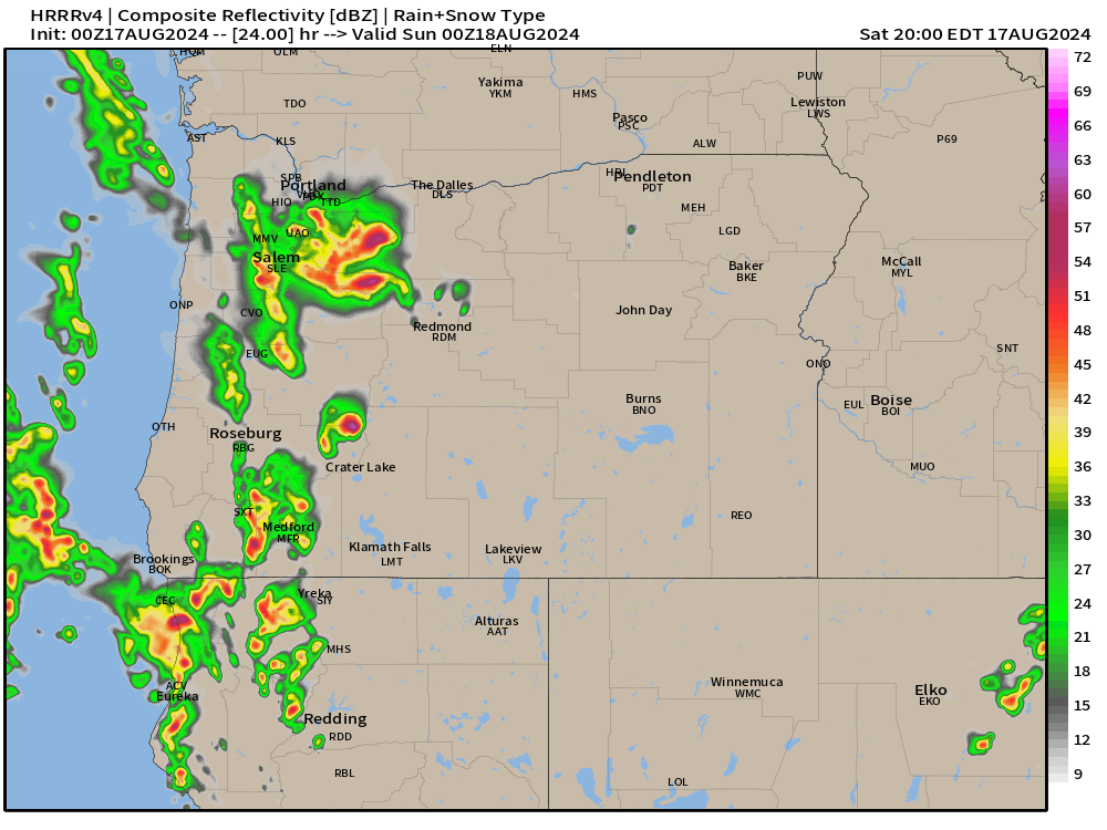
At some point between 2pm and 5pm powerful storms will roll up the valley from the south/southeast. Storms could last well through the evening with some weather models hinting at a second round of storms sometime shortly after sunset. Impacts will include gusty winds above 40mph in some locations, heavy rain, localized flooding, and numerous lightning strikes. Hail could be present in these storms too. This is about as close as we can get to a mid west type of storm. Below is the estimated radar for 5pm. Don’t get caught up looking at the exact locations of the storms in this image, but take in the big picture here which is showing very strong storms throughout the Willamette Valley and Cascades Saturday afternoon and evening.
By Sunday morning we will see a return to calmer weather. It will be cooler with more clouds at times with a slight chance of a shower, but no thunderstorms or anything wild.
Mon – Sat: Much of this coming week will be dry, but clouds will be more frequent and highs will generally stay in the upper 70s to near 80°. Additionally, there will be a slight chance for showers almost each day. No all day washouts, and the majority of this coming week will be dry, but the risk for a shower will be present.
Take care, and stay safe Saturday with the storms out there!
