
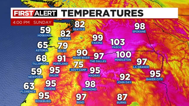
I feel I must start off with an apology. In my previous forecast I stated highs this weekend would be close to 90° and there were no signs of scorching heat. Well, I was wrong. Saturday’s high temp was a sizzling 97° and it appears Salem’s high for today will surpass 95 degrees – neither of which qualify as being “close to 90.” I knew the marine layer was going to be weak, but not this weak. Check out the intense heat as of 4pm.
Extended forecast
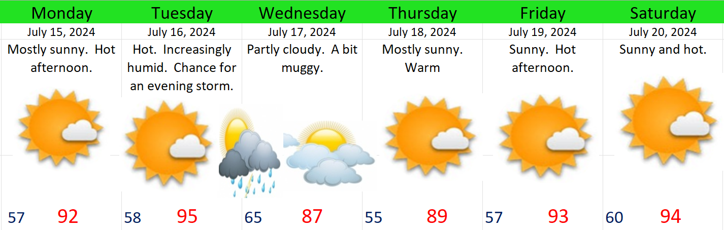
Monday: Honestly, I feel like I’m grasping at straws looking for “cooler” weather. This day COULD start out with a few clouds as the marine layer will be thicker Monday morning. Highs upper 80s to low 90s – depending on cloud cover at the start of the day.
Tuesday: A hot and humid day. Temperatures will soar into the mid 90s ahead of an upper level disturbance which will approach from the southwest. Moisture increases through the day making for very uncomfortable conditions outdoors. This disturbance in the atmosphere will trigger thunderstorms anywhere from the coast to the Cascades. I plan to provide an additional update Monday evening with more details on thunderstorm chances and coverage, but for now plan on at least a chance of thunderstorms Tuesday evening overnight into early Wed.
Wednesday: Perhaps our best shot at staying below 90 degrees. Cloud cover and cooler air ushered in behind the Tuesday evening storms could keep highs in the mid 80s. Still a little muggy feeling.
Thursday: Morning lows in the mid 50s should make for a nice start to the day before highs rise to near 90°.
Fri & Sat: Hot with highs in the low to mid 90s and lows down to around 60.
Stay cool and safe out there as the intense heat continues.
