
January was a wild month, but things have calmed down lately. We have seen some really nice days with the tail end of January being especially mild. Salem set a new record high of 66° for the date of January 28th missing the all time January record of 68°. Today turned out to be a fantastic day as well. It honestly felt like March rather than the beginning of February.
Sunday is looking nice, but not quite as amazing as today was due to two reasons: 1.) Gusty winds of 20 to 30mph develop as the day goes on which will provide an extra chill to the air. 2.) Clouds will be slowly moving in all day long with rain arriving by dinner time (5 to 7pm).
Here’s the next several days with details below.
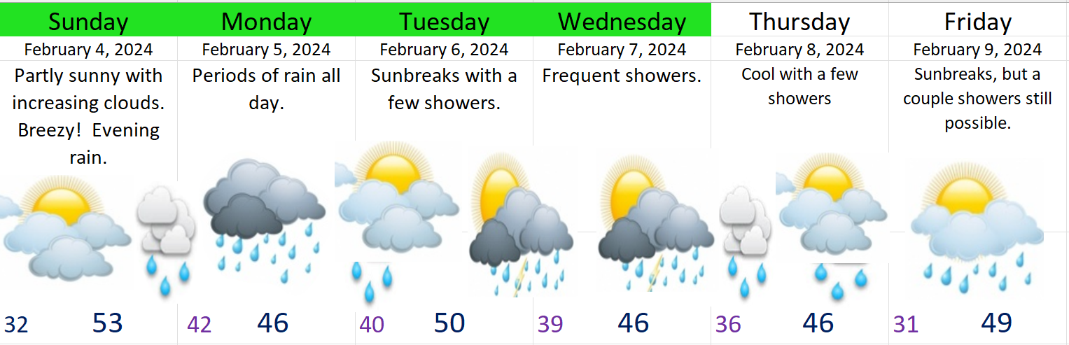
Monday: Drippy and gray with periods of rain throughout the day.
Tuesday: Sunbreaks with a few showers or downpours possible.
Wed & Thu: Both these days will likely be on the showery and cooler side. Downpours of rain and even some hail likely both these days.
Friday: Slight chance for showers as we stay in a cooler pattern.
The Cascades
Snow levels will remain at or below pass levels Monday through Friday. Not a lot of snow, but anywhere from 2 to 6 inches each day should add up helping out the snowpack a little and making for some nice skiing weather really all week long and into next weekend too. Snow levels will be at their lowest Wednesday and Thursday. Perhaps down to 1500′.
Have a great rest of your weekend!
