
It’s still Christmas break for many people, and sadly, there is virtually no snow at the ski resorts at this time. Check out this chart showing both the average snow depth at timberline on Mount Hood, and this year’s current snow depth.
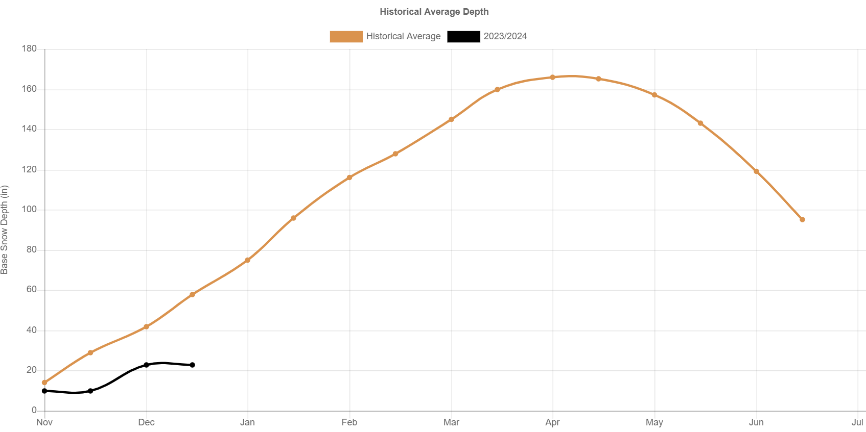
Timberline is running nearly 3 feet below average, and the same story holds true up and down the Cascades. Here’s a map a routinely share each winter. This shows the snow water equivalent compared to normal – so basically how much water is stored in the snowpack compared to average.
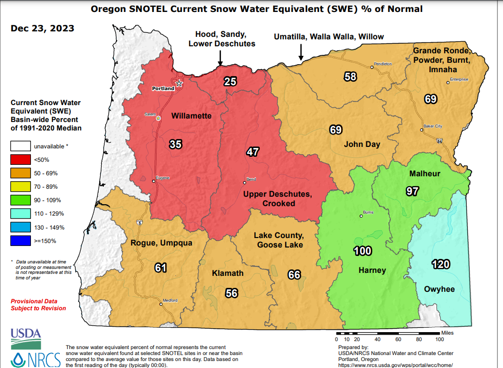
A very low snowpack for the moment across most of the state. Bad years happen, and hopefully things will turn around come January, which they just might…
Moving onto the forecast, this weekend and most of next week both look very similar to what we have been seeing: clouds, fog, more clouds, with rain at times. No big storms to speak of in sight.
We are smack dab in the dead of winter, so a foggy start to the day usually means it stays foggy all day long as the weak sun and low sun angle just aren’t strong enough to break us out of the inversion.
Tonight: Rain moves in around 4 or 5pm.
Saturday: A few showers with (hopefully) a lot of sunbreaks mixed in.
Sunday – Tuesday: Dry with a high chance for foggy conditions.
Wednesday: Rain with some mountain snow.
Looking even further out, it appears we have a decent shot at even cooler and wetter weather with potentially quite a bit of mountain snow the weekend of January 6th and 7th, so maybe some signs of hope for the ski areas. I’ll keep an eye on that.
In the meantime, happy Friday, and have a safe and fun New Year’s!!!!!
