
We have seen fairly typical Oregon style rainfall the past few days, but things are going to turn much wetter real soon. Before I jump into the latest forecast, I have a fun little development for the weather website to share with you. I now have an email you can use to send in weather related photos or videos for use on this website. In the past I’ve had people send content to both my work and personal emails, through text, on FB, Instagram, and even Snapchat, and I’m definitely still okay with those methods by the way. 🙂 😉 This simply makes it more official plus it is a great option for people who are not connected to me by phone or email. My hope is to get pictures or videos throughout the year regardless of the type of weather we are having. I’ve always loved receiving pictures from you all, especially during snow events, and it would be awesome to see even more fun updates now that I have an official weather alert email address. 🙂 The email is: bryanweatheralerts@gmail.com
Back to the forecast
As of this early afternoon, Hoodoo had almost exactly 2 feet of snow on the ground. Check out this image from earlier today showing the same spot I showed you just a few days ago.
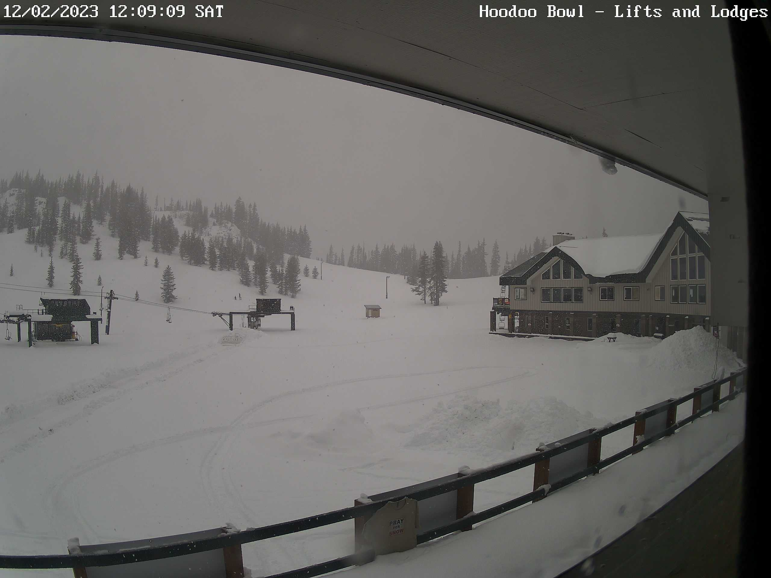
Much of this snow is about to get washed away unfortunately as series of warm and powerful moisture laden storm systems take aim right at Oregon. Snow levels will rise tonight above 7000 feet which means rain for the ski resorts.
The past few days we have seen typical rainfall totals. Remember I said I was expecting between 5 and 6 inches of rainfall in Salem by next Thursday, well I’m keeping track on a fun little chart I wanted to share here. We will see how close we get to that total when all is said and done.

Keep in mind we have rainfall moving in tonight which will change today’s total. With a weather system like this, we are dealing more with an uncontrolled firehose than a more predictable storm like we typically see around here. Pinpointing the exact time and location of the heaviest rain more than a couple of days out is extra tricky with an “atmospheric river” like this. What we do know is over the next several days, it will be pointed directly at us at various times.
Tonight and Sunday: A full on washout. Constant rain with periods of heavier rain mixed in. Some localized flooding is possible.
Monday: Could end up being a milder version of today. Lots of clouds with some rain, but dry times in between. Highs close to 60°.
Tuesday – Wednesday: More steady precip with occasional bouts of heavier rain. An increased potential for some minor flooding during this time frame for creeks, streams, and any low laying areas. The saturated ground will make these two days stand the highest chance of seeing flooding issues this week.
Thursday and Friday: Back to regular Pacific Northwest rainy weather with cooler temperatures and snow returning to the mountains. Depending on how things play out, ski resorts might be able to open up next weekend if they can receive enough snowfall during these two days, but time will tell.
It’s staying active out there which means I’ll do my best to keep you all updated. Keep those drains clear and watch out if you live in a flood prone area. 🙂
