
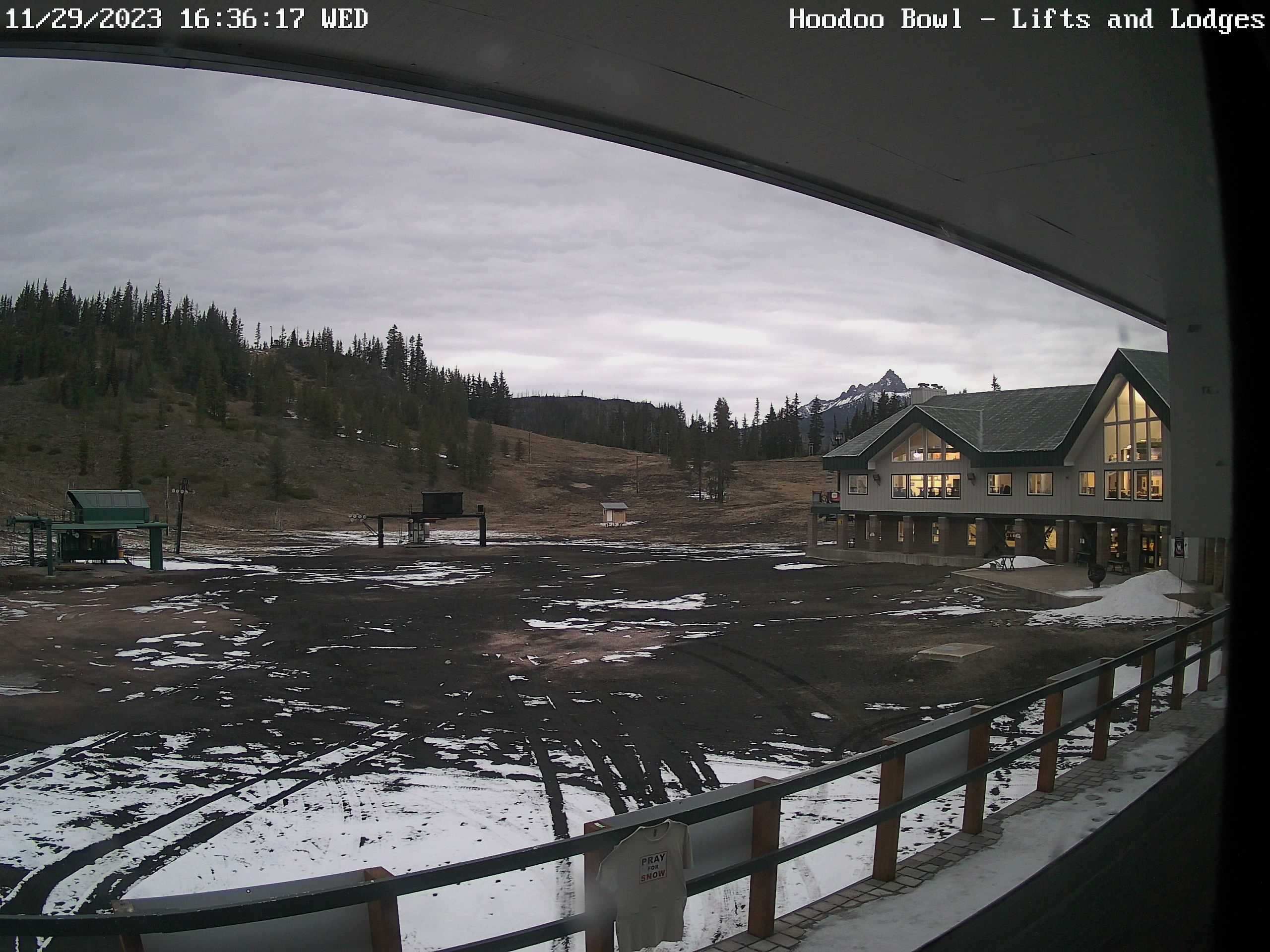
It’s been awhile since the last update, but the action is about to pick up. Let’s do a quick check on how things have been going first. Last November we were seeing feet of snow in the mountains during the month of November. As of Wednesday morning, Hoodoo had 0 inches of snow on the ground. Here’s a pic from earlier showing the bare ground up there.
This has been for two reasons. One is we are currently drier than normal for the month of November as the map below shows. Actually it shows precip departures from average from over the past 30 days, so the last few days of October are included, but you get the picture.
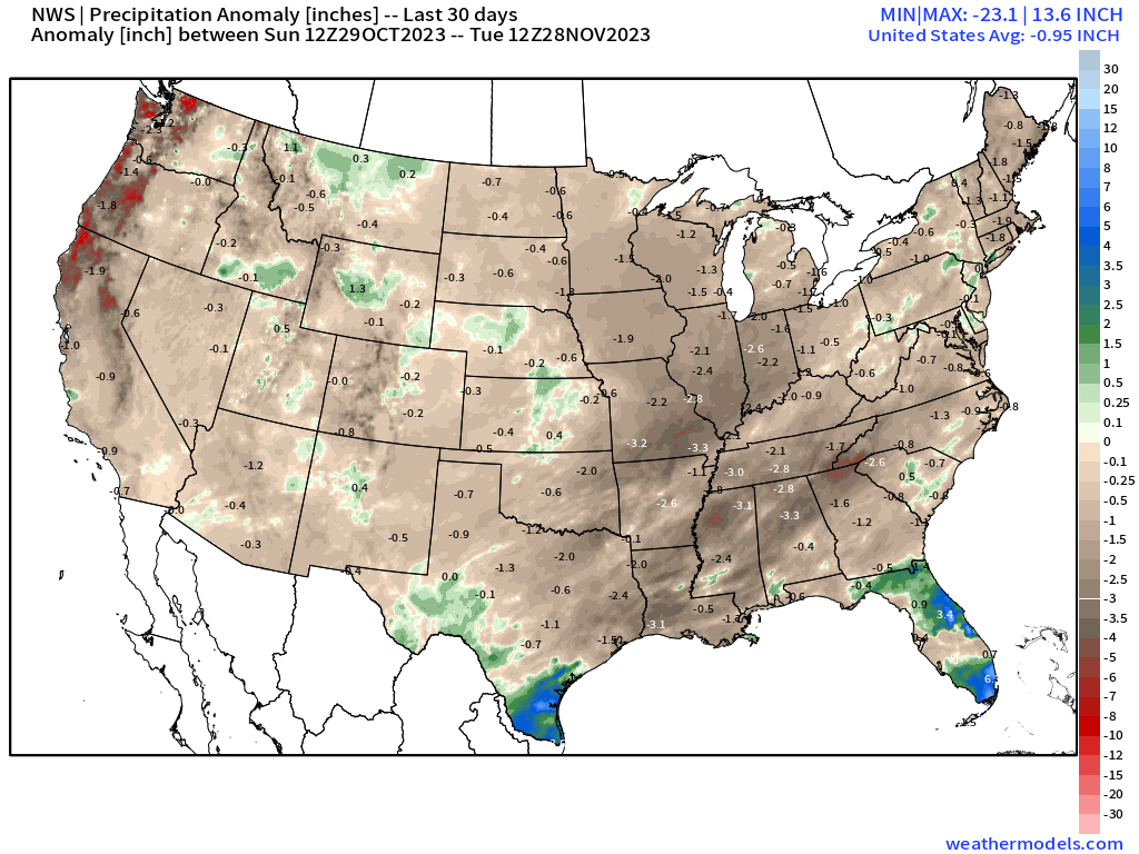
Overall, much of the country has been slightly drier. The warmer temperatures accompanying storms earlier in the month is the second reason for the basically non existent snowpack. This doesn’t mean the whole winter will go this way, and don’t let media hype convince you otherwise. In fact, I think it’s time for an update on the forecast to see what’s coming up for our region.
Highlights
Thu: Cloudy to start the day with showers and rain by mid afternoon. This will mark the end of our nice dry streak we’ve had going.
Fri: More showers with breezy winds at times. Winds gusting up to 35mph
Sat: Periods of rain and breezy. Wind gusts of 25 to 35mph early dying down to 15 to 20mph later in the day.
Sun: Heavy rain much of the day, and breezy at times. Very poor travel conditions this day.
Mon & Tue: Periods of rain. Possibility exists that we could see some dry periods mixed in between, but overall a wet couple of days.
Wed: Heavy rain moves back over our region. This day has potential to also be a real soaker. Watching for flooding too as the rainfall totals will really start to add up as the week goes on.
Thu: More regular wet weather returns with snow levels finally coming back down to pass levels.
I will provide additional updates in the coming days as the potential for flooding will be elevated over the next week or so. Flooding along streams and creeks will of course be possible; however, localized flooding could take place in low laying areas, streets with clogged drains, and locations with pour drainage. All of the areas mentioned above will be at risk for flooding during the periods of heavier rain. Sunday and Wednesday currently look like they will be the rainiest days, but Saturday, Monday, and Tuesday bare watching.
Being straightforward with you I expect Salem to pick up somewhere between 5 and 6 inches of rain between now and next Thursday – possibly even more. These are significant totals for such a short time frame which is why the flooding issue is looking like it could be a real problem.
The Cascades
Some light snow Thursday with 2 to 4 inches. Friday and Saturday will be really awful though. Those two days will feature hands down the biggest snowstorm of the season for our mountain passes. Heavy snow with strong winds will make for dangerous travel conditions Friday through early Sunday morning.
Temperatures warm up dramatically Sunday afternoon with the warmer rain storm, and just like that, much of the snow will melt away fairly quickly. Fortunately the reservoirs have a lot of space in them at the moment, and they should be able to hold a lot of the incoming water which will greatly limit the major flood potential.
The coast and Coast Range
Travel conditions will be especially bad Saturday, and even more so on Sunday. Both mudslides and coastal flooding are likely in some area Sunday through Wednesday. Not a very good time to travel a bunch. Rainfall totals look to surpass 10 inches for some of the coastal and Coast Range locations now through next Thursday. That will almost certainly send rivers like the Wilson or Nehalem close to or over flood stage.
Alright, hang on and prepare for a whole bunch of rain! We will see how close to that 5 to 6 inches of rain we actually get, but confidence is high that we will see significant rainfall totals.
