
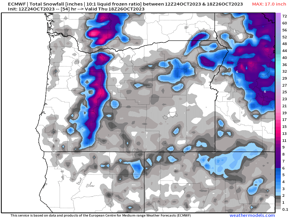
We have a classic winterlike storm happening tonight with rain and wind. Rain will transition to showers and downpours which will continue through the day on Wednesday. Something else we are seeing which we have not seen since last spring is moderate to heavy snow falling up in the Cascades. In fact, 8 to 12 inches of snow are likely by the time Thursday morning rolls around -a good snowstorm up there for October standards. Here’s the snowfall map showing snow totals measured in inches through Thursday morning.

Highlights
Wed: Sunbreaks and showers/downpours. Chilly with snow showers in the mountains.
Thu & Fri: Both of these days will feature more dry weather than wet. A few showers are expected each day with higher chances during the afternoon hours.
Sat & Sun: A beautiful chilly, but sunny fall weekend! Crisp clear skies with frosty mornings. Yes! Our first frost of the season takes place this coming weekend with lows in the upper 20s to around 30°. Brrrrrrrrrrrrr!! Highs only in the lower 50s. I suspect some of you will suddenly start feeling the Christmas music urge with the cooler weather – just a hunch hehe…… 😉
The dry with sunshine and clear skies will stick around for next Monday too.
We are entering our winter weather season, so don’t expect anymore warm weather until March probably, maybe end of February if we are lucky; although, we all know how nice our Februarys have been lately lol… I guess with that said, the next several days should have something for everyone: rain and downpours, sun, cold frosty mornings, and sunny “mild” afternoons.
Enjoy!!
