
Hopefully you all have had chances to enjoy the great outdoors and the wonderful early October sunshine! We have a much wetter week ahead, but there will still be a few dry times here and there. Details below!
Highlights
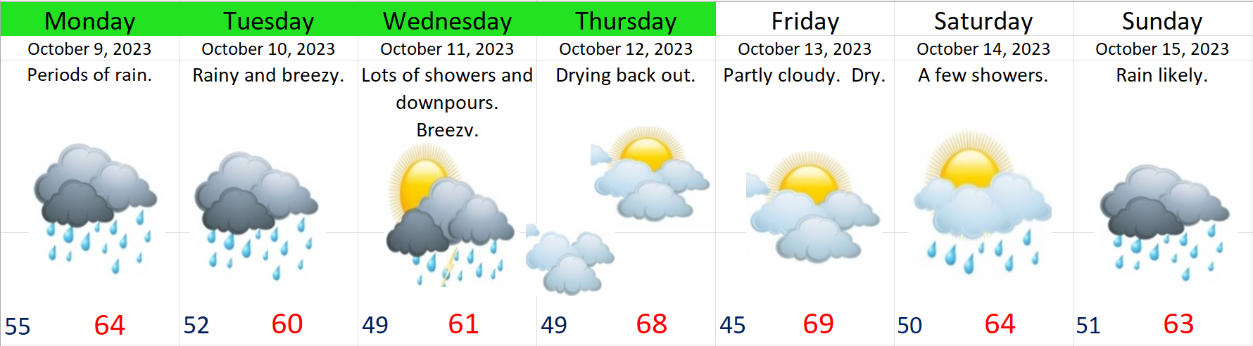
Monday: Periods of rain.
Tuesday: More rain, and breezy.
Wednesday: Stormy with heavy downpours and gusty winds at times.
Thu & Fri: Both these days should be dry starting out with morning clouds and fog before transitioning to sunbreaks during the afternoon hours. Highs should warm up close to 70°.
Saturday: A weak system will bring a couple light showers. Expect sunbreaks to mix in between showers. Not washout by any means with more dry times than wet.
Sunday: The rainy weather returns with a stronger storm.
The Coast
The coast will see increasingly large waves over the coming days. With maximum wave heights reaching 30 to 40 feet Tuesday night through Wednesday morning before slowly relaxing as we head towards Thursday.
The Cascades
It’s not quite that time of year yet, but some of the highest peaks will see a dusting of snow Tuesday night and early Wednesday morning. No big travel concerns though as passes will be rainy and breezy.
Okay, have a wonderful week and stay safe out there!!
