
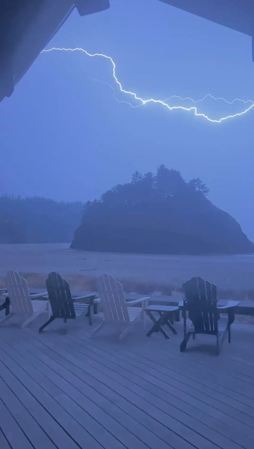
For a number of us, this past Thursday night provided some of the best nighttime thunderstorms we have seen in a few years with numerous lightning strikes. Here is a great lightning strike which was caught by Jessica Ward looking over Proposal Rock in Neskowin last Thursday night
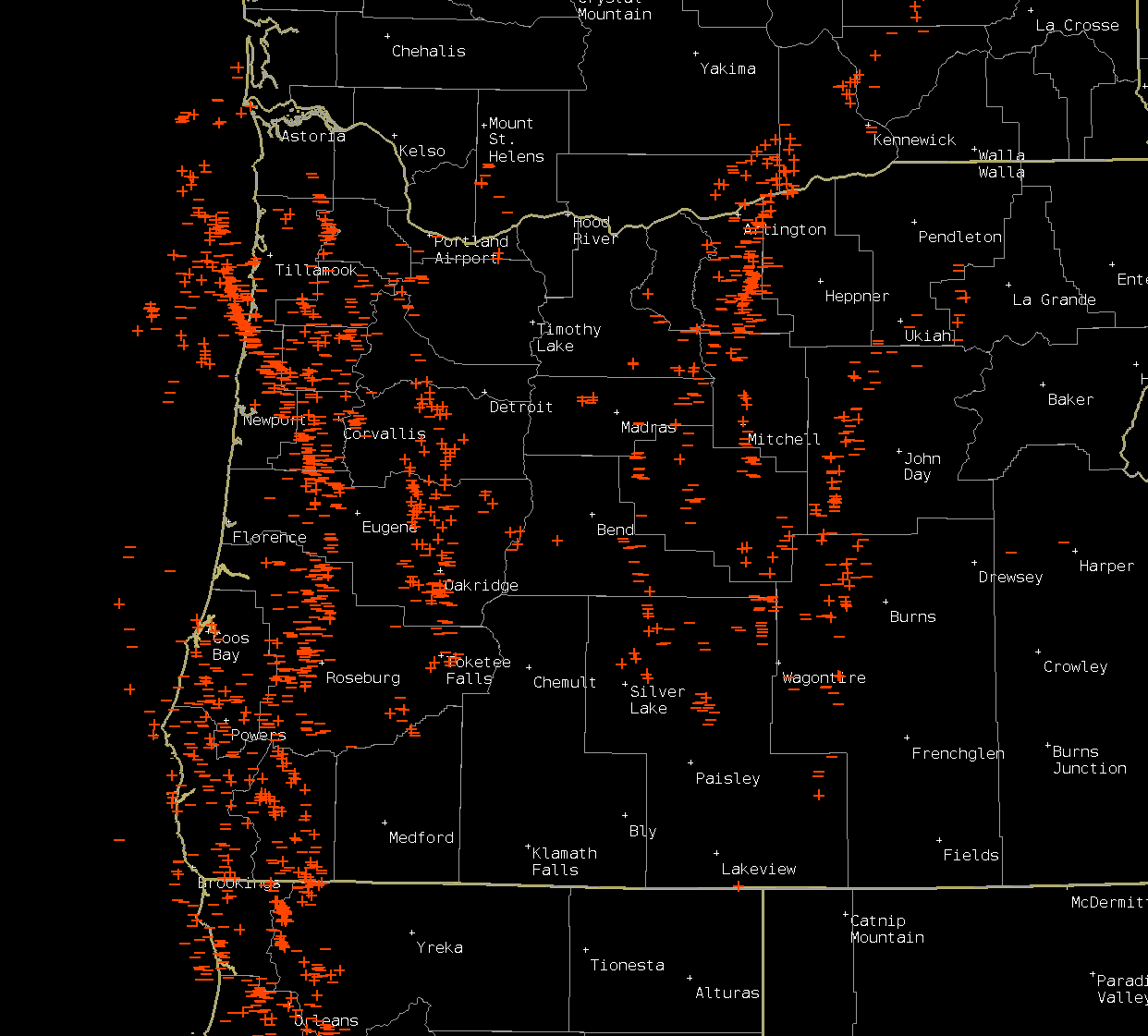
This map shows lightning strikes (both negative and positive) from Thursday night and Friday morning. It’s very typical for some of us to experience nothing while others see the storm of the decade. Generally speaking, the west side of the Willamette Valley saw the most action. You should be able to click on the image for a better view. If you are curious about the differences between negative and positive strikes, then follow this link for more info: Different types of lightning
Moving ahead, the next seven days feature multiple shots at precipitation (actual rain) as a cool and wetter pattern takes shape over us. In fact, today is already feeling rather fall-like with the grey skies and cooler temps. Here’s the extended forecast.
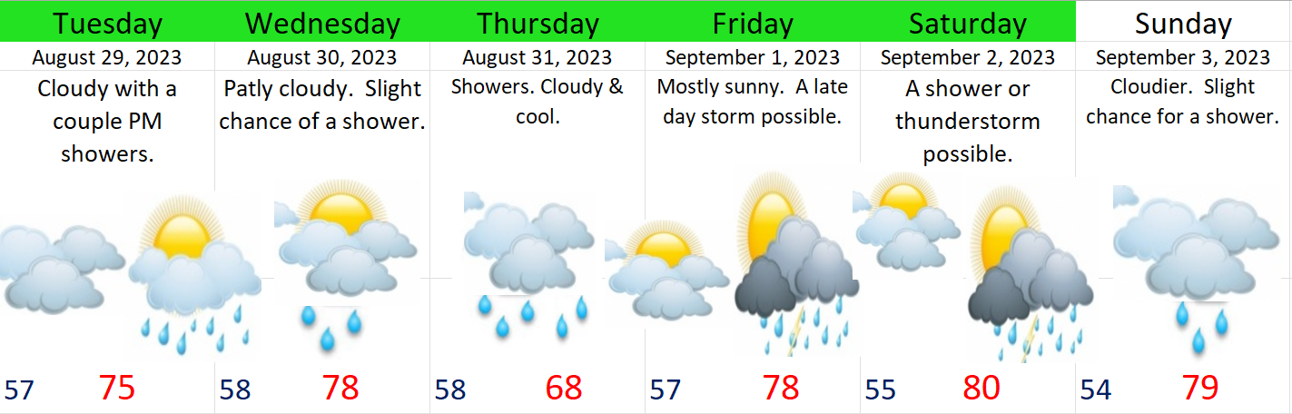
Highlights
Tuesday: Mostly cloudy with a few showers – especially late in the day.
Wednesday: Slight chance of a shower or two, but a mostly dry day. Drier than Tuesday. Highs close to 80°
Thursday: Showers and more widespread light rain. Will be the coolest day since June!
Friday: Warmer with more sunbreaks, but a chance for PM showers and thunderstorms.
Saturday: A near repeat of Friday, but with a tad more sun and slightly warmer high temps.
Sunday: Lower confidence. Currently, it’s looking cooler with possibly another shot at some rain.
No signs of the heat returning, but we all know September can feature pretty warm temps, so we will see what happens. Certainly much different than last year when we saw our dry summer heat and wildfires drag on right into the middle of October!
