A fresh update for you all with a look at a few chances for thunderstorms, a quick recap of how Hurricane Hilary affected Oregon, and of course an extended forecast. Let’s start with Hurricane Hilary.
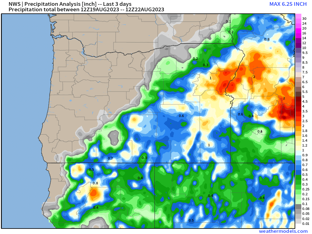
As mentioned in the previous update, the remnants of the hurricane were forecasted to move through eastern Oregon, and sure enough they did. Check out the 3 day rainfall totals.
Some of the driest parts of the state picked up 1 to 2 inches of rain. A few spots up in the Wallowas recorded upwards of 3 inches! That’s a good soaking for those areas. No big wildfire threats over there for the time being. Meanwhile, the Cascades, Coast Range, and the valleys of western Oregon remain dry with active fires still burning.
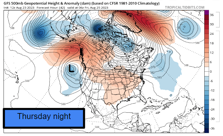
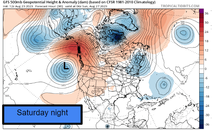
Moving onto the forecast, it’s looking more interesting as we could have our best chance for thunderstorms of the entire summer this Thursday night and Friday. We could see a rare nocturnal thunderstorm event thanks to an upper level low pulling monsoonal moisture from the south. Below are three images showing the position of this upper level low. These charts are showing wind direction and temperature anomalies for this time of year for about 13,000 feet up in the atmosphere.
Notice where I added the “L” near the center of this upper level low off of our coast, and notice how it just sits there day after day after day. On the days when it is further offshore we will see temperatures soar into the low 90s, but when it gets closer we start seeing chances for storms and or just plain old showers and cooler temperatures. Extremely tricky to forecast when it’s just meandering carelessly out there, but I will do my very best. Reminds me of some of my students who sort of just meander around the hall until they eventually stumble into class…. 😉
Extended forecast
Thu: Sunny and very warm.
Thursday night – Friday morning: Thunderstorms are possible anywhere from the coast to the Cascades and everywhere in between. Like usual no particular location is guaranteed a storm, and some of us will see nothing, but others of you will luck out and see a good light show Thursday night. 🙂
Friday afternoon/evening: Should dry out nicely. This is of course assuming we even get rain Thursday night. 😉
Sat & Sun: Very warm, mostly sunny, and dry days. Thunderstorms up in the Cascades each afternoon/evening.
Mon – Wed: The same upper level low which will bring us storms this week will finally move in at some point during this time frame. Depending on its trajectory, we could see regular showers, some light drizzle, or more thunderstorms. Regardless, these few days will be noticeably cooler and cloudier with increased chances for rain.
I’ll do my best to keep you all updated on any changes. I’ve definitely enjoyed posting a little more regularly as of late, and I hope to continue. Stay cool, safe, and healthy out there!! 🙂


