
First, the cooler nights and more reasonable daytime highs have been extremely nice after the intense heatwave we just experienced.
Second, it has become clear we will now stay dry through the next several days. In the previous update I mentioned Salem had a chance for a couple showers Sunday and Monday. Well that chance has shifted to our east. In fact, eastern Oregon is expected to get soaked in the coming days as the leftovers of Hurricane Hilary move through that particular region. Here’s the forecasted track of the storm.
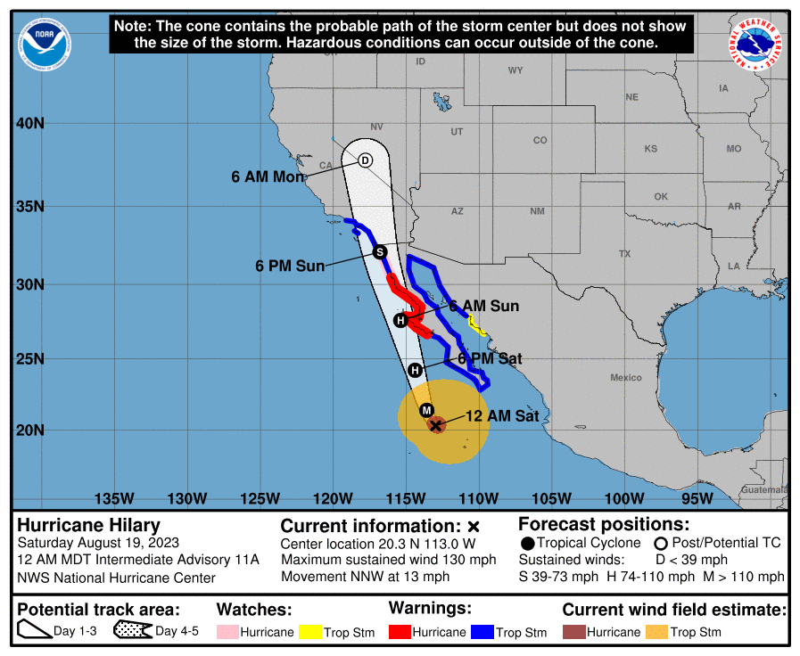
I should emphasize eastern Oregon will only be experiencing remnants of the hurricane. Rain and a few thunderstorms will be the primary effects felt in Oregon. So, don’t buy into any hype you see stating how a hurricane is going to hit Oregon.
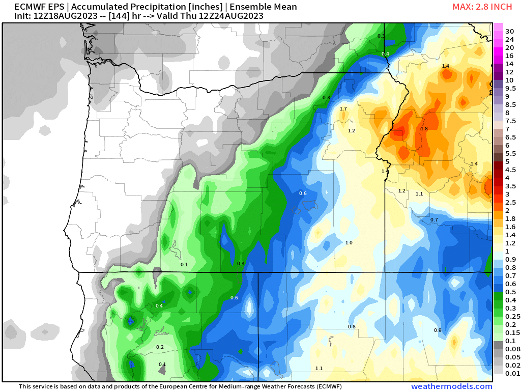
This map of the estimated rainfall totals through Wednesday does a good job of showing the soaking rain the eastern parts of the state are expected to receive. It’s definitely odd to see cities like Ontario or Baker City getting more rain than locations on the coast.
Okay, enough hurricane talk lol. On to our forecast.
Highlights
Today and Sunday: Highs 91 to 95, but lows should dip down close to 55. Smoky skies will return, especially Saturday evening through Sunday.
Mon – Wed: Highs in the lower 80s, and lows in the lower 50s. Excellent late summer weather in my humble opinion with partly cloudy skies and some light breezes.
For now there is no rain in sight meaning we stay high and dry here in the Willamette Valley until further notice.
Stay safe, and enjoy the warm weather.
