
I’ve been taking a little break from providing you all with wonderful forecasts. Life has been busy with work, taxes, and everything that else that’s been popping up lately. Of course you absolutely do not need a forecaster to inform you this spring has been both very chilly and wet. If you’re looking for a forecast then skip to the “Look Ahead” section; otherwise, here’s a quick recap of spring so far.
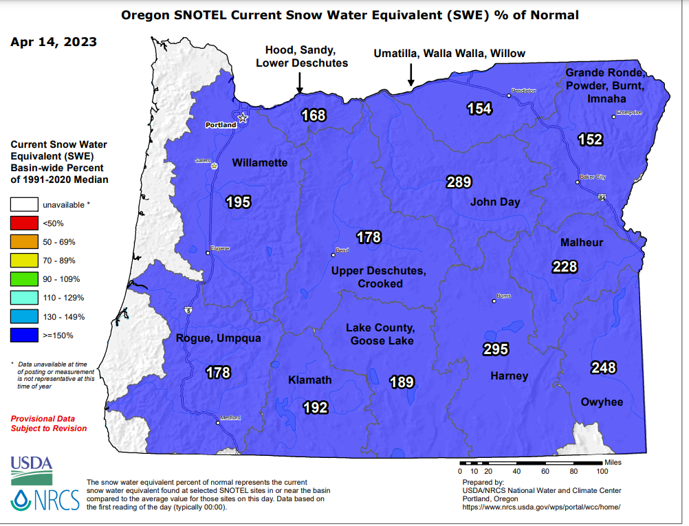
Salem ended the month of March 4.5° below average making it one of the coldest Marches since the mid 1980s! Precip was a little above normal with just over 5 inches of rain. Fast forward to April, and we are currently sitting 3.8° below normal, and have 3.63″ of rain so far which is drastically above where we should be for precipitation at this point in the month. In case you need any more evidence our spring has been cool and wet, check out the snow water equivalent map for Oregon. This map essentially measures how much water is stored in the snowpack compared to average for this time of year.
Look Ahead
Rest of today: Dry through the evening.
Sunday: It’s back to “normal” with rain and breezy winds at times with gusts 20 to 30mph.
Mon – Thu: This will be a pretty chilly and wet stretch of days with periods of rain, occasional downpours, more hail likely, maybe a thundershower, and gusty winds at times. The Cascades will pick up another 2 to 3 feet of new snow this week adding to the snowpack up there. The trickiest days to travel the Cascade passes will probably be Mon – Wed.
That’s it for now. Still waiting to hit 70 degrees though.
