
Today was a perfect example of the battle taking place between the increasingly strong sun angle and longer days versus the frigid airmass. I’ve been watching the forecast closely still, and yes, there are numerous chances for more snow coming up these next several days; however, because of the time of year, it does get harder and harder for snow to really stick during the daylight hours. Not impossible as we saw up in Portland this past Wednesday, but certainly more difficult than say the middle of December. Keep these things in mind as timing of storms will be important in factoring how much snow we get over the next couple of weeks, and yes, you read that right – the next couple of weeks. Strong signals on the forecast charts indicating that the pacific northwest stays in a very chilly pattern for the foreseeable future.
Alright, enough chit chat lol. Time for a forecast. 😉
Tonight/Sunday: As far as snow goes, I’m thinking we get a lot of snow in the air with maybe some slush during the middle of the night, and up to an inch of snow in the highest hills around town. During the day expect periods of rain and showers/brief downpours. My gut is telling me this will be nothing real exciting here in Salem as we will have too much of a south wind keeping us warm enough for just rain. The image below actually conveys my feelings pretty well. Blue is snow, greens and yellows represent rainfall, and it shows Salem right in the battle zone of rain and snow. It’s very rare for us to get a lot of snow when we are in that “battle zone.” Plus, like I mentioned earlier, a southerly breeze will keep us just warm enough.

Now, the Portland metro area will likely be a very different story as they could easily see an inch or two of snow before finally warming up Sunday morning as the south wind will have less of an influence up there.
Sunday during the day will feature rain and or rain/snow mix, but nothing that accumulates below say 1000′. Tons of snow up in the mountains though, with 8 to 12 inches falling between now and Sunday night!!
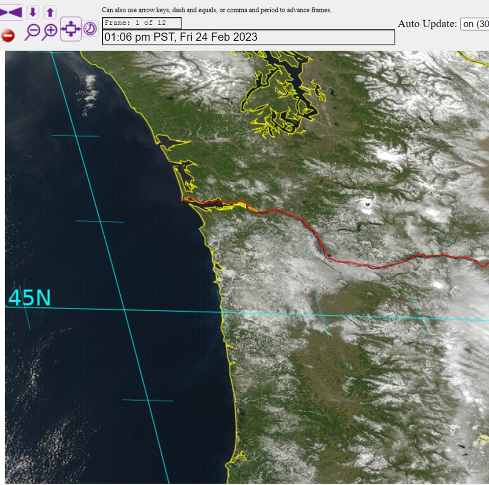
Below is a cool satellite image showing the snow cover on Friday. Notice a pretty substantial gap in snow coverage between the Portland metro area and Salem, and then very little snow south of the Salem area. Remember, Salem sits just below the 45th parallel line and is flanked by hills to the west and south.
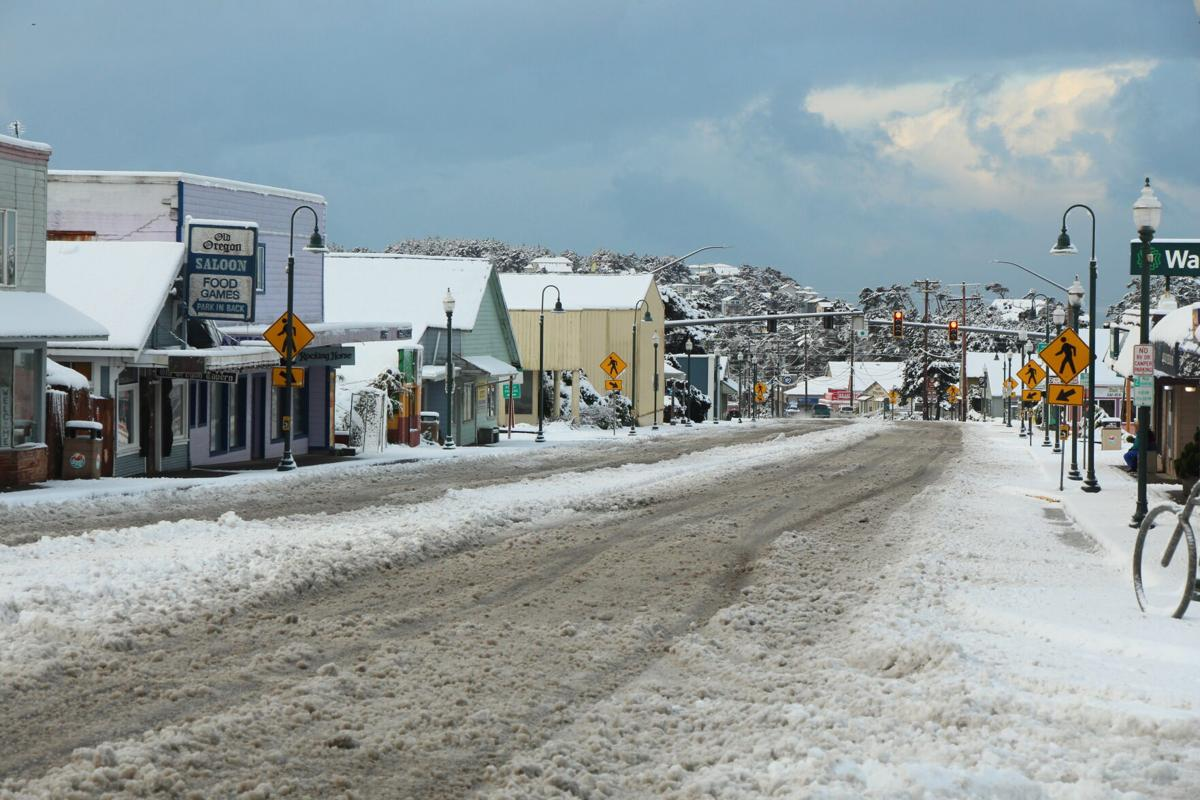
Cool to see and look at. The Coast was also hit extremely hard by snow with nearly 8 inches falling in Lincoln City! Check out this snowy looking highway 101 in downtown Lincoln City. A rare sight for sure!
That’s all for tonight. I know there are many more chances for snow coming up this week, and you should plan on snow possibly effecting your lives at times in the coming days, but I just can’t tackle all that tonight haha, so stay tuned for future updates and take care. 🙂
