It’s been awhile since I provided you all with a state of the art Bryan Weather Alert forecast! 😉
I’ve been focusing on spending extra time with family and job not to mention our weather here has really not been all that exciting; however, that’s all about to change as we have an extremely dynamic system arriving Sunday night and Monday. There’s a ton to cover with this storm, so let’s get started.
First things first, most of Sunday will still be dry which means you have time to get those outdoor projects done. Sometime between 4 and 6PM is when rain arrives and it should continue to fall through the night. Winds will kick up during the afternoon as the storm approaches with gusts up to 35mph.
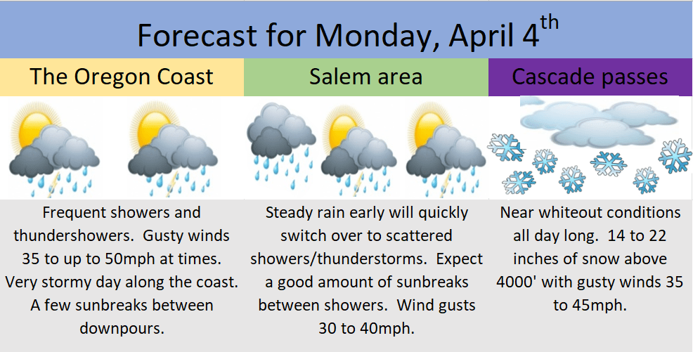
This graphic for Monday’s weather covers the coast, Salem area, and the Cascades. Additional details below.
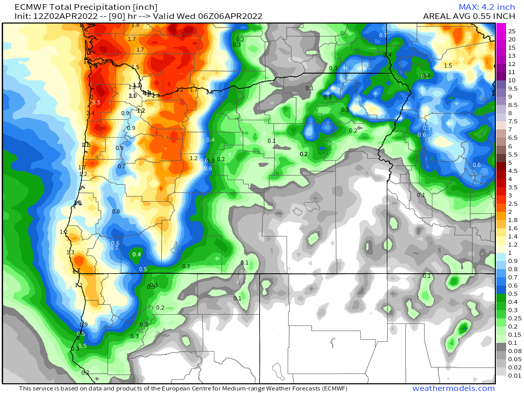
This type of pattern is great for giving the mountains 2 to 3 times as much precipitation as the valley which means tons of snow for the Cascades and a major soaking rain in the Coast Range. The total precipitation map through Tuesday night shows this very well.
The other concern on will be the thunderstorms we COULD see in between sunbreaks on Monday. The atmosphere is going to be unusually unstable Monday which could lead to the sudden development of thunderstorms at any point during the day Monday. These storms have the potential to contain lightning, thunder, and small hail; however, the largest threat with these storms will likely be the heavy downpours, and very gusty winds associated with them. Wind gusts could reach 40 to 45mph with some storms. These winds will be very localized, but they have the potential to cause a few problems for the areas they strike.
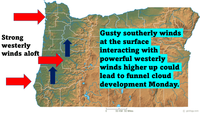
There is also a slight risk for a tornado or funnel cloud Monday across the region too.
We’ll see what happens, and of course even in a pattern like this, tornados in Oregon are typically very weak and still few and far between. It’s just going to be a bit more of a risk than we are use to seeing. Something to watch out for.
Looking ahead to the rest of the week, Tuesday will be a shower and sunbreak type of day with showers ending abruptly right around sunset. More snow for the Cascades.
Dry, sunny, and beautiful springtime weather Wednesday and Thursday with highs upper 60s Wed, and around 75° on Thu.
The threat of showers returns next weekend, but still a ways out, so we will focus on that later.
Take care and have a great rest of your weekend!!


