
Honestly it just wouldn’t be February around here without some sort of arctic air, snow, and or ice. We have an impressive arctic airmass on our doorstep. Here’s what I’m expecting.
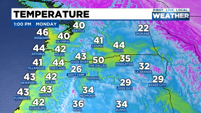
The rest of today will be showery with snow mixing in at times as many of you have already seen. I expect very little (if any) accumulation – maybe a dusting, but not much more than that. What I do expect are roads to possibly be icy tonight and tomorrow morning. With all these showers around it’s easy to imagine roads being slippery overnight. Right now the cold air is still hundreds of miles away, but it’s coming. Check out the temps as of 1PM today across the NW. Spokane really stands out sitting at a chilly 22° while 135 miles to the south in Pasco WA is still in the mid 40s.
Tonight we clear out fairly quickly. There are no indications that showers will stick around long. This will greatly limit the potential for seeing any snowfall here in the valley.
Tuesday and Wednesday will be extremely cold for this late in the season with highs in the upper 30s. Lows Wednesday morning will be particularly cold starting out in the upper teens! Wall to wall sunshine though. 🙂
Watching the forecast for Thursday carefully as we have a small chance at seeing some snow flurries or light snow showers that day, but we will address that as time gets closer.
Main concern will be for icy roads tonight and tomorrow morning. Stay safe and stay warm!
