
Record warmth has gripped the region exactly one year after (to the date) we experienced our worst ice storm in decades. Seems like distant memory right? We also tied our coldest high temperature ever recorded for the day on February 12th, 2021 with a high of 30°. But what a huge difference a year makes. We are now in the middle of a historic “heatwave” for mid February. I borrowed this graphic from Fox 12 Oregon showing some of the record highs set on yesterday (February 11th).

Temperatures as of 1PM look like this:
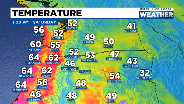
60s dominating the region again today both along the coast and in the valley. The only exceptions are locations near Eugene and south towards Roseburg where low level clouds and fog have limited the warming a bit.
Sunday will also be very warm as we see a third day of 60 degree temps. Really incredible!
Monday will probably feel like a slap in the face with highs in the upper 40s along with clouds and frequent showers. Close to a foot of snow is expected to fall in the Cascades and the valley should receive nice little soaking.
Maybe a leftover shower Tuesday before drying back out for Wednesday through next Saturday. Highs most of next week will be in the low to mid 50s.
Have a great weekend!
