
We have a wild three days of weather ahead with a lot going on. First we have gusty winds (as you have probably noticed) with gusts up to 30mph. Gusts could turn even stronger as a powerful cold front slides south.
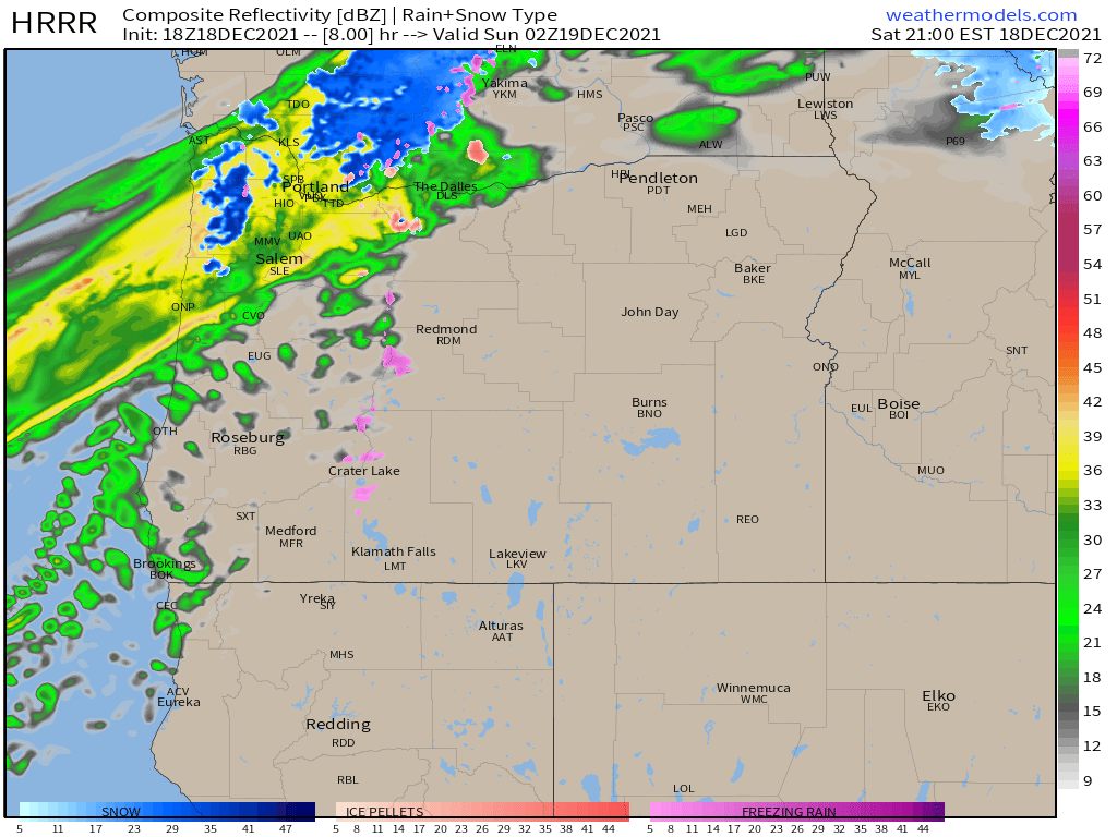
Heavy rain will turn to a heavy wet snow tonight for many locations between Salem and Portland. The snow may not stick all that much, but it will make for extremely hazardous travel conditions. This is a situation where the precip will be falling heavy enough behind the cold front to literary drag the snow level to the valley floor. This radar image shows what conditions should look like around 6pm. Lots of heavy rain with the front moving through…
But then the front stalls out and the snow level plummets. Here is what the radar might look like by the time we reach midnight.
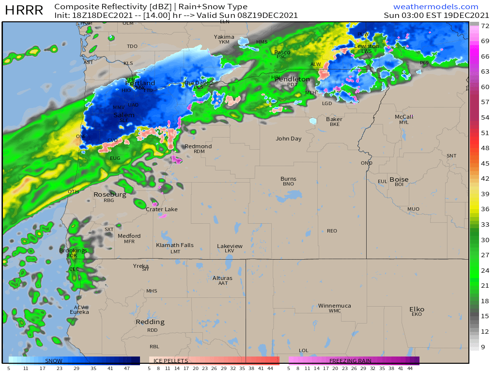
Heavy snow could last for several hours before switching back to rain Sunday morning as the atmosphere overhead warms back up thanks to a warm front moving in.
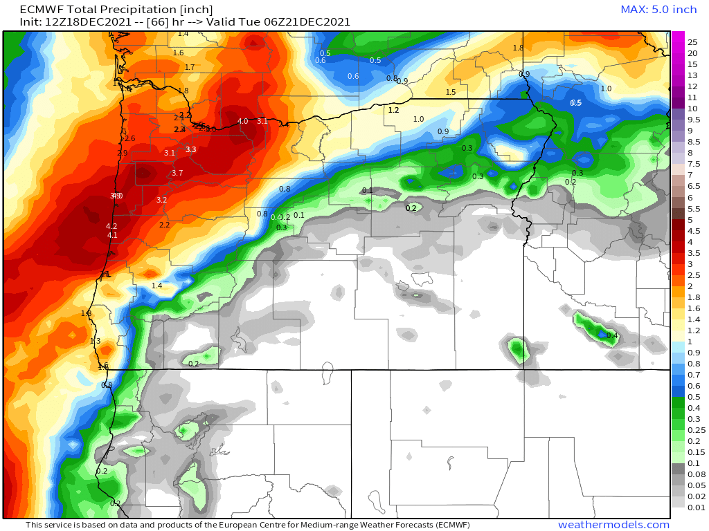
Steady rain continues all day Sunday and Monday dropping over 3 inches of rain across the region between this evening and Monday night. Flooding is a concern I have as snow melt is coupled with heavy rain. This will lead to sharp rises on the area’s creeks, and rivers. Keep a close eye if you live in a flood prone area. Check out these rainfall totals through Monday night.
But that is not all folks lol. Cold air will surge south from Canada and strong east winds will transport it westerward through the Columbia River Gorge. This will result in freezing rain and heavy snow along l-84 in the Gorge specifically on Sunday. So if you are traveling through the Gorge Sunday all I will say is the odds are not in your favor.
Cold and potentially snowy weather is still on track to move in around the 23rd or 24th and could potentially last through the rest of the month. More on that later. Let’s just make it through the next 3 days safely first. Have a great weekend and stay safe!!!
