
First off I hope everyone knows just how close we were to snow this past Wednesday. I greatly dislike these close call scenarios. Last January Salem saw a surprise snow event in a fairly similar setup. I was not expecting snow here in Salem Wednesday, but I 100% mentioned it as being a possibility if everything had come together just right. Turns out we ended up with a very cold rain. Some of you saw snow mixing during the morning and the Coast Range saw a fair amount of snow, but right here in Salem we avoided the snow, this time… 😉 🙂
Friday should stay mostly, if not completely dry. Lots of clouds, maybe some sunbreaks too.
Showers and increasing periods of rain on Saturday. Fairly mild too.
Sunday will be rainy. In fact I have concerns we may see flooding on some of our rivers. Check out how much snow has fallen over the past 7 days.
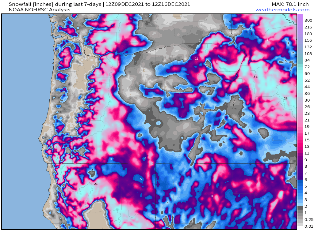
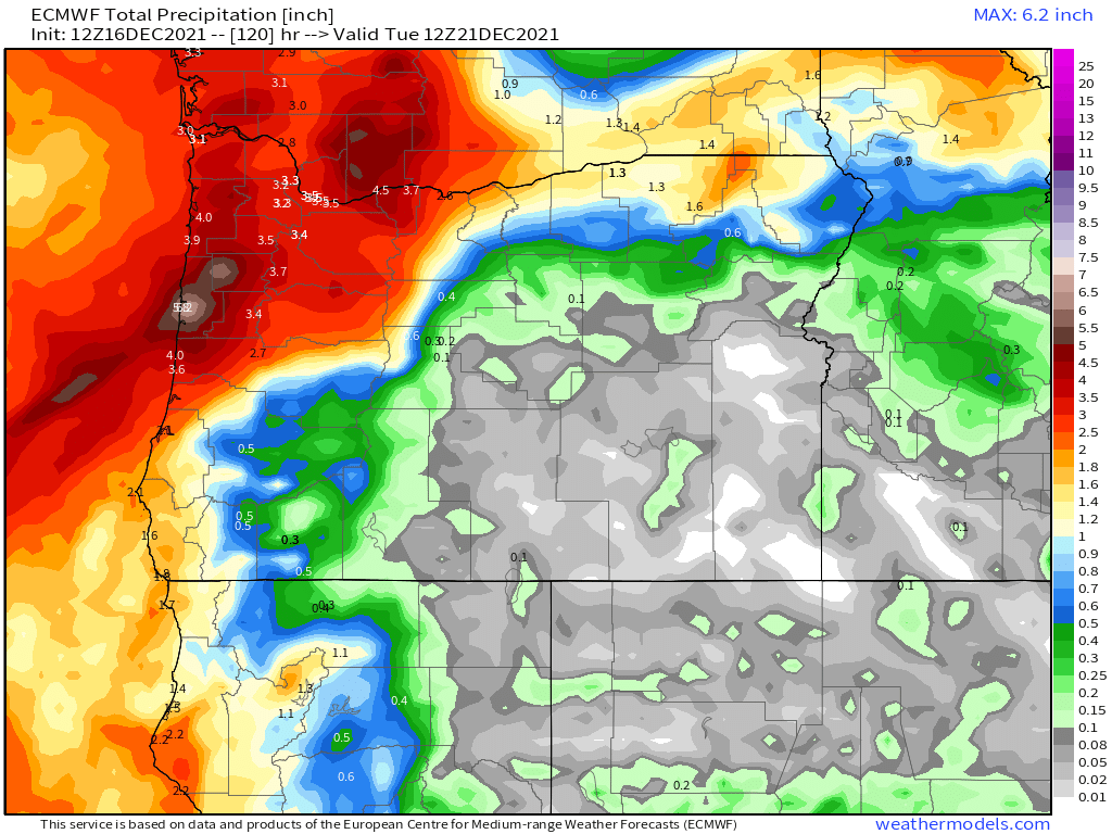
Many of the higher elevations in the Coast Range have over a foot of heavy wet snow on the ground, and there are several feet up in the Cascades. Now look at how much rain is expected between now and Monday night. Keep in mind most of this is forecast to fall in just two days – Sunday and Monday.
I will likely have an update Saturday concerning the potential for flooding. Keep this on your radar.
Showers stick around for both Tuesday and Wednesday of next week with snow levels lowering back down below pass levels which means the Cascades should still have excellent Christmas break skiing conditions!!!!
Even colder weather is still on track to move in around Christmas. Not sure yet how cold or if we will see snow, but I will be keeping an eye on this over the coming days. Definitely looking cool/colder in the long term.
Have a fantastic evening and a great Friday!!
