
November 2021 is running well above normal in the precipitation department with a little over 2 inches of rain so far this month. Definitely a La Nina feel out there lately. The mountains also picked up a solid foot of snow over the weekend, and now we are looking at what will be the rainiest couple of days we have seen this fall. Take a look at the estimated rainfall for now through Saturday morning.
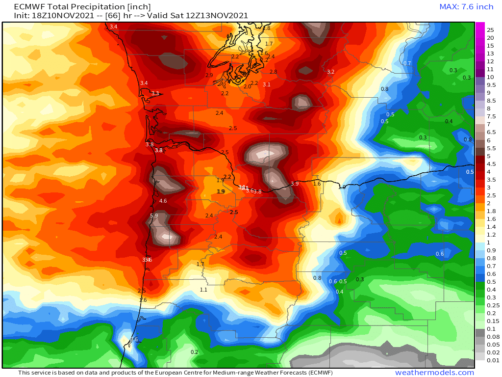
Moderate to heavy rain moves in overnight. By the time you wake up Thursday morning, over an inch of rain will likely have fallen with almost another inch expected during the day on Thursday through Friday night. This storm is ushering in very mild weather which means rain even up in the mountains. There is also a chance of thunderstorms with the rain tonight. It’s going to be one of those stormy nights.
All this rain plus the melting of our mini snowpack in the Cascades will lead to some flooding. We are under a flood watch and I suspect there will be some minor to moderate flooding along some of our low laying areas, creeks, and streams.
I don’t expect major flooding and I don’t expect any flooding on the large rivers like the Willamette.
The rain shuts off Friday night fairly quickly leaving Saturday and most of Sunday dry. Some showers might sneak in Sunday late in the day. If you have plans this weekend the good news is you should have some decent weather to go with them.
Another storm system rolls in on Monday bringing more rain, cooler air, and mountain snow.
There you have it. Stormy with no big dry stretch in sight. Stay safe and watch for flooding.
