
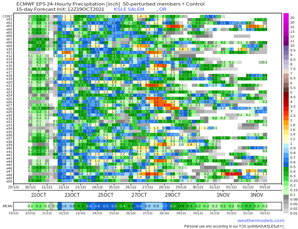
I have a fun new chart to show you all. This chart below is really good at conveying the big picture up to two weeks out with each horizontal line showing a single possible outcome. Time on this chart goes from left to right and it shows 24 hour rainfall totals (measured in inches) ending every 12 hours which means there is some overlap with these totals.
What I look for on charts like this one are patterns and trends – not details. So in this case the concentrated number of predictions showing heavier rainfall around the 22nd and again near the 28th of October provide me with a high level of confidence some sort of big rainstorm is heading our way both those days. Another use of these maps is just looking at the probability for rainfall on any given day. For example, from looking at all of these possible outcomes, it seems extremely clear to me that today will be the last completely dry day until at least the 30th with many of the predictions showing rainfall every single day for the next 11 days.
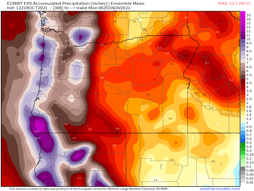
We are heading into a very stormy and wet weather pattern. Right in line with what we would expect during a La Nina. Between now and the end of the month we could easily see over 5 inches of rain! Check out this total rainfall map ending close to midnight on Oct 31st.
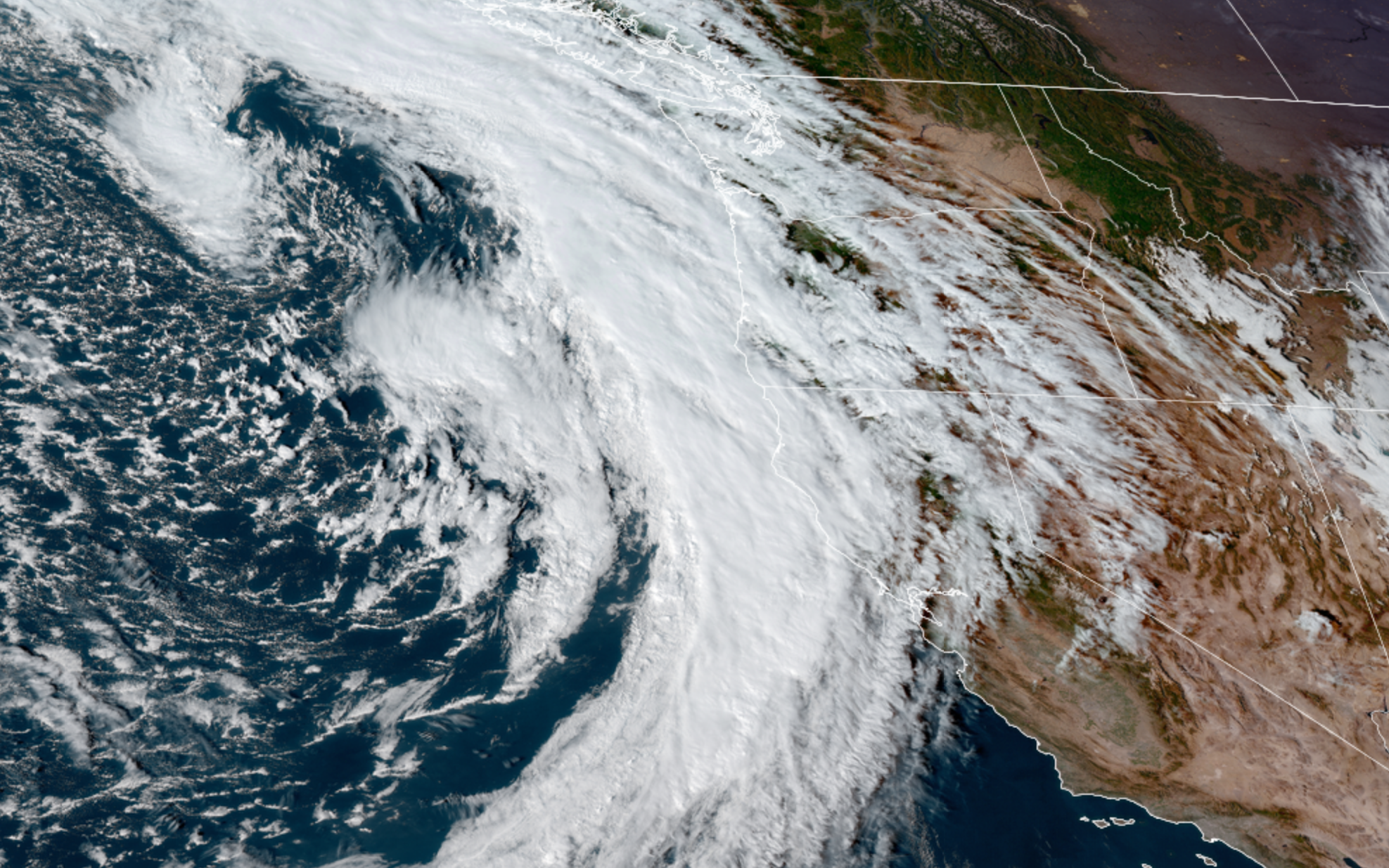
Again, the message seems very clear to me which is very wet times are heading our way. Here’s a satellite image of tomorrow’s storm heading our way.
Highlights
Two other things to really watch for with these storms are: number one, the high surf and big waves at the coast. These storms are capable of producing some really big waves. Great for storm watching, but be careful if you head out there.
The other concern I have is for high winds and the increased potential for power outages in the coming days as strong winds develop with some of these storm systems. In fact, we could see fairly gusty winds Wednesday with this first storm system. Winds will likely gust 30 to maybe 40mph tomorrow morning. Nothing too crazy is being predicted for the moment, but this pattern will bring the windiest weather we have seen since January.
We also have a chance for a few thunderstorms Wednesday.
Thursday will start out mostly or even completely dry and could stay dry until the late afternoon before the next storm rolls in.
Expect both the weekend and much of next week to be stormy and quite wet.
Stay safe!
