
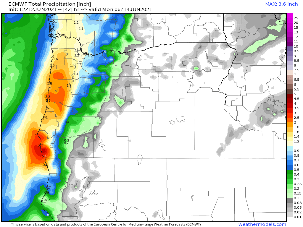
A quick update regarding our wet weather. Currently, I hope you are enjoying the nice dry break we are seeing right now. In fact, we should have several more hours of dry, increasingly humid, and mild conditions with temps reaching the 70s this afternoon; however, a very moist “slug” of moisture is posed to move in during the later evening hours. Right now I’m thinking rain moves in after 6PM. Rain continues Saturday night through most of Sunday. Expect Sunday to be very wet. The rain tonight and tomorrow is really going to favor the coast, Coast Range, and the western half of the Willamette Valley. This rainfall map (through Monday evening) shows this well.
You can also see tonight’s storm system moving towards us on satellite by using the link below:
- We should see a few more breaks in the rain on Monday with showers increasing late in the day along with an elevated chance for thunderstorms over the Cascades.
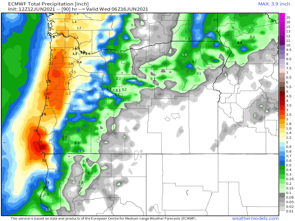
- Sunbreaks, PM showers, and thunderstorms on Tuesday. The Monday afternoon through Tuesday evening time frame contains our best bet at seeing thunderstorms around here. Thunderstorms will be more likely the further north you go, but Salem should still at least see some nice downpours this day. We dry out quickly Tuesday evening after roughly 6PM. All this rain is going to add up. This map shows the expected rainfall through Tuesday night. This is on top of the nice rainfall we saw Friday!
- After the rain we dry up on Wed with AM clouds & PM sun. Highs in the upper 70s.
- Thu – next weekend will be very summer like as highs climb into the 80s with lots of sunshine!
Have a great weekend and stay safe!
