
First off I have to say the showers this week have underperformed just a little. Salem has officially picked up a mere 0.03″ of rain since this cooler & “wetter” weather began back on Saturday.
The main “rain event” from the start has been and still is looking to be Friday through next Tuesday as several waves of moisture ride up into western Oregon. Trying to pinpoint exactly when these waves of moisture will show up is proving to be more difficult than usual due to the trajectory/path of this storm system. The main thing to keep in mind is we will have several rounds of steady rainfall Sat through Tue with breaks of dry weather mixed in between. There will also be a chance for thunder Sun – Tue. Below is the forecasted total precipitation through Monday night from both of the major weather models.
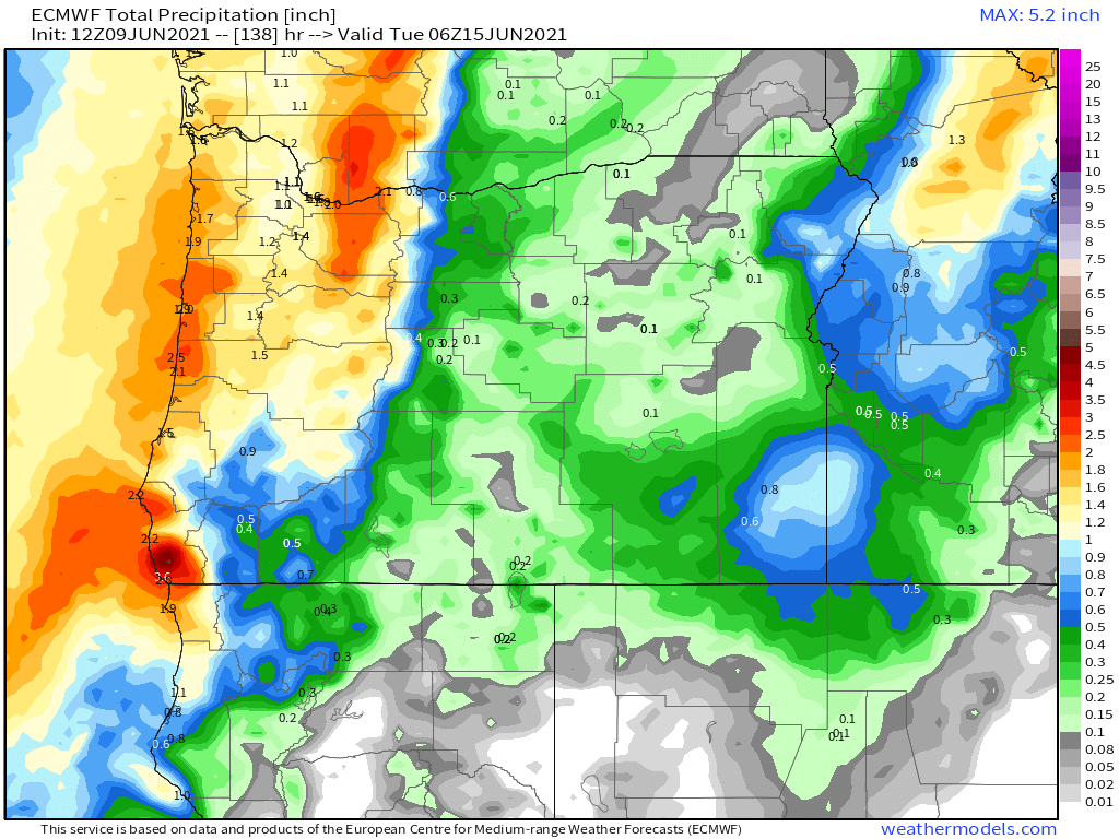
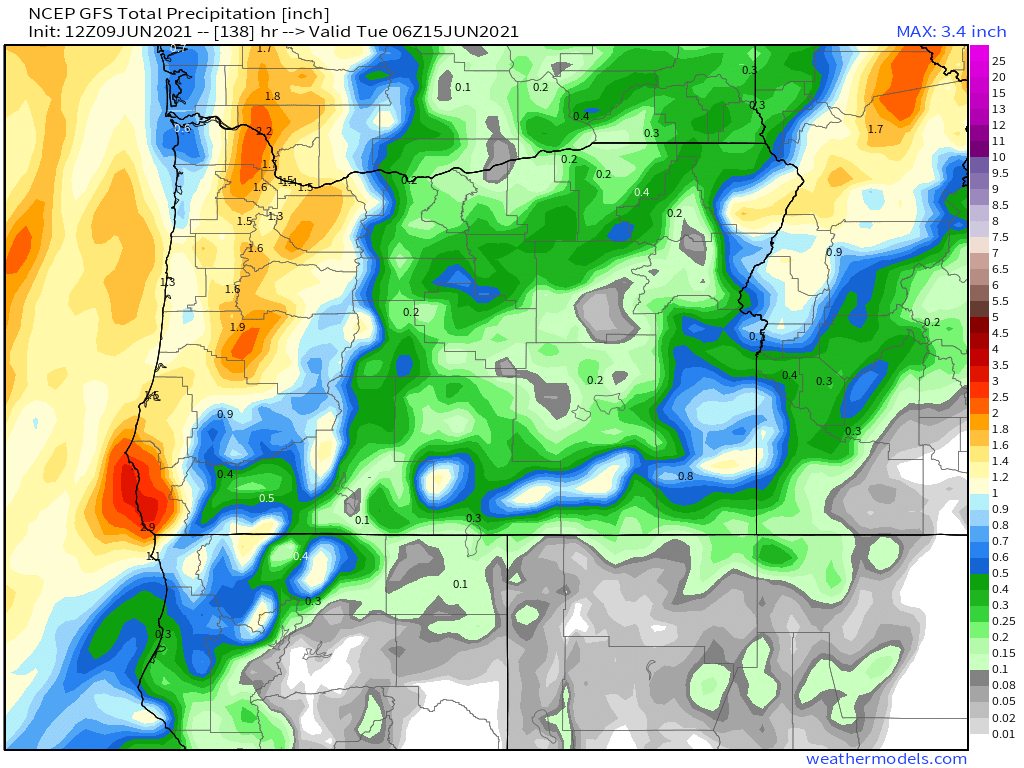
It appears we are still on track to pick up at least an inch to maybe even over an inch and a half of rain in the coming days which would be great news for our drought!
A few quick highlights
1.) Thursday: Unfortunately, this day has gone from being “totally dry” to “mostly dry with a slight chance of a sprinkle.” Nothing too heavy, but just enough to prevent it from being totally dry.
2.) Friday’s going to be wet with periods of rain. More rain the further north you go.
3.) Sat – Tue: Humid, mild, and fairly wet with periods of rain and maybe even a thunderstorm or two.
In related news it looks like the radar is up and running a day early! You can track the showers out there with this link.
https://weather.cod.edu/satrad/nexrad/index.php?type=RTX-N0Q-1-24
Happy “Hump Day!” and enjoy the cooler weather while it lasts. I imagine summer weather will return in no time…
