
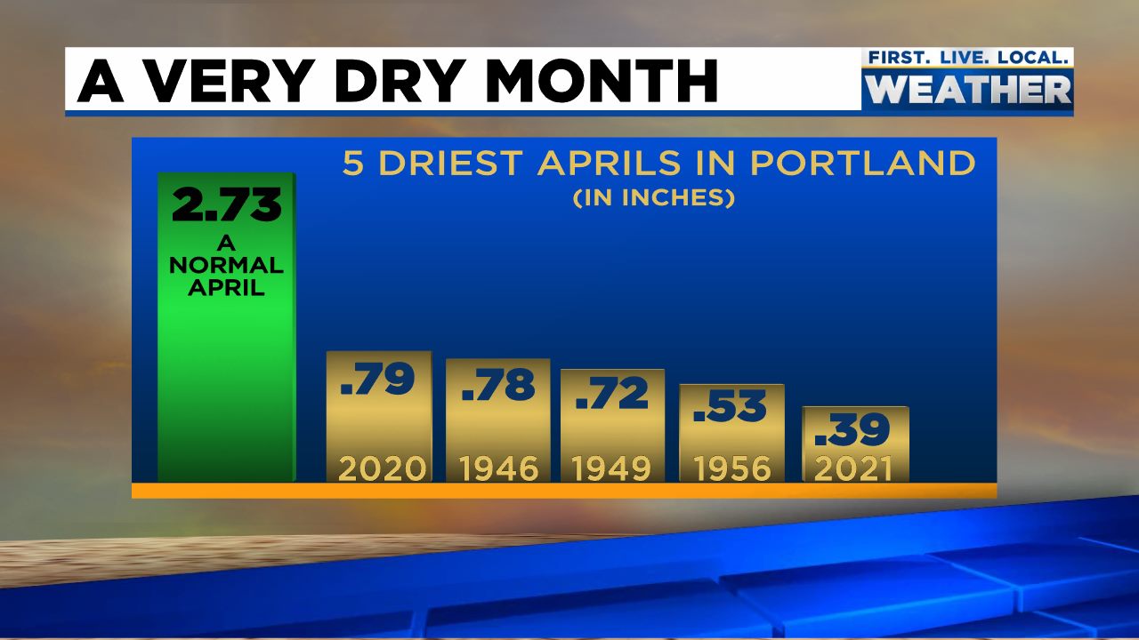
It was definitely a very unusual April around here as we started off chilly and dry with some record low temps set around the region with lows dipping into the upper 20s on two separate occasions. Then we flipped the switch to warm and dry (very warm in fact). Whether it was cold or warm, the entire month was extremely dry for April. Some last minute rain Friday night bumped us up to 1.27″ (45% of normal) for the month. I almost hate to say this, but we could sure use some good soaking rainstorms over the next couple of months. Check out this graphic from Fox 12 Oregon for Portland where they saw even less rainfall setting a new all time record for driest April up there.
April ended up warmer than normal coming in at 2.27° above average for the month – pretty impressive considering we had lows in the upper 20s a couple days during the first half of the month. Those 80 degree days the second half sure did help to warm us up! Now let’s take a look at what the next 7 days hold for us.
Forecast
Highlights
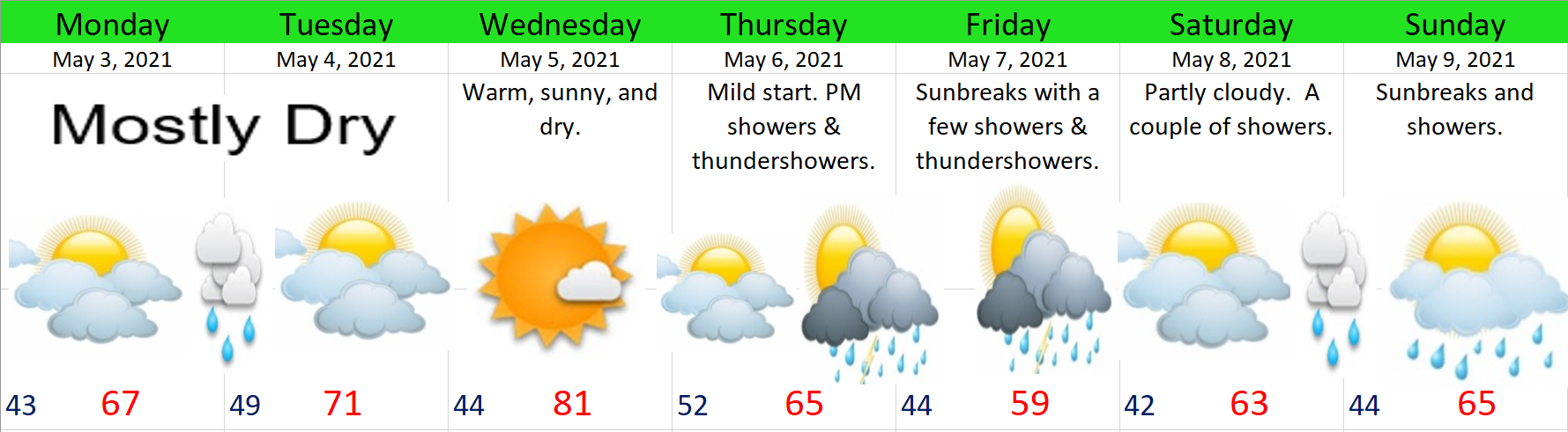
- Wednesday’s going to be the nice summer like day of the week with highs in the low 80s and lots of sunshine.
- Thursday should start off dry, but showers and maybe even a few thundershowers move in during the afternoon and evening hours.
- Frequent showers on Friday.
- Saturday through next Monday will be partly cloudy with a couple of showers each day.
Have a great rest of your Sunday!
